Jeddito, Arizona
Jeddito (Navajo: Jádító) is a census-designated place (CDP) in Navajo County, Arizona, United States. The population was 293 at the 2010 census.
Jeddito, Arizona | |
|---|---|
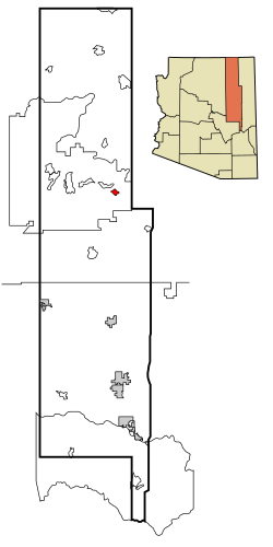 Location in Navajo County and the state of Arizona | |
 Jeddito, Arizona Location in the United States | |
| Coordinates: 35°46′19″N 110°7′37″W | |
| Country | United States |
| State | Arizona |
| County | Navajo |
| Area | |
| • Total | 5.42 sq mi (14.04 km2) |
| • Land | 5.42 sq mi (14.03 km2) |
| • Water | 0.00 sq mi (0.01 km2) |
| Elevation | 6,340 ft (1,932 m) |
| Population (2010) | |
| • Total | 293 |
| • Estimate (2016)[2] | N/A |
| Time zone | UTC-7 (MST) |
| ZIP code | 86034 |
| Area code(s) | 928 |
| FIPS code | 04-36150 |
| GNIS feature ID | 0024262 |
Geography
Jeddito is located at 35°46′19″N 110°7′37″W (35.772023, -110.127016).[3]
According to the United States Census Bureau, the CDP has a total area of 5.6 square miles (15 km2), all of it land.
Jeddito lies within a 123 km2 (47 sq mi) exclave of the Navajo Nation. This exclave is surrounded by territory of the Hopi Indian Reservation, which is itself surrounded by the Navajo Nation. There was a population of 1,065 living on the exclave in the 2000 census.
Demographics
| Historical population | |||
|---|---|---|---|
| Census | Pop. | %± | |
| 2000 | 390 | — | |
| 2010 | 293 | −24.9% | |
| U.S. Decennial Census[4] | |||
| Languages (2000) [5] | Percent |
|---|---|
| Spoke Navajo at home | 72.12% |
| Spoke English at home | 27.88% |
At the 2000 census there were 390 people, 99 households, and 79 families living in the CDP. The population density was 70.0 people per square mile (27.0/km²). There were 126 housing units at an average density of 22.6/sq mi (8.7/km²). The racial makeup of the CDP was 6.41% White, 92.56% Native American, 0.26% Asian, 0.26% from other races, and 0.51% from two or more races. 0.51% of the population were Hispanic or Latino of any race.[6] Of the 99 households 59.6% had children under the age of 18 living with them, 45.5% were married couples living together, 30.3% had a female householder with no husband present, and 20.2% were non-families. 17.2% of households were one person and 1.0% were one person aged 65 or older. The average household size was 3.94 and the average family size was 4.49.
The age distribution was 48.7% under the age of 18, 7.7% from 18 to 24, 26.7% from 25 to 44, 13.6% from 45 to 64, and 3.3% 65 or older. The median age was 19 years. For every 100 females, there were 77.3 males. For every 100 females age 18 and over, there were 81.8 males.
The median household income was $20,417 and the median family income was $12,778. Males had a median income of $35,375 versus $30,469 for females. The per capita income for the CDP was $5,347. About 42.3% of families and 45.5% of the population were below the poverty line, including 56.1% of those under age 18 and 25.0% of those age 65 or over.
Education
Jeddito is a part of the Cedar Unified School District.
The Navajo name of Jádító (Antelope Water) was derived from nearby watering points, which were frequently used by antelopes. Most families living within the Jeddito "island" are members of the extended families who were forcefully evicted from the old Hopi Reservation (District 6) in September and October 1944. This marked the first mass relocation of Navajos determined to be living on the wrong side of the Navajo-Hopi boundary. The portion referred to as Jeddito "island" is totally surrounded by the Hopi Partitioned Land. Another segment of the chapter land base is part of the main Navajo reservation on the Apache County side. The "island" part is situated exclusively in Navajo County.
White Cone High School serves Jeddito.
References
- "2016 U.S. Gazetteer Files". United States Census Bureau. Retrieved Jul 18, 2017.
- "Population and Housing Unit Estimates". Retrieved June 9, 2017.
- "US Gazetteer files: 2010, 2000, and 1990". United States Census Bureau. 2011-02-12. Retrieved 2011-04-23.
- "Census of Population and Housing". Census.gov. Retrieved June 4, 2016.
- https://apps.mla.org/cgi-shl/docstudio/docs.pl?map_data_results
- "U.S. Census website". United States Census Bureau. Retrieved 2008-01-31.
- Jeddito, Census Tract 9448, Navajo County, Arizona United States Census Bureau