Rough Rock, Arizona
Rough Rock (Navajo: Tséchʼízhí) is a census-designated place (CDP) in Apache County, Arizona, United States. The population was 414 at the 2010 census.[3]
Rough Rock, Arizona | |
|---|---|
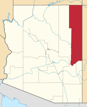
 Location in Apache County and the state of Arizona | |
 Rough Rock, Arizona Location in the United States | |
| Coordinates: 36°24′53″N 109°51′20″W | |
| Country | United States |
| State | Arizona |
| County | Apache |
| Area | |
| • Total | 12.79 sq mi (33.12 km2) |
| • Land | 12.79 sq mi (33.12 km2) |
| • Water | 0.00 sq mi (0.01 km2) |
| Elevation | 6,280 ft (1,914 m) |
| Population (2010) | |
| • Total | 414 |
| • Estimate (2016)[2] | N/A |
| Time zone | UTC-7 (MST) |
| ZIP code | 86503 |
| Area code | 928 |
| FIPS code | 04-61370 |
| GNIS feature ID | 0010520 |
Geography
Rough Rock is located at 36°24′53″N 109°51′20″W (36.414660, -109.855648).[4]
According to the United States Census Bureau, the CDP has a total area of 12.8 square miles (33.1 km2), all of it land.[3]
Demographics
| Historical population | |||
|---|---|---|---|
| Census | Pop. | %± | |
| U.S. Decennial Census[5] | |||
As of the census[6] of 2000, there were 1300 people, 113 households, and 89 families living in the CDP. The population density was 36.5 people per square mile (14.1/km²). There were 152 housing units at an average density of 11.8/sq mi (4.6/km²). The racial makeup of the CDP was 96.16% Native American, 2.77% White, 0.64% Asian, and 0.43% from two or more races. 0.21% of the population were Hispanic or Latino of any race.
There were 113 households out of which 50.4% had children under the age of 18 living with them, 54.0% were married couples living together, 18.6% had a female householder with no husband present, and 21.2% were non-families. 19.5% of all households were made up of individuals and 4.4% had someone living alone who was 65 years of age or older. The average household size was 4.15 and the average family size was 4.97.
In the CDP, the age distribution of the population shows 42.9% under the age of 18, 9.6% from 18 to 24, 26.4% from 25 to 44, 16.6% from 45 to 64, and 4.5% who were 65 years of age or older. The median age was 23 years. For every 100 females, there were 95.4 males. For every 100 females age 18 and over, there were 90.1 males.
The median income for a household in the CDP was $26,172, and the median income for a family was $26,484. Males had a median income of $28,068 versus $11,346 for females. The per capita income for the CDP was $6,741. About 23.7% of families and 29.8% of the population were below the poverty line, including 37.2% of those under age 18 and 20.0% of those age 65 or over.
Education
The area is served by Chinle Unified School District #24,[7] which operates Chinle High School.
In addition the Rough Rock Community School is operated by the U.S. Bureau of Indian Affairs's Office of Indian Education Programs.
Popular culture
The town is mentioned in Judy Collins' "Song For Martin": "In Rough Rock, Arizona, he lived for many years alone. A gangly kid from Colorado, who could sing the sweetest song...."
References
- "2016 U.S. Gazetteer Files". United States Census Bureau. Retrieved Jul 18, 2017.
- "Population and Housing Unit Estimates". Retrieved June 9, 2017.
- "Geographic Identifiers: 2010 Demographic Profile Data (G001): Rough Rock CDP, Arizona". U.S. Census Bureau, American Factfinder. Archived from the original on February 12, 2020. Retrieved April 30, 2013.
- "US Gazetteer files: 2010, 2000, and 1990". United States Census Bureau. 2011-02-12. Retrieved 2011-04-23.
- "Census of Population and Housing". Census.gov. Retrieved June 4, 2016.
- "U.S. Census website". United States Census Bureau. Retrieved 2008-01-31.
- "SCHOOL DISTRICT REFERENCE MAP (2010 CENSUS): Apache County, AZ" (PDF). 2010 U.S. Census. U.S. Census Bureau. Retrieved 2020-04-08. - Chinle USD is depicted on pages 1 and 2.