East Fork, Arizona
East Fork (Western Apache: Hawúʼishįįhé) is a census-designated place (CDP) in Navajo County, Arizona, United States, on the Fort Apache Indian Reservation. The population was 699 at the 2010 census.
East Fork, Arizona | |
|---|---|
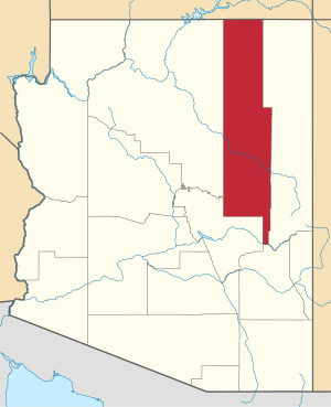
 Location in Navajo County and the state of Arizona | |
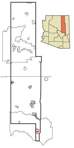
 East Fork, Arizona Location in the United States | |
| Coordinates: 33°48′1″N 109°55′43″W | |
| Country | United States |
| State | Arizona |
| County | Navajo |
| Area | |
| • Total | 2.06 sq mi (5.34 km2) |
| • Land | 2.06 sq mi (5.34 km2) |
| • Water | 0.00 sq mi (0.00 km2) |
| Elevation | 5,240 ft (1,597 m) |
| Population (2010) | |
| • Total | 699 |
| • Estimate (2016)[2] | N/A |
| Time zone | UTC-7 (MST) |
| FIPS code | 04-21310 |
| GNIS feature ID | 0025319 |
Geography
East Fork is located at 33°48′1″N 109°55′43″W (33.800242, -109.928566).[3]
According to the United States Census Bureau, the CDP has a total area of 2.9 square miles (7.5 km2), all land.
Demographics
| Historical population | |||
|---|---|---|---|
| Census | Pop. | %± | |
| 2000 | 880 | — | |
| 2010 | 699 | −20.6% | |
| U.S. Decennial Census[4] | |||
At the 2000 census there were 880 people, 209 households, and 169 families living in the CDP. The population density was 305.9 people per square mile (118.0/km²). There were 228 housing units at an average density of 79.3/sq mi (30.6/km²). The racial makeup of the CDP was 99.55% Native American, 0.45% White, and no Black/African American, Asian, Pacific Islander, other races, or two or more races. 0.68% of the population were Hispanic or Latino of any race.[5] Of the 209 households 41.1% had children under the age of 18 living with them, 41.6% were married couples living together, 29.7% had a female householder with no husband present, and 19.1% were non-families. 16.3% of households were one person and 1.4% were one person aged 65 or older. The average household size was 4.21 and the average family size was 4.64.
The age distribution was 40.7% under the age of 18, 10.7% from 18 to 24, 26.4% from 25 to 44, 17.6% from 45 to 64, and 4.7% 65 or older. The median age was 24 years. For every 100 females, there were 96.9 males. For every 100 females age 18 and over, there were 100.8 males.
The median household income was $15,208 and the median family income was $20,000. Males had a median income of $14,125 versus $16,034 for females. The per capita income for the CDP was $4,772. About 44.0% of families and 53.9% of the population were below the poverty line, including 57.1% of those under age 18 and 72.5% of those age 65 or over.
Education
East Fork is served by the Whiteriver Unified School District.
Transportation
The White Mountain Apache Tribe operates the Fort Apache Connection Transit, which provides local bus service.[6]
References
- "2016 U.S. Gazetteer Files". United States Census Bureau. Retrieved Jul 18, 2017.
- "Population and Housing Unit Estimates". Retrieved June 9, 2017.
- "US Gazetteer files: 2010, 2000, and 1990". United States Census Bureau. 2011-02-12. Retrieved 2011-04-23.
- "Census of Population and Housing". Census.gov. Retrieved June 4, 2016.
- "U.S. Census website". United States Census Bureau. Retrieved 2008-01-31.
- "Tribal Transportation". WMAT DOT. Retrieved 2020-02-03.