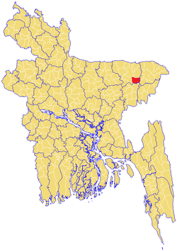
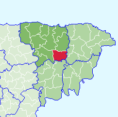
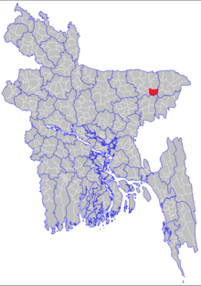
Jagannathpur Upazila
Jagannathpur (Bengali: জগন্নাথপুর, Sylheti: ꠎꠉꠘ꠆ꠘꠣꠕꠙꠥꠞ) is an upazila located in the south-east of the district of Sunamganj and in the middle of the division of Sylhet, Bangladesh. It is bordered by Chhatak and Dakshin Sunamganj to the north, Bishwanath and Osmani Nagar to the east, Derai to the west, and Nabiganj to the south.
Jagannathpur | |
|---|---|
Upazila | |
 | |
 | |
| Country | Bangladesh |
| Division | Sylhet Division |
| District | Sunamganj District |
| Government | |
| • MP (Sunamganj-3) | M. A. Mannan (Bangladesh Awami League) |
| • Upazila Chairman | Ataur Rahman (Bangladesh Nationalist Party) |
| Area | |
| • Total | 368.27 km2 (142.19 sq mi) |
| Population | |
| • Total | 225,271 |
| • Density | 610/km2 (1,600/sq mi) |
| Demonym(s) | Jagannathpuri |
| Demographics | |
| • Literacy rate | 27.9%[1] |
| Languages | |
| • Official language | Bengali[2] |
| • Regional language | Sylheti[3] |
| Time zone | UTC+6 (BST) |
| Postal code | 3060-65 |
| Website | jagannathpur |
Etymology
Jagannath is a compound of two Sanskrit words: jagat (universe) and nāth (lord), which literally means the lord of the universe, and pur means city or village. Jagannathpur means the city of the lord of the universe.
History
Early history
Jagannathpur was an important part of Muazzamabad, as Kamalshahi was the capital and mint city of Muazzamabad and it was located in Shaharpara, which is in north-east of the present-day Jagannathpur Upazila proper. However, according to a ballad written by one Taranath Chaudhury, Jagannathpur was a kingdom and Vijay Manikya was its king and this king was a follower of Jagannath Mishra, who was the father of Chaitanya Mahaprabhu (1486–1534). Jagannath Misrah built a Basu Dev temple under the auspice of Vijay Manikya and this temple was named after Jagannath Misrah, i.e. Jagannath temple. Eventually a settlement established encircling the Jagannath temple and as the settlement grew, it became a village, which inherited the name from the temple. However, historians such as Achyut Charan Choudhury and Syed Mujtaba Ali are in opinion that Taranath Chaudhury characterised his song on Manikya Dynasty of Tripura, but the peasants and ryots of Jagannathpur found pride in that ballad and begun to misrepresent it as a royal chronicle of Jagannathpur. They also proclaim that Vijay Manikkya established a kingdom called Pandua on the eastern border of Jagannathpur, but the name of Pandua has changed to Perua, which now has shrunk to a tiny village market between Jalalpur and Habibpur. In reality, Pandua is a ruined city in Malda district of West Bengal, India, which means Pandua in Malda was the location of Taranath Chaudhury's ballad.
Most probably the king Vijay Manikya (1532-1563) of Tripura or Twipra Kingdom named Jagannathpur after Jagannath Temple in Puri in the state of Odisha, India. It is believed that a disciple of Chaitanya Mahaprabhu built a temple in Jagannathpur replicating the temple in Puri. This temple was originally named Jagannath Temple but eventually it renamed as Basu Dev Temple. There is much more evidence that indicates Vijay Manikya was a king of Tripura and the myth of kingdom of Jagannathpur was germinated following a novella penned by one Taranath Chaudhary, who also claimed in his tale to be the last surviving offspring of Vijay Manikya.[4]
In sixteenth century, Jagannathpur was a zamindari (equivalent of the medieval European serfdom) of two sisters, Shivani and Mohini, who were granted the zamindari by the sovereign of Muazzamabad. Shivani and Mohini were cheated by their choudharies and diwans, which led to impecuniosities and resultant non-payment of revenue collected from the serfs led to forfeiture of zamindari. Shivani and Mohini refused to give up their zamindari and instead declared a battle against the Khans of Muazzamabad. On the order of the reigning Khan, Jagannathpur was besieged by Paragal Khan from Paragola (present-day Pagla), Syed Habib Ullah from Habibganj (present-day Habiganj) and Kuwaz Khan from Shaharpara. No battle ensued and truce was declared on the condition that Kuwaz Khan and Syed Habib Ullah respectively walk down the aisle with Shivani and Mohini.[5]
After the Conquest of Gour in 1303, many disciples of Shah Jalal migrated and settled in present-day Jagannathpur where they preached Islam to the local people. In 1315, under the spiritual leadership of Shah Kamal Qahafah, he came with his 12 spiritual disciples to Shaharpara, which on the north-eastern the boundary of Jagannathpur, and preached to the people the message of Islam. One of the disciples (Syed Shamsuddin) stayed at Syedpur. Dawar Baksh Khatib and Dilawar Bakhsh stayed in the village of Dhawrai, Feson Ullah at the village of Fesi, Shah Shamsuddin Behari stayed village of Atghor, Shah Kala Manik stayed at the village of Maniharagow, Shah Kalu and Shah Chand stayed in Peerergaon and Chandbharang. Shah Jalaluddin at Quskipur.
Geography
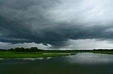
Jagannathpur is located at 24.7667°N 91.5431°E. It is bordered with Chhatak in the north, Bishwanath to the east, Osmani Nagar to the south east, Nabiganj on the south, Derai to the west and Dakshin Sunamganj in the north west. It has 28546 units of households and total area of 368.27 km². Jagannathpur is geographically divided into two distinct regions: Upper-Jagannathpur and Lower-Jagannathpur, the former comparatively consists of highland and the latter consists of lowland and Nulluar haor is the largest among the swamps. Local government offices — Union Council Office — are scattered in both upper and lower Jagannathpur. Patli, Mirpur, Asharkandi, Syedpur–Shaharpara are located on the upper region while Kalkalia, Jagannathpur, Raniganj, Pailgaon and Chilaura–Haldipur are on lowland. Before the formation of Jagannathpur thana (police station) in circa 1922 CE, upper Jagannathpur was under the jurisdiction of Rasoolganj thana and lower Jagannathpur was under the jurisdiction of Derai thana, and both Jagannathpur and Derai Upazilas were under the jurisdiction of the District of Rasoolganj. Settlements and villages have mainly founded along riverbanks and on fringe of haors.
Economy
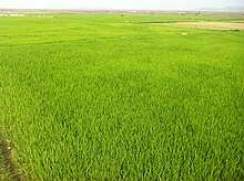
Jagannathpur is regarded as the breadbasket of the District of Sunamganj; fertile paddy-fields has been providing crops in abundance, which has been the source of wealth and stability in the area and this has been further boosted by remittance from abroad. There are 14 post offices available in the area, including 12 banks.
Demographics
At the 1991 Bangladesh census, Jagannathpur had a population of 188,139, of whom 95,285 were aged 18 or older. Males constituted 51.13% of the population, and females 48.87%. Jagannathpur had an average literacy rate of 27.9% (7+ years), against the national average of 32.4%.[1] Of the population Muslim accounted for 81.75%, Hindu for 18.10%, Buddhist for 0.02%, Christian for 0.01%. There are 247 mosques and 5 Hindu temples in the Upazila.[6]
At the 2001 census, it had a population of 225,271, of whom 51.7% were male and 48.3% were female, which shows the Upazila has a balanced gender ratio.
Immigration and migration
Migration process has been constant and steady in Jagannathpur Upazila and it can be characterised as a two-way traffic for centuries. People from villages have been migrating to towns and cities and especially overseas to United Kingdom (London, Birmingham, Manchester, Oldham, Scunthorpe, Leeds and Sunderland) whilst people from other parts of Bangladesh, especially from Comilla, Noakhali, Barishal, Faridpur and Mymensingh, are filling up the vacuum created by relocation of the native people. It has been identified that migration is occurring amongst people of two specific categories and they are moving out of rural to urban areas for employment and economic reasons.
Category 1 consists of people who have acquired education and seek employment. A large section of the first educated mass and elite alike have migrated to Sunamganj Municipality. Majority of the lawyers and government employees from Jagannathpur have migrated to Sunamganj town from the time of creation of Pakistan in 1947 and before the birth of Bangladesh in 1971.
Category 2 consists of well-heeled mass and elite, mainly of immigrant community and they have purchased second homes in the city of Sylhet and partially relocated in the city and abroad. The necessity of moving to city was felt in the years immediately after the independence of Bangladesh due to targeted robberies and harassing of so-called ‘Londoni’ families and villages during the entire decade of the 1970s. Another contributory factor was communications. Jagannathpur was isolated from both Sunamganj and Sylhet towns till the 1990s and amenities were very scarce. The second and third generations of category 1 and 2 are also migrating to the metropolis of Dhaka. The trend of migrating to Dhaka culminated with the millennium development activities from the eve of 2000 CE. As of 1986, an estimated 95 per cent of the Bangladeshi community in the UK originate from the Sylhet region,[7] and Jagannathpur is one of the upazilas in Sylhet which has the highest number of expatriates in the UK.[8] They mainly settled in towns and cities such as St Albans (Hertfordshire), London, in particular Tower Hamlets, people from Jagannathpur can be found in the Brick Lane area (Spitalfields and Banglatown), Newham and Redbridge and Birmingham, Oldham, Leeds, Northampton, Bedford Kidderminster, Haslingden and Sunderland.[9] A wave of immigration from Jagannathpur began after the post war shortages of industrial labour in England. This was combined with a further a sudden industrial boom of the cotton industry, mainly young men were given the opportunity to immigrate to the UK and work in the cotton mills.[10] Migration took place for various reason such as for a better quality of life or wealth, escape poverty, and send money back home for financial support. Many people of Jagannathpur had previously resided in the villages, and agricultural business was a major occupation as many farmers owned a vast amount of rich paddy fields and estates.
Due to immigration, there has been a large shift in the demographics and statistics of Jaganathpur, and also the entire region of Sylhet. The second generation settlers live in the UK and regard it as their home. Despite the cultural barriers and the perceived isolation there has been a paramount of success breeding from the people of Jaganathpur and other parts of Sylhet. They have overcome institutionalised racism, language barriers, social barriers and religious barriers to produce a successful and highly educated young population. Most of whom are now entrepreneurs, doctors, lawyers, diplomats, politicians, biomedical scientists and other professionals.[11] A fair number of people from Jaganathpur have found success and fame through the catering industry and are very successful restaurateurs throughout the country, although the industry is known as Indian, the majority are in fact Bangladeshi origin and essence, as over 85 per cent of Indian restaurants in the UK are owned and managed by Bangladeshi Sylhetis.[12]
Shah Abdul Majid Qureshi who was a pioneer in the curry industry was from Jagannathpur, including Anwar Choudhury[13] - the first and, as of 2004, only Bangladeshi-born and Bangladeshi ethnic British High Commissioner to Bangladesh,[14] Cllr Ghulam Murtuza — the first Bangladeshi born Mayor in the London Borough of Tower Hamlets, and Ahmed Fakhruddin — late veteran community activist was also from Jagannathpur. Haji Abdul Motin aka Motin Miah, a non-resident British Bangladeshi organizer of Bangladesh independent war in 1971 at manchester, and Alhajj Mohammed Gulzar Hussain, a non resident British Bangladeshi organizer of Bangladesh independent war in 1971 at St. Albans, UK were also from Jagannathpur. The first person from Syedpur to be elected to both council seats was Cllr Syed Mumshad Ahmed, son of Alhajj Syed Mostaque Ahmed (kidderminster, wyre forest district councillor 2008 and worcesterhires county councillor 2009).
Administration

A separate Thana was established at Jagannathpur on 1 October 1920 by a gazette notification by Anamul Haque of Parargaon; the thana was upgraded first as an Upazila in 1983,[15] and then as a municipality on the 29 September 1999.[13]
In the Upazila of Jagannathpur, there are 1 municipality, 8 union councils, 9 wards, 43 mahallahs, 263 mauzas and 310 villages. The unions are:
- Kolkolia Union
- Patli Union
- Mirpur Union
- Chilaura–Haldipur Union
- Raniganj Union
- Syedpur Shaharpara Union
- Asharkandi Union
- Pailgaon Union
Municipality
The Upazila Municipality consists of 9 wards:
- Ward 1: Ishaqpur, Bhagyanarayanpur, Bhobanipur, Shashanhabi
- Ward 2: Oihargai, Oiharshahi, Inayetnagar, Pushka Rakhyapur, Ludorpur
- Ward 3: Borotpur, Srirampur, Rampur, Salehpur
- Ward 4: Habibpur, Shahapur, Kishorepur, Majhpara, Durlavpur, Ashighar, Chikka
- Ward 5: Bagzor, Bari Jagannathpur, Hariharpur, Uttar Srinidhipur
- Ward 6: Jagannathpur, Karimpur, Badaura, Hashimabad, Aliyabad
- Ward 7: Ikorochhoi, Monimpur
- Ward 8: Paruya, Purbo Bhobanipur
- Ward 9: Sherpur, Jatrapasha, Paschim Bhobanipur
There are approximately 35,682 households present in Jagannathpur.[16]
Education
There are 6 colleges, 15 high schools (2 junior), up to 119 primary schools under government control, 21 private schools and 34 madrasahs.Notable educational institutions are: Swarup Chandra Government High School, Safat Ullah High School, Shahjalal College and Jagannathpur College.The literacy rate as per 2001 census was 45.3%, which was the highest in Sunamganj, and one of the highest in Sylhet.[16]
Notable people
- Radharaman Dutta (1833–1915), composer and lyricist who was born in Keshabpur.[17]
- Abdus Samad Azad, politician and statesman, former Minister for Foreign Affairs (1971–1973 and 1996–2001) who was born in Bhurakhali.[18]
- Alaur Rahman, singer and music composer, who was born in Alagdi village.
- Anwar Choudhury, Bangladeshi-born British High Commissioner who was born in Prabhakarpur.
- Apsana Begum, British politician and MP for Poplar and Limehouse.
- Sree Bharat Chandra Roy, Founder of Swarup Chandra Govt High School, Estd.1926.
See also
References
- "Population Census Wing, BBS". Archived from the original on 2005-03-27. Retrieved November 10, 2006.
- "Article 3. The state language". The Constitution of the People's Republic of Bangladesh. bdlaws.minlaw.gov.bd. Ministry of Law, The People's Republic of Bangladesh. Retrieved 1 February 2017.
- "Sylheti". Ethnologue.
- Rajmala, the Royal Chronicle of Tripura Kingdom
- Choudhury, N: History of Jagannathpur
- Jagannathpur - History
- Gardner, Katy (July 1992). "International migration and the rural context in Sylhet". New Community. 18 (4): 579–590. doi:10.1080/1369183X.1992.9976331.
- Siddiquee, Iqbasl (2005-07-16). "Door-to-Door Campaign in Sunamganj-3". The Daily Star. Retrieved 2008-07-27.
- Smith, Michael; John Eade (2008). Transnational Ties: Cities, Migrations, and Identities. Transaction Publishers. p. 149. ISBN 978-1-4128-0806-4.
- "Faith - Bangladeshi London". BBC London. Retrieved 2005-05-27.
- Karim, Rezaul (June 2007). "Bangladeshis: Moving with the times". FORUM. The Daily Star. Retrieved 2007-06-01.
- Gillan, Audrey (2002-06-21). "From Bangladesh to Brick Lane". The Guardian. Retrieved 2002-07-21.
- An introduction to Jagannathpur Jagannathpur.com
- "Profile:Anwar Choudhury". BBC News. 2004-05-21. Retrieved 2016-08-03.
- Chanda, Jiban Kumar (2012). "Jagannathpur Upazila". In Islam, Sirajul; Jamal, Ahmed A. (eds.). Banglapedia: National Encyclopedia of Bangladesh (Second ed.). Asiatic Society of Bangladesh.
- Area, Population and Literacy Rate by Upazila/Thana-2001 Archived 2007-11-24 at the Wayback Machine Bangladesh Bureau of Statistics
- Siddiquee, Iqbal (4 March 2008). "Radha Raman Utshab held in Sylhet". The Daily Star.
- Ahmed, Helal Uddin (2012). "Azad, Abdus Samad". In Islam, Sirajul; Jamal, Ahmed A. (eds.). Banglapedia: National Encyclopedia of Bangladesh (Second ed.). Asiatic Society of Bangladesh.
Capital: Sunamganj | ||
| Upazilas | ||
| Constituencies | ||
| Attractions and sites | ||
| Rivers | ||
| Inhabited areas | ||
| Educational institutions | ||
| Transport | ||
| History | ||
Capital: Sylhet | ||
| Habiganj District | 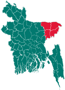 | |
| Moulvibazar District | ||
| Sunamganj District | ||
| Sylhet District | ||