Beanibazar Upazila
Beanibazar (Bengali: বিয়ানীবাজার, Sylheti: ꠛꠤꠀꠘꠤꠛꠣꠏꠣꠞ) is an Upazila of Sylhet District in the Division of Sylhet, Bangladesh.
.
Beanibazar Upazila বিয়ানীবাজার ꠛꠤꠀꠘꠤꠛꠣꠏꠣꠞ | |
|---|---|
 | |
| Division | Sylhet Division |
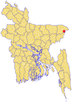
| District | Sylhet District |
| Area | |
| • Total | 253.22 km2 (97.77 sq mi) |
| Population | |
| • Total | 181,547 |
| • Density | 720/km2 (1,900/sq mi) |
| Demonym(s) | Beanibazari, Biyanibazari |
| Time zone | UTC+6 (BST) |
| Postal code | 3170-75 |
| Website | www |
Beanibazar is located at 24.8250°N 92.1625°E.
History
After the Conquest of Gour in 1303, Khwaja Adina Sufi - a disciple of Shah Jalal - migrated to what is now Adinabad in Charkhai (in Beanibazar) where they preached Islam to the local people. The name Beanibazar is derived from the existing Bihani Bazaar ("Morning Market") which was founded by the local landowner Krishna Kishore Pal Chowdhury.[1] Previously, Beanibazar was constituent part of Panchakhanda, which means "Five Parts".
At the Delhi Durbar on 12 December 1911, King George V announced the reunification of a Bengal Province and the creation of an Assam Province. During this time, the Sylhet region was split into four mahakumas (or subdivisions); Sylhet (including Moulvibazar), Habiganj, Sunamganj and Karimganj. In 1882, the Sylhet Mahakuma was split into two; Sylhet and South Sylhet. On 18 May 1940, one of the five thanas of the Karimganj Mahakuma, Jolodhup, was planned to also be split into two – Beanibazar and Barlekha. Beanibazar went to Sylhet Mahakuma while Barlekha went to South Sylhet Mahakuma.[2] The upazila was the headquarters of the Nankar Rebellion. Beanibazar became an upazila in 1983.[3] In 2009, the Beanibazar Sporting Club was founded.
Geography
Beanibazar is located at 24.8250°N 92.1625°E. It has 27,089 households and a total area of 253.22 km².[4]
Sheola Sutarkandi International Border Crossing
Sheola-Sutarkandi International Border Crossing on Bangladesh–India border on Karimganj-Beanibazar route is in Karimganj district of the Indian state of Assam. Famous for having an International trade centre, Sutarkandi is an international border of India and Bangladesh. Through this space, export of fruits, silicon and coal is done. The place is situated in the district of Karimganj, Assam. It is located 14km away from Karimganj and contains principal custom check post for the trade flow. Two national highway runs through Sutarkandi that is National Highway 151 (old) and National Highway 7 (new) which is 45 km from the border of Sylhet town of Bangladesh.[5]
Demographics
As of the 1991 Bangladesh census, Beanibazar had a population of 181,547, 49.5% of whom are male and 50.5% are female. 89,317 (or 49.2%) of the population are over the age of eighteen.
Beanibazar has an average literacy rate of 80.5% (7+ years) compared to the national average of 32.4%.[6]
News papers
- The weekly Beanibazar Barta
- Beanibazar Times
- Polash Afzal[7]
- BeanibazarNews24[8]
References
- "উপজেলার পটভূমি". বিয়ানীবাজার উপজেলা (in Bengali). Bangladesh.gov.bd. 2020-01-13. Retrieved 2020-01-14.
- "উপজেলা পটভূমি". Government of Bangladesh (in Bengali). Retrieved 24 September 2018.
- Azizur Rahman (2012). "Beanibazar Upazila". In Sirajul Islam and Ahmed A. Jamal (ed.). Banglapedia: National Encyclopedia of Bangladesh (Second ed.). Asiatic Society of Bangladesh.
- http://www.beanibazarkontho.com/
- https://www.tourmyindia.com/states/assam/sutarkandi-indo-bangladesh-border.html
- "Population Census Wing, BBS". Archived from the original on 2005-03-27. Retrieved November 10, 2006.
- "প্রচ্ছদ – বিয়ানীবাজার কন্ঠ". www.beanibazarkontho.com. Retrieved 1 January 2018.
- "Home". beanibazarnews24.com. Retrieved 1 January 2018.
See also
- Districts of Bangladesh
- Divisions of Bangladesh
- Upozilas of Bangladesh
- Unions in Beanibazar