Tahirpur Upazila
Tahirpur (Bengali: তাহিরপুর) is an upazila of Sunamganj District in the division of Sylhet, Bangladesh.[1]
Tahirpur তাহিরপুর | |
|---|---|
 | |
| Division | Sylhet Division |
| District | Sunamganj District |
| Government | |
| • MP (Sunamganj-1) | Moazzem Hossain Ratan (Awami League) |
| Area | |
| • Total | 313.7 km2 (121.1 sq mi) |
| Population | |
| • Total | 155,188 |
| • Density | 490/km2 (1,300/sq mi) |
| Demonym(s) | Tahirpuri, Tahirfuri |
| Time zone | UTC+6 (BST) |
| Postal code | 3030 |
| Website | tahirpur |
History
In ancient times, Tahirpur was a part of the Pragjyotisha Kingdom ruled by Raja Bhagadatta. Bhagadatta's subcapital was in Laur Hill. The Raja was killed in the Kurukshetra War and the Laur Kingdom (modern-day Sunamganj District) separated from the Pragjyotisha kingdom.[2] 19 successive Rajas ruled over Laur all descendants of Raja Bhagadatta. Keshab Misra of Kannauj and his descendants then took over Laur.
After the Conquest of Taraf in 1304, Shah Arifin Rafiuddin, a disciple of Shah Jalal, migrated and settled in present-day Tahirpur where he preached Islam to the local people. His khanqah also remains here in Sarping/Laurergarh but the part containing his mazar is on the other side of the border in Meghalaya on top of Laur Hill. Tahirpur contained the village of Nabagram, now in Badaghat Union, which served as the capital of the Laur Kingdom. In the 18th century, Tahirpur became a part of Brajendra Kishore Roy Chowdhury's zamindari based in Gouripur House in Mymensingh. Tahirpur was then a predominantly Hindu-populated area. During this period, the local council resolved a false accusation against a Bengali Muslim by the name of Tahir Ali. Following this, Tahir Ali settled in this area and named his village Tahirpur.[3]
Tahirpur was founded as a thana in 1924 named after the village of Tahirpur and was situated in the Sunamganj subdivision. It had three trade centres; Tahirpur Bazar, Sripur Bazar and Badaghat Bazar. Its first post office, the Tahirpur post office, was opened in its Laur pargana. In 1912, there was a police outpost in Tahirpur which had 1 sub-inspector, 1 head constable and 6 constables.[4]
During the Bangladesh Liberation War of 1971, refugee camps were set up in the nearby Khasi and Jaintia Hills. During the Bhashan Pani movement from 1997 to 1998, ten peasants were murdered with many also being arrested or kept confined.[1]
Geography
Tahirpur is located at 25.0917°N 91.1750°E. With and area of 313.70 km2, it is bounded by the Indian state of Meghalaya to the north, Jamalganj and Dharmapasha Upazilas on the south, Bishwamvarpur Upazila on the east, and Dharmapasha Upazila on the west.
Demographics
Tahirpur Upazila contains about 22,000 households, with a total population of about 155,000, with a sex ratio of about 51.9% male to 48.1% female. The population is overwhelmingly Muslim, with about 9.8% Hindu, and less than 0.5% other religions.
Administration Tahirpur Thana, now an upazila, was formed in 1924.
| Name & GO Code | Area(km2) | Population | Male | Female | Density | Literacy rate |
|---|---|---|---|---|---|---|
| Uttar Bardal 82 | 34.02 | 25,514 | 13,035 | 12,479 | 750.2 | 20.93% |
| Badaghat 71 | 35.6 | 33,454 | 16924 | 16530 | 940 | 29.76% |
| Uttar Sreepur 92 | 94.8 | 33,4547 | 17761 | 15696 | 353 | 34.05% |
| Tahirpur 64 | 52.46 | 15,300 | 7,964 | 7,336 | 292 | 33.81% |
| Dakshin Bardal 43 | 17.27 | 16,827 | 8,949 | 7,878 | 975 | 33.60% |
| Dakshin Sreepur 33 | 59.07 | 16,605 | 8,651 | 7,954 | 281 | 34.33% |
| Balijuri 10 | 29.35 | 14,031 | 7,253 | 6,778 | 478 | 36.24% |
Administration
Tahirpur has 7 Unions/Wards, 136 Mauzas/Mahallas, and 244 villages.
Chairman : Kamruzzaman kamrul
Women Vice Chairman :Achiya Afendi
Vice Chairman : Akhonji
Upazila Nirbahi Officer (UNO):
About Also:
Source Bangladesh Population Census 2001, Bangladesh Bureau of Statistics.
Archaeological heritage and relics Remnants of the residence of Raja Bijoy Singh (16th century).
Historical events During the war of liberation in 1971, a number of refugee camps were established on the foot of the Khasia Jainta hills near Tahirpur. In 1997-98 Bhasan Pani Movement was held in Tahirpur in which 10 peasants were killed and many were arrested and were kept confined.
Religious institutions Mosque 233, temple 45, church 1, tomb 3, sacred place 1.
Literacy rate and educational institutions Average literacy 31.2%; male 36.2%, female 25.9%. Noted educational institutions: Zainal Abedin College (1992), Badaghat College (1994), Tahirpur Government High School (1950), Tahirpur Girls' High School (1988), Badaghat High School (1962), Takerghat Chunapathar Khani Prokalpa High School (1966), Janata High School (1989), Balijuri High School (1965), Tahirpur Hifzul Ulam Senior Madrasa (1973), Rahmania Senior Madrasa (1973).
Cultural organisations Library 1, club 10, women organisation 1, playground 3.
Tourist spots Tanguar Haor, Janmadham (birthplace) of Sree Sree Adaita Prabhu, Pana Tirtha and Barek Tila.
Main sources of income Agriculture 68.05%, non-agricultural labourer 7.53%, industry 0.35%, commerce 11.56%, transport and communication 1.07%, service 2.30%, construction 0.57%, religious service 0.32%, rent and remittance 0.22% and others 8.03%.
Ownership of agricultural land Landowner 59.34%, landless 40.66%; agricultural landowner: urban 60.84% and rural 59.27%.
Main crops Paddy, nut, wheat, mustard.
Extinct or nearly extinct crops Tobacco, kaun.
Main fruits Mango, jackfruit, banana, papaya, lemon, watermelon.
Fisheries, dairies and poultries Fishery 10, dairy 20, poultry 70.
Communication facilities Pucca road 15 km, mud road 201 km.
Extinct or nearly extinct traditional transport Palanquin, bullock cart.
Cottage industries Weaving, bamboo work, cane work.
Hats, bazars and fairs Hats and bazars are 20, fairs 2, most noted of which are Badaghat Bazar, Tahirpur Bazar, Balijuri Bazar, Anwarpur Bazar, Panatirtha Baruni Mela at Rajargaon and Shah Arefin Mela at Laurergarh.
Main exports Paddy, fish, limestone.
Access to electricity All the unions of the upazila are under rural electrification net-work. However 3.93% of the dwelling households have access to electricity.
Natural resources Limestone, sand and coal.
Sources of drinking water Tube-well 81.74%, tap 1%, pond 4.54% and others 12.72%.
Sanitation 11.23% (rural 9.90% and urban 38.69%) of dwelling households of the upazila use sanitary latrines and 77.08% (rural 77.87% and urban 60.84%) of dwelling households use non-sanitary latrines; 11.69% of households do not have latrine facilities.
Health centres Upazila health centre 1, family planning centre 7, satellite clinic 1.
Natural disasters The floods of 1974, 1988 and 1998 caused heavy damages to cattle and other properties of the upazila.
See also
- Upazilas of Bangladesh
- Districts of Bangladesh
- Divisions of Bangladesh
References
| Wikimedia Commons has media related to Tahirpur Upazila. |
- Md Alomgir Hassan (2012), "Tahirpur Upazila", in Sirajul Islam and Ahmed A. Jamal (ed.), Banglapedia: National Encyclopedia of Bangladesh (Second ed.), Asiatic Society of Bangladesh
- R. C. Majumdar (1977). "3". Ancient India (8 ed.). Delhi: Motilal Banarsidass Publishers. p. 267.
- "Upazila background". Tahirpur Upazila.
- Assam District Gazetteers - Supplement. 2. Shillong. 1915. p. 26.
- Md Masuk Mia (2018)
"Tahirpur Upazila" [file:///E:/C%20Programming/Html/Sylhet/Tahirpur.html]
Capital: Sunamganj | ||
| Upazilas | ||
| Constituencies | ||
| Attractions and sites | ||
| Rivers | ||
| Inhabited areas | ||
| Educational institutions | ||
| Transport | ||
| History | ||
Capital: Sylhet | ||
| Habiganj District | 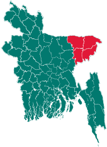 | |
| Moulvibazar District | ||
| Sunamganj District | ||
| Sylhet District | ||