Gowainghat Upazila
Gowainghat (Bengali: গোয়াইনঘাট, Sylheti: ꠉꠥꠀꠁꠘꠉꠣꠐ) is an Upazila of Sylhet District in the Division of Sylhet, Bangladesh.[1]
Gowainghat গোয়াইনঘাট ꠉꠥꠀꠁꠘꠉꠣꠐ | |
|---|---|
Upazila | |
 Gowainghat Location in Bangladesh | |
| Coordinates: 25°6.2′N 91°53.5′E | |
| Country | |
| Division | Sylhet Division |
| District | Sylhet District |
| Area | |
| • Total | 486.1 km2 (187.7 sq mi) |
| Population (2001) | |
| • Total | 207,170 |
| • Density | 430/km2 (1,100/sq mi) |
| Time zone | UTC+6 (BST) |
| Website | gowainghat |
History
The British Empire conquered the Jaintia Kingdom on 25 March 1835, finally incorporating Gowainghat in its Sylhet District Collectorate.[2] In 1908, the Gowainghat Thana was founded with the union of 5 parganas; Dhargram, Araikha, Piyaingul, Panchbhag and Jaflong and then separated into 9 union councils. During the Bangladesh Liberation War, the Pakistani army launched an attack in Ujuhat, Alirgaon killing 25 freedom fighters on the night of 28 November 1971. 7 mass graves are found in the upazila in Ujuhat, Atgram, Tamabil Zero Point, Health Complex and Birkuli. To commemorate the loss of lives, a memorial has been built. The thana prospered, officially upgrading to an upazila on 14 March 1983.[3]
Geography
Gowainghat is located at 25.1028°N 91.8917°E . It has 34,133 households and a total area of 486.1 km². The rivers are quarried for their stones, in areas like Bichnakandi.[4]
Demographics
As of 2001 Bangladesh census, Gowainghat has a population of 207,170. Males constituted 51.80% of the population, and females 48.20%. Gowainghat has an average literacy rate of 22.8%.[5]
Administration
Gowainghat has 9 Unions, 260 Mauzas, and 267 villages.
The unions are:
- poschim Alirgaon Union
- purbo Alirgaon Union
- Daubari Union
- Fatehpur Union
- Lengura Union
- Nandirgaon Union
- Paschim Jaflong Union
- Purba Jaflong Union
- Rustampur Union
- Towakul Union
See also
- Upazilas of Bangladesh
- Districts of Bangladesh
- Divisions of Bangladesh
References
| Wikimedia Commons has media related to Gowainghat Upazila. |
- Abdul Hai Al-Hadi (2012). "Gowainghat Upazila". In Sirajul Islam and Ahmed A. Jamal (ed.). Banglapedia: National Encyclopedia of Bangladesh (Second ed.). Asiatic Society of Bangladesh.
- B C Allen (1905). Assam District Gazetteers. 2. Calcutta: Government of Assam.
- গোয়াইনঘাট উপজেলা. Gowainghat (in Bengali).
- "Suspension of stones collection : Over 5 lakh workers jobless in Sylhet | Business News 24 BD". businessnews24bd.com. Retrieved 2016-11-29.
- "Census Results by Upazila/Thana" (PDF). Bangladesh Bureau of Statistics. 2001. Archived from the original (PDF) on November 24, 2007. Retrieved 2008-08-27.
Capital: Sylhet | ||
| Habiganj District | 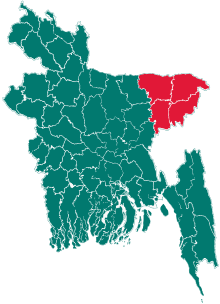 | |
| Moulvibazar District | ||
| Sunamganj District | ||
| Sylhet District | ||