Imbert, Dominican Republic
Imbert is a town in the Puerto Plata province of the Dominican Republic. The town is named after José María Imbert.
Imbert | |
|---|---|
 Seal | |
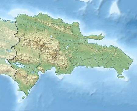 Imbert Imbert in the Dominican Republic | |
| Coordinates: 19°45′0″N 70°49′48″W | |
| Country | |
| Province | Puerto Plata |
| Area | |
| • Total | 170.70 km2 (65.91 sq mi) |
| Population (2012)[2] | |
| • Total | 30,514 |
| • Density | 180/km2 (460/sq mi) |
| Municipal Districts | 0 |
Climate
| Climate data for Imbert, Dominican Republic (1961–1990) | |||||||||||||
|---|---|---|---|---|---|---|---|---|---|---|---|---|---|
| Month | Jan | Feb | Mar | Apr | May | Jun | Jul | Aug | Sep | Oct | Nov | Dec | Year |
| Record high °C (°F) | 34.9 (94.8) |
36.5 (97.7) |
35.5 (95.9) |
35.7 (96.3) |
37.3 (99.1) |
37.7 (99.9) |
39.0 (102.2) |
38.5 (101.3) |
37.3 (99.1) |
37.5 (99.5) |
38.5 (101.3) |
35.3 (95.5) |
39.0 (102.2) |
| Average high °C (°F) | 28.4 (83.1) |
28.9 (84.0) |
29.6 (85.3) |
30.1 (86.2) |
31.3 (88.3) |
33.2 (91.8) |
33.1 (91.6) |
33.4 (92.1) |
33.5 (92.3) |
32.7 (90.9) |
30.0 (86.0) |
28.2 (82.8) |
31.0 (87.8) |
| Average low °C (°F) | 16.8 (62.2) |
16.7 (62.1) |
17.1 (62.8) |
17.9 (64.2) |
19.3 (66.7) |
20.2 (68.4) |
20.4 (68.7) |
20.3 (68.5) |
20.2 (68.4) |
19.8 (67.6) |
18.9 (66.0) |
17.5 (63.5) |
18.8 (65.8) |
| Record low °C (°F) | 12.2 (54.0) |
12.0 (53.6) |
11.0 (51.8) |
12.5 (54.5) |
13.0 (55.4) |
11.7 (53.1) |
15.0 (59.0) |
12.8 (55.0) |
16.3 (61.3) |
14.7 (58.5) |
13.5 (56.3) |
10.8 (51.4) |
10.8 (51.4) |
| Average rainfall mm (inches) | 169.6 (6.68) |
148.5 (5.85) |
126.6 (4.98) |
171.7 (6.76) |
148.0 (5.83) |
84.9 (3.34) |
73.1 (2.88) |
75.3 (2.96) |
88.7 (3.49) |
141.6 (5.57) |
226.8 (8.93) |
264.6 (10.42) |
1,719.4 (67.69) |
| Average rainy days (≥ 1.0 mm) | 10.2 | 8.2 | 7.0 | 8.1 | 9.1 | 7.0 | 6.7 | 6.5 | 6.7 | 9.3 | 11.6 | 12.7 | 103.1 |
| Source: NOAA[3] | |||||||||||||
References
- Superficies a nivel de municipios, Oficina Nacional de Estadistica Archived April 17, 2009, at the Wayback Machine
- Censo 2002 de Población y Vivienda, Oficina Nacional de Estadistica
- "Imbert Climate Normals 1961-1990". National Oceanic and Atmospheric Administration. Retrieved September 15, 2016.
Sources
- World Gazeteer: Dominican Republic at Archive.today (archived 2012-12-04) – World-Gazetteer.com
This article is issued from Wikipedia. The text is licensed under Creative Commons - Attribution - Sharealike. Additional terms may apply for the media files.