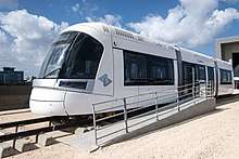
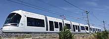
Tel Aviv Light Rail
The Tel Aviv Metropolitan Area Mass-Transit System is a planned mass transit system for the Tel Aviv Metropolitan Area. The system will include different types of rapid transit like light rail (which will run underground in some areas), bus and more.
Work on the Red Line, the first in the project, started on September 21, 2011, following years of preparatory works and numerous delays.[1] The Red line is planned to open in 2021. Construction of the Purple line started in December 2018. Work on the Green line was set to begin in January 2019.[2][3]
History

The first proposals for a tramway in the area were made by the Lebanese engineer George Franjieh in November 1892, about nine weeks after the inauguration of the Jaffa–Jerusalem railway. The plan called for a main line between southern and northeastern Jaffa, with spurs to the harbor and the eastern orchards. The plan was considered uneconomical and was shelved. A later plan called for a light railway from Jaffa to the nearby settlements of Rishon LeZion, Petah Tikva and Wilhelma.[4]
A Decauville light railway was built in Jaffa and Tel Aviv in World War I, connecting the port with the Yarkon River. It was used for about a decade after the war, and dismantled at a later date.
A subway system was first planned in the mid-1960s, and in 1967 a station at the Shalom Meir Tower was inaugurated in the presence of then Prime Minister Levi Eshkol. However, financial difficulties forced the abandonment of the project, and Shalom Meir remains the only subway station in Tel Aviv, disconnected from other transport links.
Revised plan: Light Rail
In 2000, the plan for a subway was changed to one for light rail, and more plausible plans for a mass transit system in Tel Aviv were unveiled. The first 22 kilometres (14 mi) Red Line has been approved, and excavation began in late 2009, with construction of the underground stations beginning in August 2015. The Red Line is expected to become operational in 2021.
In December 2006, the MTS group was awarded a BOT contract for the Red Line of the light rail, by which they are to build and operate the line for its first 32 years. MTS consisted of Africa Israel, Siemens of Germany, the Egged Bus Cooperative, Chinese infrastructure company CCECC, the Portuguese infrastructure firm Soares da Costa, and the leading Dutch transportation company HTM.[5] After many years of delays due to MTS financing issues, in December 2010 the government revoked MTS' concession and nationalized the project, putting it under the authority of NTA, the government agency which was in charge with overseeing the overall development of the rapid transit system in the Tel Aviv metro area.[6]
Current status
Construction on the first line, from Bat Yam to Petah Tikva, began in August 2015.[7][8] In February 2017, most of the stations on the red line were already under construction. The preparations for the construction of the second line (Green Line) started on February 5, 2017 on Ibn Gabirol Street in Tel Aviv. Infrastructure works for the Purple Line began in December 2018.
Planned lines
The blueprint includes four lines: two in planning stages, one under approval and one under construction. They will cover 100 km (62 mi) around the Tel Aviv metropolitan area.
| Line | Length | Status | Open Date | Primary Cities |
Terminals | No. Stations |
|---|---|---|---|---|---|---|
| Red Line [9] | 23 km (14 mi)[10] | Under Construction | October 2021 est. | Petah Tikva, Bnei Brak, Ramat Gan, Tel Aviv–Jaffa, Bat Yam | Petah Tikva Bus Terminal ● Kiryat Aryeh Depot (Petah Tikva) Nisenboim (Bat Yam) |
33 (10 underground) |
| Green Line[11] | 35 km (22 mi)[10] | In tender (will start construction in 2020)[12] | 2024 est. | Herzliya, Tel Aviv, Holon, Rishon LeZion | Herzliya Pituah ● Tel Aviv University Holon Depot ● Moshe Dayan (Rishon LeZion) |
62 (4 underground)[13] |
| Purple Line[14] | 36 km (22 mi) | In tender (will start construction in 2020) | 2024 est. | Yehud, Or Yehuda, Ramat Gan, Tel Aviv, Kiryat Ono, Giv'at Shmuel | Tayasim Junction (Yehud) ● Yahalom Industrial Zone (Or Yehuda) ● Bar Ilan University (Ramat Gan) Arlozorov (Tel Aviv) |
56 |
| Brown Line[15] | 28 km (17 mi) | Early Plans | – | Ramle–Rishon LeZion | Ramle ● Rishon Lezion Center | Unknown |
Red Line
About 10 kilometres (6 mi) of the 22 kilometres (14 mi) Red Line is to be built underground, with the remaining overground segment constructed in as a light rail/tram. It is to have 33 stops, 10 of which would be underground, with an average distance of about 500 metres between overground stops and of about 1000 metres between overground ones. The average distance between the overground stops would be 1 km. The line would run from Bat Yam in the southwest, through Jaffa and central Tel Aviv, and carry on to Petah Tikva, through Ramat Gan and Bnei Brak. An interchange is planned for Tel Aviv Central railway station. It has been forecast that by 2020, 100 million people would be using this line annually.
Stations (underground in italics): Nissenbaum, HaAmal, Kaf Tet BeNovember, Yoseftal, Bar Ilan, Balfour, Jabotinsky, Rothschild, HaAztmaut, Machrozet, HaBaashat, Issakov, Erlich, Ben Tzvi, Salame, Elifelet, Allenby, Carlebach, Yehudit, Shaul HaMelech, Arlozorov, Abba Hillel, Bialik, Ben-Gurion, Aharonowitz. From Aharonowitz, one branch continues to Shenkar, Rabin, Beilinson, Dankner, Orlov, Pinsker, Petah Tikva Central Bus Station (Terminal); another continues to Em HaMoshavot and the Kiryat Aryeh Maintenance Depot.
The work on Allenby station began on February 8, 2015.
Green Line
The second or Green Line, in the tender phase, is a 35 kilometres (22 mi) line with 62 stops that would run from the west of Rishon LeZion northwards through Holon through central Tel Aviv and will split into two branches: One to Herzliya in the north, and one to Ramat HaHayal neighborhood in Tel Aviv in the northeast. Only its central Tel Aviv segment would be underground, from Levinski Street through Ibn Gabirol Street until the Yarkon River. Four of the fifty-eight stations will be underground. The expected annual passenger forecast is 65 million. NTA is including the design and boring of the Green Line's tunnels as part of Red Line's tunnels overall contract so that work on the Green Line's underground portion can commence immediately following the completion of the Red Line tunnels. The preparations for the construction of this line begun on Feb 5th 2017 in Ibn Gabirol street in Tel Aviv.
Purple Line
The third, or Purple Line, is envisaged as a 28 kilometres (17 mi) line with 44 stops and will connect Sheba Hospital through Giv'at Shmuel and Kiryat Ono, and will connect Arlozorov in Tel Aviv to Yehud and Or Yehuda through Ramat Gan. This line will be over-ground for its entire route.
Brown Line
The sixth, or Brown Line, is a planned BRT line that will serve the southern metropolitan area, beginning in Moshe Dayan Railway Station at western Rishon LeZion in a connection with the Red Line and the Green Line, continues east via central Rishon Lezion, bypasses Assaf HaRofeh Medical Center, and continues to Ramle where it splits into two branches: One continues to Lod in the northeast, and the second continues to eastern Ramle in the east. There is a possibility of making it a light rail line eventually.
Cancelled lines
The following lines were planned but some of them are now expected to be replaced by the Tel Aviv Metro lines.
Yellow Line
This line would have begun in Kfar Saba then continued on to Hod Hasharon, Herzliya, Ramat Hasharon on Sokolov Street, before joining Ben-Gurion Street in Ramat Gan, then Yitzhak Rabin Street in Givataim, then Moshe Dayan Street in Tel Aviv, Mikveh Israel, it would end in Holon after crossing Ariel Sharon Park. This line was designed initially as a bus rapid transit, however, currently the possibility of making it a metro line is being considered.
Blue Line
The fifth, or Blue Line, was the first line of the BRT system and the first line not to pass via Tel Aviv. The line would begin in Rehovot and continue to HaRishonim Railway Station in Rishon LeZion via Ness Ziona and end at the Holon junction. This line's route is part of the Tel Aviv Metro plan.
Pink Line
The seventh, or Pink Line, was a planned BRT line that will serve the northern metropolitan area, beginning in northeastern Kfar Saba and continues through its main streets until, crossing Highway 4 to Ra'anana and continues through Ahuza Street until western Ra'anana and continues to Herzliya and crosses it until the Marina area, where it terminates. There is an alternative service of the line through Highway 4 and Highway 2 to Tel Aviv, that splits from the main service in the Kfar Saba-Ra'anana border.
Planned BRT Line
Orange Line
The eighth and last to date, or Orange Line, is a planned BRT line that will be the only line which is isolated from the system. It will serve only the city of Netanya in the northern metropolitan area. It will be a circular line that connects both sides of the city, crossing Highway 2. Actual route of the line is still unknown. The line will be connected to the system only by other transport means, such as Israel Railways and buses.
References
- Amiram Barkat (September 20, 2011). "Work begins on Tel Aviv light rail". Globes. Retrieved April 15, 2012.
- Sonia Gorodeisky (December 25, 2018). "Work begins on second Tel Aviv light rail line". Globes. Retrieved January 3, 2019.
- The project that could help determine Israel's future, The Jerusalem Post, Carl Hoffman, January 9, 2016
- Cotterell, Paul. "A Tramway Project in Jaffa". HaRakevet (6): 11–12.
- "6: Light Rapid Transit". HaRakevet (80): 4. March 2008. ISSN 0964-8763.
- http://www.nrg.co.il/online/16/ART2/188/317.html The government officially nationalizes the construction of the Tel Aviv red line (Hebrew)
- http://www.ynetnews.com/articles/0,7340,L-4648378,00.html
- http://www.haaretz.com/israel-news/.premium-1.669048
- The Red Line (in Hebrew)
- Thomas, Tris (January 16, 2012). "Pre-Qualification call for Tel-Aviv Metro works". Tunnelling Journal. Retrieved February 29, 2012.
- The Green Line (in Hebrew)
- The project that could help determine Israel's future, The Jerusalem Post, Carl Hoffman, January 9, 2016
- Maor, Tami (December 24, 2012). "Test Drilling for Green Line of Tel Aviv Light Rail". Tel Aviv Local (in Hebrew). Retrieved December 25, 2012.
- The Purple Line (in Hebrew)
- The Brown Line (in Hebrew)
External links
| Wikimedia Commons has media related to Tel Aviv Light Rail. |
- June 2010 update to the map of National Outline Plan 23 regarding the light rail at the Israel Land Administration
- NTA (in English) – Tel Aviv Subway developer, builder and operator.
- NTA (in Hebrew)
- Map of all lines on Govmap.gov.il
| Roads |
| ||||
|---|---|---|---|---|---|
| Bus operators | |||||
| Rail transport |
| ||||
| Sea ports | |||||
| Aviation |
| ||||
| Cable cars | |||||
| By city | |||||
| Smart cards | |||||