Grade II* listed buildings in Greater Manchester
There are 236 Grade II* listed buildings in Greater Manchester, England. In the United Kingdom, the term listed building refers to a building or other structure officially designated as being of special architectural, historical or cultural significance; Grade II* structures are those considered to be "particularly significant buildings of more than local interest".[1] In England, the authority for listing under the Planning (Listed Buildings and Conservation Areas) Act 1990[2] rests with English Heritage, a non-departmental public body sponsored by the Department for Culture, Media and Sport.
The metropolitan county of Greater Manchester is made up of 10 metropolitan boroughs: Bolton, Bury, Manchester, Oldham, Rochdale, Salford, Stockport, Tameside, Trafford and Wigan. The Grade II* buildings in each borough are listed separately. Manchester, the world's first industrialised city,[3] has 77 of Greater Manchester's 238 Grade II* listed buildings, the highest number of any borough. Bury has the least, with only eight. The River Irwell forms the boundary between Salford and Trafford, so one listed structure, Barton Swing Aqueduct, has been listed under both Salford and Trafford.
Most of Greater Manchester's listed buildings date from the Victorian and Edwardian periods.[1] According to an Association for Industrial Archaeology publication, Greater Manchester is "one of the classic areas of industrial and urban growth in Britain, the result of a combination of forces that came together in the 18th and 19th centuries: a phenomenal rise in population, the appearance of the specialist industrial town, a transport revolution, and weak local lordship".[4] Much of the region, historically a part of Lancashire, was at the forefront of textile manufacturing from the early 19th century until the early 20th century, and the county includes several former mill towns.[5][6] Greater Manchester has a wealth of industrial heritage, represented by industrial architecture found throughout the county,[6] but many of its Grade II* listed buildings have a municipal, ecclesiastic or other cultural heritage.
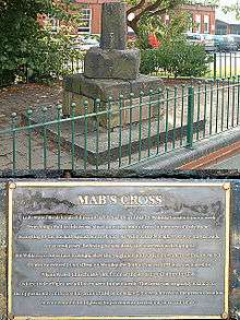
It is uncertain which Grade II* listed structure in Greater Manchester is the oldest. However, three of the 238 buildings date from the 13th century, making them the oldest. Brandlesholme Old Hall in Bury was once an open-hall cruck-framed house, originating in the 13th century, although altered and extended in the 16th century and completely remodelled in 1849.[7] The Church of St Chad in Rochdale has a 13th-century tower (with an 1870 extension).[8] And Mab's Cross in Wigan, the stump of a boundary cross, is probably 13th century in origin.[9] The newest Grade II* listed building in Greater Manchester is the Daily Express Building, designed by Sir Owen Williams in 1939.[10] Due to the heavy impact of the Industrial Revolution on Greater Manchester, just under half of its Grade II* listed buildings (112, 47%) were completed in the 19th century.
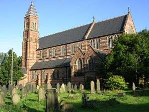
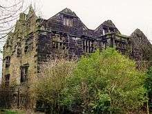
Bolton

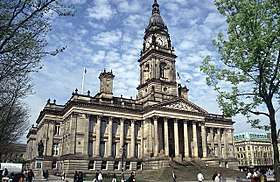
.JPG)
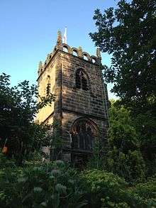
Bury
| Name | Location | Type | Architect | Completed [note 1] | Date designated | Grid ref.[note 2] Geo-coordinates |
Entry number [note 3] | Image | Ref. |
|---|---|---|---|---|---|---|---|---|---|
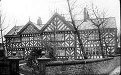
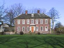
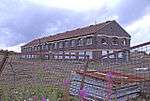
| Brandlesholme Old Hall | Brandlesholme Road, Bury | Open Hall House | 13th century | 29 January 1985 | SD7877213210 53°36′54″N 2°19′20″W |
1067287 |  | [11] | |
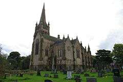
| Christ Church | High Street, Walshaw | Church | Lawrence Booth | 1888 | 29 January 1985 | SD7766611564 53°36′01″N 2°20′20″W |
1163417 | [12] | |
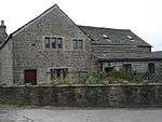
| Dearden Fold Farmhouse | Bury Old Road, Radcliffe | House | 16th century | 29 January 1985 | SD7582010176 53°35′15″N 2°22′00″W |
1356793 |  Dearden Fold Farmhouse | [13] | |
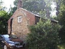
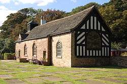
| Hey House | Holcombe Old Road, Ramsbottom | Hunting Lodge | c. 1616 | 9 August 1966 | SD7768815915 53°38′21″N 2°20′20″W |
1067269 | 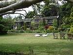 Hey House | [14] | |
| Lower Chesham | Bell Lane, Bury | House | 1713 | 26 May 1976 | SD8151111357 53°35′54″N 2°16′51″W |
1067281 | | [15] | |
| Monument to John Brooks to west of Parish Church of St Mary the Virgin | Church Lane, Prestwich | Commemorative Monument | John Thomas | c. 1851 | 29 January 1985 | SD8104303665 53°31′45″N 2°17′15″W |
1067254 | 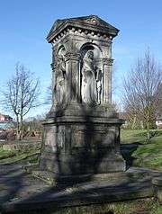 Monument to John Brooks to west of Parish Church of St Mary the Virgin | |
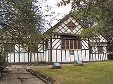
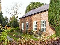
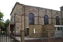
| Presbyterian Chapel | Knowsley Road, Ainsworth | Presbyterian Chapel | 16th century | 29 July 1966 | SD7629510322 53°35′20″N 2°21′34″W |
1163487 | _-_geograph.org.uk_-_448023.jpg) Presbyterian Chapel | [16] | |
| Radcliffe Cenotaph | Blackburn Street, Radcliffe | Cenotaph | Sydney Marsh | 1922 | 10 March 1992 | SD7837107362 53°33′45″N 2°19′41″W |
1067192 | 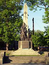 Radcliffe Cenotaph | [17] |
| War Memorial to the Lancashire Fusiliers, Gallipoli Gardens | Gallipoli Gardens, Bury | War memorial | Sir Edwin Lutyens | 1922 | 2 September 1992 | SD8032510670 53°35′32″N 2°17′55″W |
1250814 | ||
| Bury War Memorial | Bury | War memorial | 1924 | 7 April 2017 | SD8040810841 53°35′38″N 2°17′51″W |
1444845 | .jpg) Bury War Memorial |
.JPG)
Manchester
| Name | Location | Type | Architect | Completed [note 1] | Date designated | Grid ref.[note 2] Geo-coordinates |
Entry number [note 3] | Image | Ref. |
|---|---|---|---|---|---|---|---|---|---|
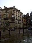
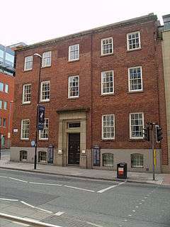
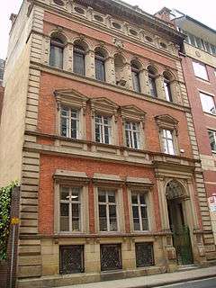
| 25 St Ann Street | St Ann Street, Manchester | Bank | J. E. Gregan | 1848 | 25 February 1952 | SJ8382298379 53°28′55″N 2°14′43″W |
1270792 | [18] | |
| 38 and 42 Mosley Street | Mosley Street, Manchester | Bank | Edward Walters | 1862 | 25 February 1952 | SJ8415398209 53°28′49″N 2°14′25″W |
1220165 | [19] | |
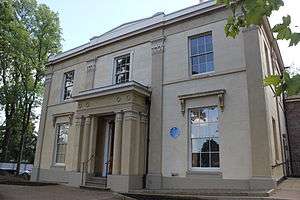
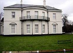
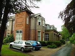
| Mrs Gaskell's House | Plymouth Grove, Chorlton-on-Medlock | Villa | probably Richard Lane | 1830-40 | 25 February 1952 | SJ8540596333 53°27′49″N 2°13′17″W |
1271082 | [20] | |
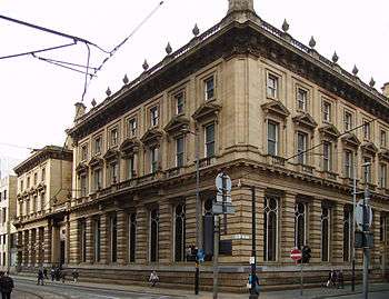
| 100 King Street (formerly the Midland Bank) | King Street, Manchester | Bank | Sir Edwin Lutyens with Whinney, Son and Austen Hall | 1929 | 3 October 1974 | SJ8401798235 53°28′50″N 2°14′32″W |
1219241 | 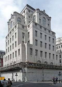 100 King Street (formerly the Midland Bank) | [21] |
| Anglican Church of St Benedict | Ardwick, Manchester | Clergy House | 1880 | 3 October 1974 | SJ8655896989 53°28′10″N 2°12′14″W |
1207939 | 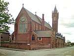 Anglican Church of St Benedict | ||
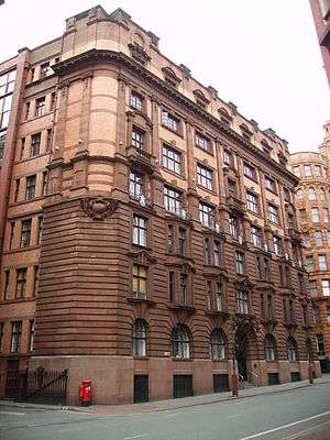
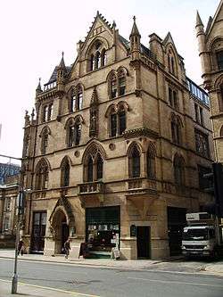
| Asia House | Princess Street, Manchester | Warehouse | Harry S. Fairhurst | 1900–10 | 3 October 1974 | SJ8428897624 53°28′30″N 2°14′17″W |
1247432 | [22] | |
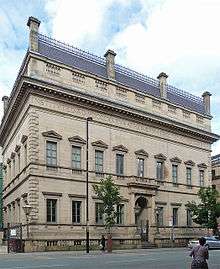
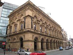
| Manchester Athenaeum | Princess Street, Manchester | Art Gallery | Sir Charles Barry | 1837 | 3 October 1974 | SJ8407797991 53°28′42″N 2°14′29″W |
1270889 | [23] | |
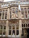
| Barton's Building Including Barton Arcade | Deansgate, Manchester | Shop | Corbett, Raby and Sawyer | 1871 | 25 January 1972 | SJ8375098469 53°28′58″N 2°14′47″W |
1200850 | 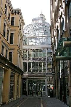 Barton's Building Including Barton Arcade | [24] |
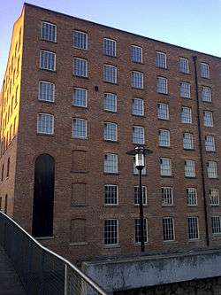
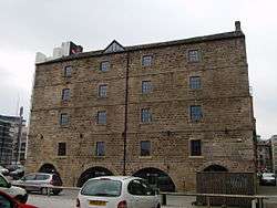
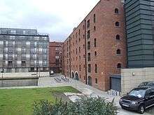
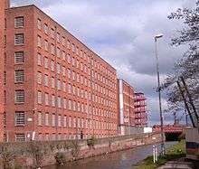
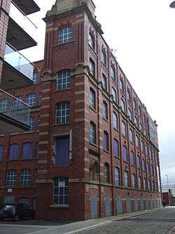
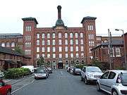
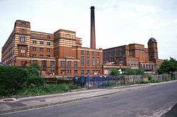
| Beehive Mill | Jersey Street, Ancoats | Cotton Mill | Early 1820s | 11 November 1988 | SJ8509798719 53°29′06″N 2°13′34″W |
1291735 | [25] | ||
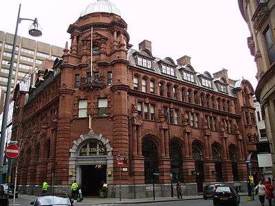
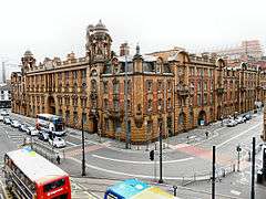
| Watts Warehouse (now Britannia Hotel) | Portland Street, Manchester | Warehouse | Travis and Mangnall | 1856 | 25 February 1952 | SJ8433698041 53°28′44″N 2°14′15″W |
1246952 | 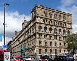 Watts Warehouse (now Britannia Hotel) | [26] |
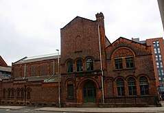
| British Muslim Heritage Centre (former G.M.B. National College) | College Road, Whalley Range | Theological College | Irwin and Chester | 1840–43 | 3 October 1974 | SJ8254394730 53°26′57″N 2°15′52″W |
1197762 |  British Muslim Heritage Centre (former G.M.B. National College) | [27] |
| Brookfield Unitarian Church | Hyde Road, Gorton | Unitarian Chapel | Thomas Worthington | 1871 | 3 October 1974 | SJ8891795918 53°27′36″N 2°10′06″W |
1218832 | [28] | |
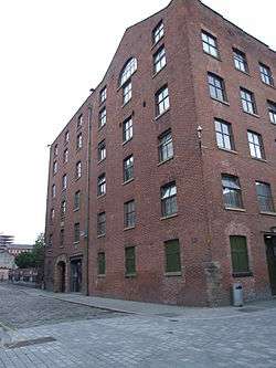
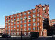
| Brownsfield Mill | Binns Place, Ancoats | Cotton Mill | c. 1825 | 11 November 1988 | SJ8489298400 53°28′56″N 2°13′45″W |
1207994 | [29] | ||
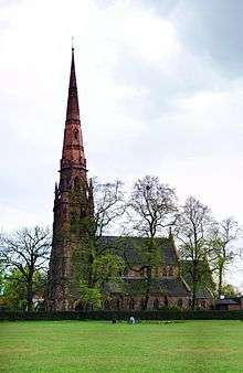
| Christ Church | Lloyd Street North, Moss Side | Church | Cecil Hardisty | 1896 | 24 April 1987 | SJ8441495852 53°27′33″N 2°14′10″W |
1283013 | [30] | |
| Church of St Francis and monastic building attached to church | Gorton Lane, Gorton | Church | E. W. Pugin | 1872 | 18 December 1963 | SJ8766296872 53°28′06″N 2°11′14″W |
1282967 | [31] | |
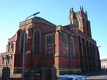
| Church of St Cross | Ashton New Road, Clayton | Church | William Butterfield | 1866 | 18 December 1963 | SJ8801698539 53°29′00″N 2°10′55″W |
1283072 | [32] | |
| Church of St George | Chester Road, Hulme | Church | Francis Goodwin | 1828 | 3 October 1974 | SJ8288997296 53°28′20″N 2°15′33″W |
1208640 | [33] | |
| Church of St James | Stenner Lane, Didsbury | Parish Church | Early 17th century (rebuild) | 25 February 1952 | SJ8469190378 53°24′36″N 2°13′54″W |
1270663 | [34] | ||
| Church of St John the Evangelist | Waterloo Road, Cheetham Hill | Church | Paley and Austin | 1871 | 3 October 1974 | SD8400700961 53°30′18″N 2°14′33″W |
1254832 | [35] | |
| Church of St Mary | Upper Moss Lane, Hulme | Anglican Church | J. S. Crowther | 1858 | 3 October 1974 | SJ8339696089 53°27′41″N 2°15′06″W |
1270659 | [36] | |
| Church of St Michael and All Angels | Orton Road, Northenden | Church | Nugent Francis Cachemaille-Day | 1937 | 16 January 1981 | SJ8134490378 53°24′36″N 2°16′56″W |
1271360 | [37] | |
| Church of St Nicholas | Kingsway, Burnage | Church | Welch, Cachemaille-Day and Lander | 1932 | 10 October 1980 | SJ8584491472 53°25′11″N 2°12′52″W |
1219254 | [38] | |
| Church of St Peter | Old Market Street, Blackley | Church | E. H. Shellard | 1844 | 20 June 1988 | SD8564502998 53°31′24″N 2°13′05″W |
1246275 | [39][40] | |
| Church of St Wilfrid | Ford Lane, Northenden | Parish Church | J. S. Crowther (rebuild) | 15th century, rebuilt 1873–76 | 25 February 1952 | SJ8324190062 53°24′26″N 2°15′13″W |
1200834 | [41] | |
| City Police Courts | Minshull Street, Manchester | Magistrates' Court | Thomas Worthington | 1871 | 3 October 1974 | SJ8450498008 53°28′43″N 2°14′06″W |
1219894 | [42] | |
| Clayton Hall | Ashton New Road, Clayton | House | 15th century | 25 February 1952 | SJ8814198568 53°29′01″N 2°10′49″W |
1197795 | [43] | ||
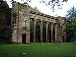
| Colonnade by Lake to South of Heaton Hall | Heaton Park, Crumpsall | Colonnade | Francis Godwin | 1824 | 25 February 1952 | SD8302503605 53°31′44″N 2°15′27″W |
1282992 | [44] | |
| County Court | Quay Street, Manchester | Town house | Mid 18th century | 3 October 1974 | SJ8336498014 53°28′43″N 2°15′08″W |
1247447 | [45] | ||
| Daily Express Building | Great Ancoats Street, Ancoats | Newspaper office and print works | Owen Williams | 1939 | 3 October 1974 | SJ8474598693 53°29′05″N 2°13′53″W |
1218285 | [46] | |
| Dale Street Warehouse | Dale Street, Manchester | Warehouse | William Crossley | 1806 | 10 November 1972 | SJ8469298190 53°28′49″N 2°13′56″W |
1200845 | [47] | |
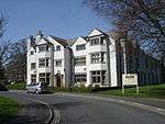
| Didsbury School of Education (original portion only), Manchester Metropolitan University | Wilmslow Road, Didsbury | House | c. 1790 | 25 February 1952 | SJ8479590600 53°24′43″N 2°13′49″W |
1254970 | 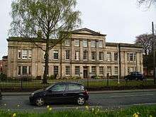 Didsbury School of Education (original portion only), Manchester Metropolitan University | [48] | |
| Doubling Mill and Fireproof Mill | Redhill Street, Ancoats | Cotton Mill | 1842 | 20 June 1988 | SJ8510698622 53°29′03″N 2°13′33″W |
1270855 | [49] | ||
| Ellen Wilkinson High School | Hyde Road, Ardwick | Charity School | Thomas Worthington | 1880 | 3 October 1974 | SJ8573496978 53°28′10″N 2°12′59″W |
1291812 | [50] | |
| Estate Exchange | Fountain Street, Manchester | Office | Thomas Worthington | 1852 | 3 October 1974 | SJ8409498236 53°28′50″N 2°14′28″W |
1200835 | [51] | |
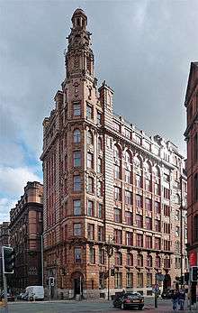
| Former National Westminster Bank | York Street, Manchester | Bank | Charles Heathcote | 1902 | 4 January 1972 | SJ8408498297 53°28′52″N 2°14′29″W |
1255042 | [52] | |
| Free Trade Hall | Peter Street, Manchester | Assembly Hall | Edward Walters | 1856 | 18 December 1963 | SJ8368397930 53°28′40″N 2°14′50″W |
1246666 | [53] | |
| Great Northern Warehouse | Deansgate, Manchester | Warehouse | W. T. Foxlee | 1896 | 4 May 1979 | SJ8356597867 53°28′38″N 2°14′57″W |
1268529 | [54] | |
| Grove House, Manchester (former Student Health Centre) | Oxford Road, Chorlton-on-Medlock | House | Early 19th century | 18 December 1963 | SJ8484896141 53°27′42″N 2°13′47″W |
1246450 | 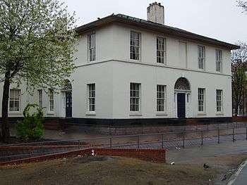 Grove House, Manchester (former Student Health Centre) | [55] | |
| Grand Lodge | Heaton Park, Crumpsall | Gate Lodge | Lewis Wyatt | c. 1807 | 25 February 1952 | SD8268003209 53°31′31″N 2°15′46″W |
1200812 | [56] | |
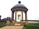
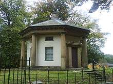
| Heaton Park Temple | Heaton Park, Crumpsall | Garden Temple | James Wyatt | Late 18th century | 25 February 1952 | SD8349304560 53°32′15″N 2°15′02″W |
1200813 | [57] | |
| Holy Trinity Platt Church | Platt Lane, Rusholme | Church | Edmund Sharpe | 1846 | 18 December 1963 | SJ8512494842 53°27′00″N 2°13′32″W |
1246948 | [58] | |
| Hope Mill | Pollard Street, Manchester | Textile mill | 1824 | 6 June 1994 | SJ8573498512 53°28′59″N 2°12′59″W |
1246950 |  Hope Mill | ||
| Hough End Hall | Nell Lane, Chorlton-cum-Hardy | Manor House | 1596 | 25 February 1952 | SJ8249293244 53°26′08″N 2°15′54″W |
1283002 | [59] | ||
| India House (including attached wrought iron gateway linked to Lancaster House) | Whitworth Street, Manchester | Warehouse | Harry S. Fairhurst | 1912 | 3 October 1974 | SJ8421597619 53°28′30″N 2°14′21″W |
1254836 | 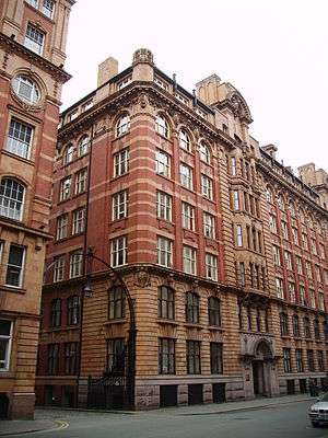 India House (including attached wrought iron gateway linked to Lancaster House) | [60] |
| Jackson's Warehouse | Tariff Street, Manchester | Warehouse | 1836 | 3 October 1974 | SJ8480098336 53°28′53″N 2°13′50″W |
1254689 | [61] | ||
| Lancaster House | Whitworth Street, Manchester | Apartment | Harry S. Fairhurst | 1912 | 3 October 1974 | SJ8427097647 53°28′31″N 2°14′18″W |
1254887 | [62] | |
| Lawrence Buildings | Mount Street, Manchester | Government Office | Pennington and Bridgen | 1874 | 3 October 1974 | SJ8380298016 53°28′43″N 2°14′44″W |
1220257 | [63] | |
| London Road Fire Station | London Road, Manchester | Fire station | Woodhouse, Willoughby and Langham | 1901-6 | 3 October 1974 | SJ8466497798 53°28′36″N 2°13′57″W |
1197918 | [64] | |
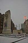
| Manchester Cenotaph | St Peter's Square, Manchester | Cenotaph | Sir Edwin Lutyens | 1924 | 3 September 1974 | SJ8391997905 53°28′39″N 2°14′38″W |
1270697 | [65] | |
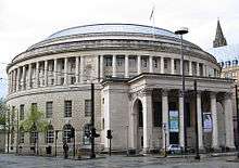
| Manchester Central Library | St Peter's Square, Manchester | Library | Vincent Harris | 1934 | 3 October 1974 | SJ8386597942 53°28′41″N 2°14′40″W |
1270759 | [66] | |
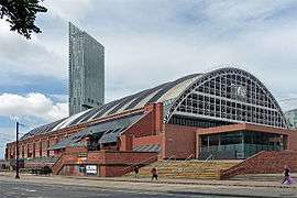
| Manchester Central Convention Complex | Windmill Street, Manchester | Railway station | Sir John Fowler | 1879 | 18 December 1963 | SJ8373797786 53°28′36″N 2°14′47″W |
1270514 | [67] | |
| Manchester Jewish Museum | Cheetham Hill Road, Cheetham | Synagogue | Edward Salomons | 1889 | 3 October 1974 | SJ8431799904 53°29′44″N 2°14′16″W |
1208472 | [68] | |
| Manchester Law Library | Kennedy Street, Manchester | Library | Thomas Hartas | 1885 | 3 October 1974 | SJ8391998165 53°28′48″N 2°14′38″W |
1219102 | [69] | |
| Manchester Reform Club | Spring Gardens, Manchester | Club | Edward Salomons | 1871 | 3 October 1974 | SJ8402798281 53°28′52″N 2°14′32″W |
1282987 | [70] | |
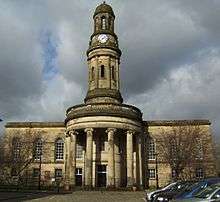
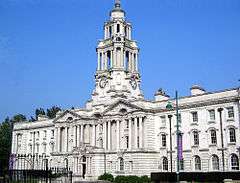
| Manchester Town Hall Extension | Lloyd Street, Manchester | Town hall | Vincent Harris | 1938 | 3 October 1974 | SJ8388598012 53°28′43″N 2°14′39″W |
1197917 | [71] | |
| Mechanics' Institute, Manchester | Princess Street, Manchester | Mechanics Institute | J. E. Gregan | 1854 | 11 May 1972 | SJ8422697827 53°28′37″N 2°14′21″W |
1247391 | [72] | |
| Memorial Hall | Southmill Street, Manchester | Public Hall | Thomas Worthington | 1866 | 14 February 1972 | SJ8376598041 53°28′44″N 2°14′46″W |
1254637 | [73] | |
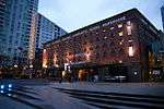
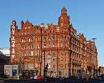
| Midland Hotel | Peter Street, Manchester | Hotel | Charles Trubshaw | 1903 | 3 October 1974 | SJ8382897870 53°28′38″N 2°14′42″W |
1271154 | [74] | |
| New Mill | Jersey Street, Ancoats | Textile mill | 1804 | 20 June 1988 | SJ8503298642 53°29′03″N 2°13′37″W |
1200821 | [75] | ||
| Old Mill and Decker Mill | Redhill Street, Ancoats | Textile mill | 1798 (Old Mill), 1802 (Decker Mill) | 20 June 1988 | SJ8507298584 53°29′02″N 2°13′35″W |
1247473 | [76] | ||
| The Pankhurst Centre | Nelson Street, Chorlton-on-Medlock | Villa | c. 1840 | 10 June 1974 | SJ8499296288 53°27′47″N 2°13′39″W |
1197896 | 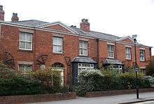 The Pankhurst Centre | [77] | |
| Paragon Mill | Jersey Street, Ancoats | Textile mill | 1912 | 11 November 1988 | SJ8496198591 53°29′02″N 2°13′41″W |
1219048 | [78] | ||
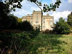
| Parrs Wood House | Wilmslow Road, Parrs Wood | Country House | Late 18th century | 25 February 1952 | SJ8564890302 53°24′34″N 2°13′03″W |
1254971 | [79] | ||
| Peacock Mausoleum to west of Brookfield Unitarian Church | Hyde Road, Gorton | Mausoleum | 1875 | 3 October 1974 | SJ8888795936 53°27′36″N 2°10′08″W |
1218905 | 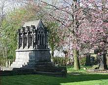 Peacock Mausoleum to west of Brookfield Unitarian Church | [80] | |
| Platt Hall | Platt Fields Park, Fallowfield | House | Thomas Lightoler | c. 1764 | 25 March 1952 | SJ8533594879 53°27′02″N 2°13′20″W |
1246947 | [81] | |
| The Portico Library and The Bank public house | Mosley Street, Manchester | Library | Thomas Harrison | 1806 | 25 February 1952 | SJ8414398139 53°28′47″N 2°14′25″W |
1197930 | 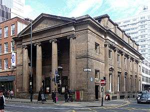 The Portico Library and The Bank public house | [82] |
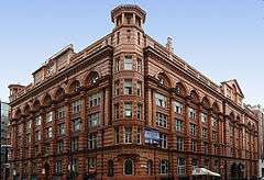
| The Palace Hotel, Manchester | Oxford Street, Manchester | Office | Alfred Waterhouse | 1891 | 3 October 1974 | SJ8414597533 53°28′27″N 2°14′25″W |
1271429 | 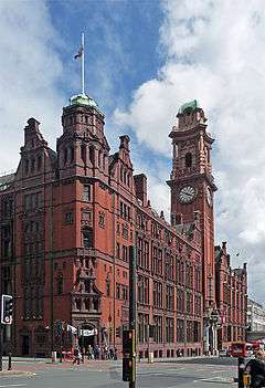 The Palace Hotel, Manchester | [83] |
| Rose Hill | Longley Lane, Northenden | House | Mid 19th century | 11 April 1991 | SJ8355389457 53°24′06″N 2°14′56″W |
1291365 | [84] | ||
| Royal Mill | Redhill Street, Ancoats | Textile mill | 1912 | 11 November 1988 | SJ8497098596 53°29′02″N 2°13′41″W |
1247474 | [85] | ||
| Slade Hall | Slade Lane, Longsight | Manor house | 1585 | 25 February 1952 | SJ8701794889 53°27′02″N 2°11′49″W |
1254632 | [86] | ||
| Smithy Lodge to east of Heaton Hall | Heaton Park, Crumpsall | Lodge | Lewis Wyatt | 1806 | 25 February 1952 | SD8400504491 53°32′13″N 2°14′34″W |
1282994 | [87] | |
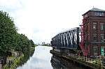
| Store Street Aqueduct | Store Street, Ancoats | Aqueduct | 1799 | 6 June 1994 | SJ8500998116 53°28′46″N 2°13′38″W |
1270666 | [88] | ||
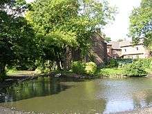
| The Towers (Shirley Institute) | Wilmslow Road, Didsbury | House | Thomas Worthington | 1872 | 4 March 1974 | SJ8506390163 53°24′29″N 2°13′34″W |
1270516 | 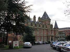 The Towers (Shirley Institute) | [89] |
| Tootal, Broadhurst and Lee Building | Oxford Street, Manchester | Textile Warehouse | J. Gibbons Sankey | 1896 | 3 October 1974 | SJ8402497647 53°28′31″N 2°14′32″W |
1271294 | [90] | |
| Upper Brook Street Chapel, Manchester | Upper Brook Street, Chorlton-on-Medlock | Church School | Sir Charles Barry | 1839 | 3 October 1974 | SJ8474596980 53°28′10″N 2°13′53″W |
1270670 | [91] | |
| Victoria Baths with attached forecourt walls | Hathersage Road, Longsight | Baths | 1906 | 18 January 1983 | SJ8572595951 53°27′36″N 2°12′59″W |
1200808 | 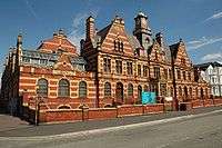 Victoria Baths with attached forecourt walls | [92] | |
| Victoria Mill | Lower Vickers Street, Miles Platting | Cotton Mill | George Woodhouse | 1869 | 29 November 1988 | SJ8590999261 53°29′24″N 2°12′50″W |
1197924 | [93] | |
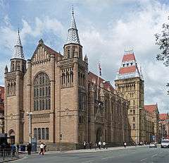
| Victoria University of Manchester including Christie Library, Whitworth Hall | Oxford Road, Chorlton-on-Medlock | University | Alfred and Paul Waterhouse | 1870 | 18 December 1963 | SJ8457496590 53°27′57″N 2°14′02″W |
1271428 | [94] | |
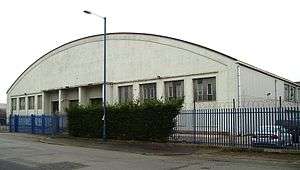
| Wythenshawe Bus Depot | Harling Road, Sharston Industrial Area, Wythenshawe | Bus garage | G. Noel-Hill | 1942 | 13 July 2001 | SJ8306089384 53°24′04″N 2°15′22″W |
1389256 | [95] | |
| Wythenshawe Hall | Wythenshawe Park, Wythenshawe | Jettied House | Early 16th century | 25 February 1952 | SJ8160489825 53°24′18″N 2°16′41″W |
1255034 | [96] |


.jpg)

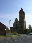
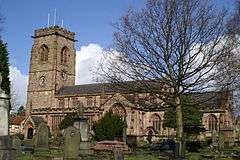
Oldham
| Name | Location | Type | Architect | Completed [note 1] | Date designated | Grid ref.[note 2] Geo-coordinates |
Entry number [note 3] | Image | Ref. |
|---|---|---|---|---|---|---|---|---|---|
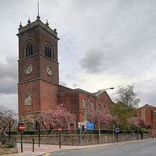
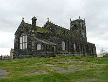
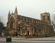
| Church of St Chad | Church Lane, Uppermill | Church | 1746 | 19 June 1967 | SE0075706405 53°33′15″N 1°59′24″W |
1162501 | _(geograph_2670491).jpg) Church of St Chad | [97][98] | |
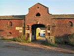
| Grotton Hall | Platting Road, Lydgate | House | 1686 | 3 July 1986 | SD9719904854 53°32′25″N 2°02′37″W |
1068157 | | ||
| Heights Chapel, St Thomas Old Church | Broad Lane, Saddleworth | Church | 1765 | 19 June 1967 | SD9821209061 53°34′41″N 2°01′43″W |
1356677 | [99] | ||
| Higher Kinders | Kinder's Lane, Saddleworth | House | 1642 | 19 June 1967 | SE0001404660 53°32′19″N 2°00′05″W |
1068176 | 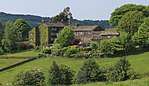 Higher Kinders | [100][101] | |
| Shore Mill | Delph, Saddleworth | Carding Mill | 1780s | 3 July 1986 | SD9860207943 53°34′05″N 2°01′21″W |
1067445 | | [102] | |
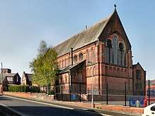
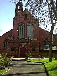
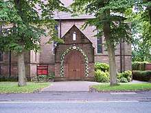
| Church of St Anne | St Anne's Avenue, Royton | Church | Temple Moore | 1909 | 6 May 1987 | SD9199007049 53°33′36″N 2°07′21″W |
1356418 | 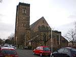 Church of St Anne | [103][104] |
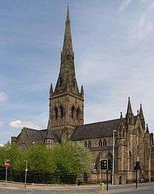
| Church of St Mary with St Peter | Church Street, Oldham | Parish Church | Richard Lane | 1830 | 23 January 1973 | SD9272905112 53°32′33″N 2°06′40″W |
1292310 | [105] | |
| Church of St Thomas | West Street, Lees | Church | E. H. Shellard | 1848 | 22 August 1967 | SD9528604454 53°32′12″N 2°04′21″W |
1068071 | 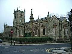 Church of St Thomas | [106] |
| Foxdenton Hall | Foxdenton Lane, Chadderton | House | 1730 | 30 May 1963 | SD8944404665 53°32′19″N 2°09′39″W |
1356429 | [107] | ||
| Independent Methodist Chapel | George Street, Oldham | Methodist Chapel | 1815 | 2 August 1983 | SD9239104861 53°32′25″N 2°06′59″W |
1201672 |  Independent Methodist Chapel | [108] | |
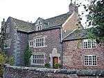
| 1–5 Ηοllins Road - also known as Hathershaw Hall | Hollins Road, Oldham | House | 17th century | 24 December 1970 | SD9223903234 53°31′33″N 2°07′07″W |
1217873 |  1–5 Ηοllins Road - also known as Hathershaw Hall | [109] | |
| Oldham War Memorial | Church Street, Oldham | War memorial | Albert Toft | 1923 | 23 January 1973 | SD9272905071 53°32′32″N 2°06′40″W |
1210137 | .jpg) Oldham War Memorial |
.JPG)
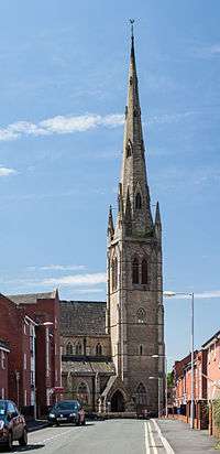
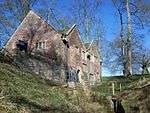
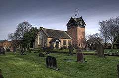
Rochdale
| Name | Location | Type | Completed [note 1] | Date designated | Grid ref.[note 2] Geo-coordinates |
Entry number [note 3] | Image |
|---|---|---|---|---|---|---|---|
| Alkrington Hall | Middleton | Apartment | By 1957 | 15 March 1957 | SD8659005179 53°32′35″N 2°12′14″W |
1068499 | 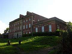 Alkrington Hall |
| Birchinley Manor Farmhouse | Rochdale | House | 1631 | 24 January 1967 | SD9300213778 53°37′14″N 2°06′26″W |
1334330 | .jpg) Birchinley Manor Farmhouse |
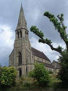
| Church of Saint Aidan | Rochdale | Church | 1913–1915 | 12 February 1985 | SD8832511642 53°36′04″N 2°10′40″W |
1084241 | 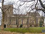 Church of Saint Aidan |
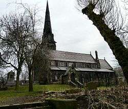
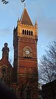
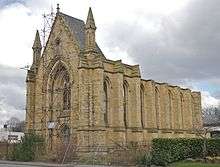
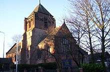
| Church of Saint Chad | Rochdale | Church | 13th century | 25 October 1951 | SD8966613145 53°36′53″N 2°09′28″W |
1045812 | 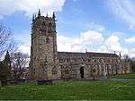 Church of Saint Chad |
| Church of Saint Luke | Heywood | Church | 1860–62 | 12 February 1985 | SD8563710769 53°35′36″N 2°13′07″W |
1346240 | 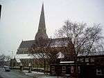 Church of Saint Luke |
| Church of Saint Mary, Wardleworth | Wardleworth | Church | 1740 | 3 December 1975 | SD8960713606 53°37′08″N 2°09′31″W |
1025294 | .jpg) Church of Saint Mary, Wardleworth |
| Clegg Hall | Littleborough | House | c. 1610 | 10 August 1951 | SD9224214490 53°37′37″N 2°07′08″W |
1309615 | |
| Crimble Mill | Heywood | Cotton Mill | Late 1820s | 15 December 1967 | SD8648911658 53°36′05″N 2°12′20″W |
1187124 | 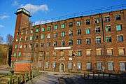 Crimble Mill |
| Dearnley Old Hall | Littleborough | House | Early to mid 17th century | 2 January 1967 | SD9221215819 53°38′20″N 2°07′09″W |
1309691 | 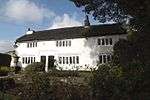 Dearnley Old Hall |
| Elm Street School (County Primary School) | Middleton | School | 1908–1910 | 19 September 1969 | SD8838205948 53°33′00″N 2°10′37″W |
1356229 | |
| Former Queen Elizabeth Old Grammar School and adjoining Schoolmaster's House | Middleton | Teachers House | 1835–1839 | 15 March 1957 | SD8741206354 53°33′13″N 2°11′29″W |
1356228 | 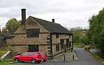 Former Queen Elizabeth Old Grammar School and adjoining Schoolmaster's House |
| Hope Chapel and Parsons House | Rochdale | House | 1985 | 12 February 1985 | SD8964213919 53°37′18″N 2°09′29″W |
1057694 | 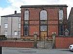 Hope Chapel and Parsons House |
| Hopwood Hall | Middleton | House | 17th century | 15 March 1957 | SD8748308299 53°34′16″N 2°11′26″W |
1068466 | |
| Long Street Methodist Church | Middleton | Gate | 1899 | 19 September 1969 | SD8704006201 53°33′08″N 2°11′50″W |
1068504 | 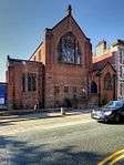 Long Street Methodist Church |
| Old Bent House and Bent House Farmhouse | Littleborough | House | 1691 | 2 January 1967 | SD9462417012 53°38′58″N 2°04′58″W |
1356234 | |
| Rough Bank Farmhouse | Newhey | Farmhouse | 1607 | 24 January 1967 | SD9471812318 53°36′27″N 2°04′53″W |
1240266 | |
| Shore Hall | Littleborough | House | 1605 | 2 January 1967 | SD9229117224 53°39′05″N 2°07′05″W |
1068515 | 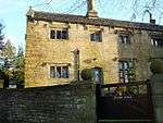 Shore Hall |
| Stubley Old Hall | Stubley Brow, Rochdale | House | 15th century | 2 January 1967 | SD9278316057 53°38′28″N 2°06′38″W |
1162360 | |
| Tonge Hall | Middleton | House | 1580s | 15 March 1957 | SD8775605821 53°32′56″N 2°11′11″W |
1068469 | |
| Windy Bank | Blackstone Edge | House | Early 16th century | 2 January 1967 | SD9445016659 53°38′47″N 2°05′08″W |
1068536 | 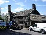 Windy Bank |
| Ye Olde Boars Head Public House | Middleton | Public House | Early 17th century | 15 March 1957 | SD8705206266 53°33′10″N 2°11′49″W |
1162256 | .jpg) Ye Olde Boars Head Public House |
Salford
| Name | Location | Type | Architect | Completed [note 1] | Date designated | Grid ref.[note 2] Geo-coordinates |
Entry number [note 3] | Image | Ref. |
|---|---|---|---|---|---|---|---|---|---|
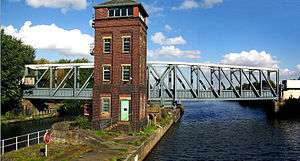
| Barton Bridge, Barton Aqueduct and Control Tower (that Part in Eccles) | Salford | Aqueduct | Sir Edward Leader Williams | c. 1894 | 16 July 1987 | SJ7663397602 53°28′29″N 2°21′13″W |
1162870 | ||
| Cathedral of St John and Attached Cathedral House | Salford | House | Matthew Ellison Hadfield | 1980 | 18 January 1980 | SJ8278998598 53°29′02″N 2°15′39″W |
1386115 | ||
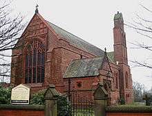
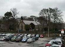
| Church of St Andrew | Eccles | Church | 1877–79 | 16 July 1987 | SJ7740098764 53°29′06″N 2°20′31″W |
1309482 |  Church of St Andrew | ||
| Church of St Luke | Pendleton, Salford | Parish Church | George Gilbert Scott | 1865 | 18 January 1980 | SJ8001398621 53°29′02″N 2°18′10″W |
1386145 | ||
| Church of St Peter | Swinton | Parish church | 1869 | 30 March 1966 | SD7745501745 53°30′43″N 2°20′29″W |
1067510 | 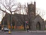 Church of St Peter | ||
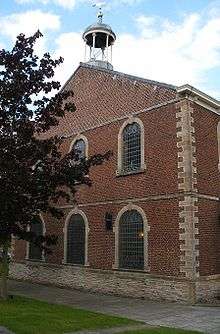
| Church of St Philip | Salford | Anglican Church | Sir Robert Smirke | 1825 | 31 January 1952 | SJ8264098619 53°29′02″N 2°15′47″W |
1386165 | ||
| Church of the Sacred Trinity | Salford | Anglican Church | By 1952 | 31 January 1952 | SJ8348698704 53°29′05″N 2°15′01″W |
1386185 |  Church of the Sacred Trinity | ||
| Former Public Baths | Salford | Indoor Swimming Pool | 1855 | 18 January 1980 | SJ8341399003 53°29′15″N 2°15′05″W |
1386123 | | ||
| Former United Reformed Church | Salford | Congregational Chapel | 1872–1874 | 18 January 1980 | SD8319602138 53°30′56″N 2°15′18″W |
1386187 | | ||
| Kersal Cell | Salford | Cruck House | 16th century | 31 January 1952 | SD8095801536 53°30′37″N 2°17′19″W |
1386144 | 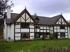 Kersal Cell | ||
| Manchester Tennis and Racquet Club | Salford | Squash Court | George Tunstal Redmayne | 1925 | 21 January 1996 | SJ8334798832 53°29′09″N 2°15′09″W |
1386080 | ||
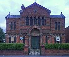
| Monton Unitarian Church | Monton | Church | 1873–75 | 9 July 1979 | SJ7650499638 53°29′35″N 2°21′20″W |
1067501 | .jpg) Monton Unitarian Church | ||
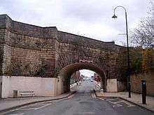
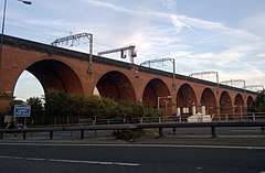
| Southern Railway Viaduct and Colonnade | Salford | Viaduct & Colonnade | 1844 | 18 January 1980 | SJ8321198497 53°28′59″N 2°15′16″W |
1386162 | 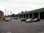 Southern Railway Viaduct and Colonnade |
Stockport
| Name | Location | Type | Completed [note 1] | Date designated | Grid ref.[note 2] Geo-coordinates |
Entry number [note 3] | Image |
|---|---|---|---|---|---|---|---|
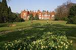
| Abney Hall | Cheadle, Stockport | House | 1847 | 30 June 1975 | SJ8595389237 53°23′59″N 2°12′46″W |
1241730 | |
| Chadkirk Chapel | Bredbury, Stockport | Chapel | 16th century | 29 March 1966 | SJ9400390218 53°24′31″N 2°05′30″W |
1259981 | |
| Church of St Martin | Marple Bridge, Stockport | Church | 1869–70 | 11 October 1985 | SJ9634989345 53°24′03″N 2°03′23″W |
1241823 | |
| Former Plaza Cinema | Stockport | Theatre | By 1997 | 12 March 1997 | SJ8937290272 53°24′33″N 2°09′41″W |
1257697 | |
| Former Rectory | Stockport | House | Mid 18th century | 14 May 1952 | SJ8991690344 53°24′35″N 2°09′11″W |
1356827 |  Former Rectory |
| Gateway to Parish Church of St Mary and Fountain to Side | Stockport | Gate | 1812 | 10 March 1975 | SJ8973690516 53°24′41″N 2°09′21″W |
1067202 | |
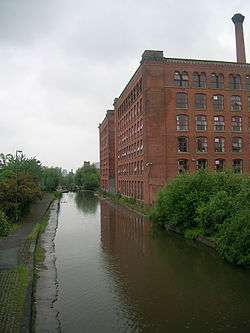
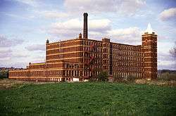
| Houldsworth Mill | Reddish, Stockport | Fireproof Factory | 1865 | 10 March 1975 | SJ8907393324 53°26′12″N 2°09′57″W |
1067171 | |
| Houldsworth School | Stockport | School | 1874 | 30 October 1973 | SJ8924493588 53°26′20″N 2°09′48″W |
1067180 |  Houldsworth School |
| Houldsworth Working Men's Club | Houldsworth, Stockport | Working Man's Club | 1874 | 30 October 1973 | SJ8930493459 53°26′16″N 2°09′45″W |
1067173 | |
| Mellor Hall and Mellor Hall Farmhouse | Mellor, Stockport | Farmhouse | 1985 | 20 December 1967 | SJ9857589287 53°24′01″N 2°01′22″W |
1241992 | |
| Moseley Old Hall | Cheadle, Stockport | Box Frame House | 1666 | 24 March 1950 | SJ8642188905 53°23′48″N 2°12′20″W |
1260364 | |
| New Hall Cottage & New Hall Farmhouse | Woodford, Stockport | Farmhouse | 1630 | 9 August 1966 | SJ8957281405 53°19′46″N 2°09′29″W |
1260441 | |
| Old Manor Farm | Marple, Stockport | Farmhouse | 15th century | 20 December 1967 | SJ9397988679 53°23′42″N 2°05′31″W |
1242469 | |
| Pear New Mill | Bredbury, Stockport | Fireproof Factory | 1908–1912 | 20 June 1991 | SJ9119690793 53°24′50″N 2°08′02″W |
1240634 | |
| Railway Viaduct | Stockport | Railway Viaduct | Opened 1840 | 10 March 1975 | SJ8910590246 53°24′32″N 2°09′55″W |
1356861 | |
| Rectory to Church of St Elisabeth | Stockport | Vicarage | 1874 | 30 October 1973 | SJ8923593536 53°26′19″N 2°09′49″W |
1067181 | 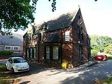 Rectory to Church of St Elisabeth |
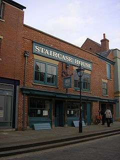
| Staircase House | Stockport | Timber Framed House | Late 15th century | 10 March 1975 | SJ8970490552 53°24′42″N 2°09′23″W |
1356855 | |
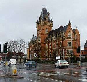
| Stockport Town Hall | Stockport | Town Hall | 1904–08 | 10 March 1975 | SJ8956489920 53°24′22″N 2°09′30″W |
1067166 | |
| Wall to the West and South of Church of St Elizabeth | Reddish, Stockport | Gate | 1882-3 | 10 March 1975 | SJ8924593445 53°26′16″N 2°09′48″W |
1067172 | 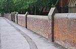 Wall to the West and South of Church of St Elizabeth |
| Wall to West of Church of St Elisabeth | Reddish, Stockport | Gate | 1874 | 10 March 1975 | SJ8921593535 53°26′19″N 2°09′50″W |
1356853 | 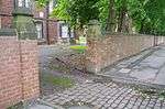 Wall to West of Church of St Elisabeth |
| Wall to West of Houldsworth School | Reddish, Stockport | Wall | 1874 | 10 March 1975 | SJ8921693580 53°26′20″N 2°09′50″W |
1162583 | 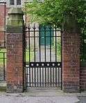 Wall to West of Houldsworth School |
| War Memorial & Art Gallery | Stockport | Art Gallery | 1925 | 11 July 2007 | SJ8953289777 53°24′17″N 2°09′32″W |
1392091 | 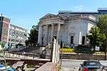 War Memorial & Art Gallery |
| Woodbank Villa and Entrance Portico | Stockport | Villa | 1812–1814 | 10 March 1975 | 53°24′36″N 2°07′52″W | 1162994 | |
| 10 Great Underbank | Stockport | Manor House/Natwest Bank | 16th century | 14 May 1952 | SJ8956790445 53°24′39″N 2°09′30″W |
1356829 |
.jpg)
.jpg)

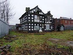
Tameside
| Name | Location | Type | Completed [note 1] | Date designated | Grid ref.[note 2] Geo-coordinates |
Entry number [note 3] | Image |
|---|---|---|---|---|---|---|---|
| Albion Congregational Church | Ashton-under-Lyne | Church | 1890–1895 | 12 January 1967 | SJ9432699003 53°29′16″N 2°05′13″W |
1356460 | 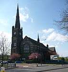 Albion Congregational Church |
| Albion Warehouse | Ashton-under-Lyne | Warehouse | By 1987 | 12 January 1967 | SJ9431599253 53°29′24″N 2°05′14″W |
1068001 | |
| Apethorn Farmhouse | Hyde | Farmhouse | 17th century to 19th century | 22 December 1969 | SJ9447893479 53°26′17″N 2°05′05″W |
1068079 |  Apethorn Farmhouse |
| Broadbottom Hall | Tameside | House | 1680 | 1 November 1966 | SJ9948593629 53°26′22″N 2°00′33″W |
1068052 | |
| Buckley Hill Farmhouse | Tameside | House | 17th century | 17 November 1966 | SJ9180799671 53°29′37″N 2°07′30″W |
1163826 | |
| Cavendish Mill | Ashton-under-Lyne | Spinning Mill | 1884-5 | 24 September 1990 | SJ9364098581 53°29′02″N 2°05′50″W |
1067948 | |
| Church of St Lawrence | Denton | Church | c. 1530 | 27 November 1967 | SJ9264095055 53°27′08″N 2°06′44″W |
1067971 | |
| St Michael and All Angels Church, Mottram | Mottram-in-Longdendale | Church | 15th century | 1 November 1966 | SJ9943195293 53°27′16″N 2°00′36″W |
1356436 | |
| Church of St Peter | Ashton-under-Lyne | Church | 1821–1824 | 12 January 1967 | SJ9306798585 53°29′02″N 2°06′21″W |
1067994 | |
| Cross | Mottram-in-Longdendale | Sundial | Medieval | 6 February 1986 | SJ9940295234 53°27′14″N 2°00′38″W |
1068028 |  Cross |
| Dukinfield Old Chapel | Dukinfield | Unitarian Chapel | 1840–1841 | 17 December 1970 | SJ9435997963 53°28′42″N 2°05′11″W |
1068077 | 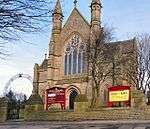 Dukinfield Old Chapel |
| Fairfield Moravian Church | Droylsden | House | c. 1785 | 17 November 1966 | SJ9016197617 53°28′31″N 2°08′59″W |
1067981 | |
| Former Municipal Baths | Ashton-under-Lyne | Industrial Building | By 1987 | 2 April 1975 | SJ9335298687 53°29′05″N 2°06′06″W |
1067992 | 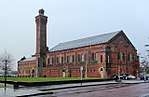 Former Municipal Baths |
| Hyde Hall | Denton | Farmhouse | 1967 | 27 November 1967 | SJ9180594273 53°26′43″N 2°07′29″W |
1318129 | |
| Old Hall Chapel | Dukinfield | Church | 1872 | 17 December 1970 | SJ9349497026 53°28′12″N 2°05′58″W |
1356422 | |
| Old Hall Fold | Ashton-under-Lyne | Farmhouse | 16th century | 12 January 1967 | SD9268900389 53°30′01″N 2°06′42″W |
1067997 | |
| St Anne's Rectory | Ashton-under-Lyne | Vicarage | 1882 | 20 July 1977 | SJ9341195603 53°27′26″N 2°06′03″W |
1067970 | |
| Stayley Hall and Adjoining West Wing | Ashton-under-Lyne | Jettied House | Late 16th century | 9 August 1966 | SJ9756299706 53°29′39″N 2°02′18″W |
1163021 | 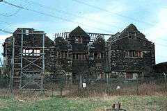 Stayley Hall and Adjoining West Wing |
| War Memorial | Stalybridge | War Memorial | c1920 after World War I | 6 February 1986 | SJ9634198565 53°29′02″N 2°03′24″W |
1163074 | 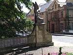 War Memorial |
| 20–23 and 23a Fairfield Square | Droylsden | House | 1785 | 17 November 1966 | SJ9014997672 53°28′32″N 2°09′00″W |
1356489 | .JPG) 20–23 and 23a Fairfield Square |


.jpg)
Trafford
| Name | Location | Type | Architect | Completed [note 1] | Date designated | Grid ref.[note 2] Geo-coordinates |
Entry number [note 3] | Image | Ref. |
|---|---|---|---|---|---|---|---|---|---|
| Church of St George | Manchester Road, Carrington | Church | Isaac Shaw | 1759 | 5 March 1959 | SJ7279592666 53°25′48″N 2°24′39″W |
1067868 | 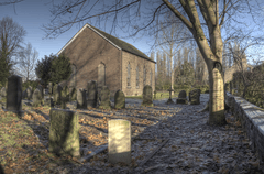 Church of St George | |
| Dunham Massey sawmill | Dunham Massey | Saw Mill | 1616 | 5 March 1959 | SJ7345787247 53°22′53″N 2°24′02″W |
1067903 | |||
| Barton Bridge, Barton Aqueduct, and Control Tower (that Part in Davyhulme) | Manchester Ship Canal, Urmston[110] | Aqueduct | Leader Williams | c. 1894 | 30 June 1987 | SJ7664597571 53°28′28″N 2°21′12″W |
1356522 | Barton Bridge, Barton Aqueduct, and Control Tower (that Part in Davyhulme) | |
| Church of St John the Divine | Brooklands Road, Sale | Church | Alfred Waterhouse | 1868 | 3 October 1974 | SJ7891390316 53°24′33″N 2°19′07″W |
1261946 | .jpg) Church of St John the Divine | |
| Church of St Margaret | Dunham Road, Altrincham | Church | W. Hayley | 1855 | 12 July 1985 | SJ7601787852 53°23′13″N 2°21′43″W |
1325200 | 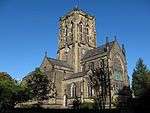 Church of St Margaret | |
| Church of St Martin | Church Lane, Sale | Church | W. H. Brakspear | 1887 | 11 November 1966 | SJ7723892993 53°26′00″N 2°20′39″W |
1067893 | ||
| Church of St Mary the Virgin | Bowdon Park Road, Bowdon | Church | W. H. Brakspear | 1860 | 12 July 1985 | SJ7586486846 53°22′40″N 2°21′51″W |
1122650 | ||
| Church of St Michael | Church Road, Flixton | Church | 15th century | 29 June 1966 | SJ7472993965 53°26′31″N 2°22′55″W |
1067876 |  Church of St Michael | ||
| Denzell House | Dunham Road, Altrincham | House | Clegg & Knowles | 1874 | 12 July 1985 | SJ7536887360 53°22′57″N 2°22′18″W |
1067925 | 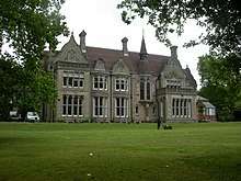 Denzell House | |
| Hale Chapel | Chapel Lane, Hale Barns | Chapel | 1723 | 2 March 1950 | SJ7914285446 53°21′56″N 2°18′54″W |
1356500 | |||
| Halecroft | Hale Road, Hale | House | Edgar Wood | 1890 | 13 October 1975 | SJ7867686399 53°22′26″N 2°19′19″W |
1356501 |
.jpg)
Wigan
| Name | Location | Type | Architect | Completed [note 1] | Date designated | Grid ref.[note 2] Geo-coordinates |
Entry number [note 3] | Image | Ref. |
|---|---|---|---|---|---|---|---|---|---|
| Ackhurst Hall | Ackhurst Lane, Orrell | Farmhouse | 1686 | 30 March 1966 | SD5454206866 53°33′23″N 2°41′16″W |
1228341 |  Ackhurst Hall | [111] | |
| Damhouse, formerly Astley Hall | Church Road, Astley | House | 1650 | 18 July 1966 | SD6986900902 53°30′14″N 2°27′21″W |
1163258 | [112] | ||
| Astley Vicarage | Church Road, Astley | Vicarage | 1704 | 18 July 1966 | SD6998400792 53°30′11″N 2°27′14″W |
1356223 |  Astley Vicarage | [113] | |
| Alder House | Alder Street, Atherton | House | 1697 | 15 July 1966 | SD6801103162 53°31′27″N 2°29′02″W |
1068470 |  Alder House | [114] | |
| Chanters Farmhouse | Chanters Avenue, Atherton | House | 1678 | 15 July 1966 | SD6811202920 53°31′19″N 2°28′57″W |
1309438 |  Chanters Farmhouse | [115] | |
| Church of St Michael and All Angels | Leigh Road, Howe Bridge, Atherton | Parish Church | Paley and Austin | 1875–1877 | 31 July 1996 | SD6649302447 53°31′03″N 2°30′24″W |
1268288 | 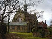 Church of St Michael and All Angels | [116] |
| Chowbent Unitarian Chapel | Bolton Old Road, Atherton | Presbyterian Chapel | 1721 | 15 July 1966 | SD6790403215 53°31′29″N 2°29′08″W |
1068472 | [117] | ||
| Barn and Stable to East of Winstanley Hall and two attached gateways | Winstanley | House | 1859 | 23 August 1986 | SD5450903088 53°31′21″N 2°41′15″W |
1228164 | | [118] | |
| Bispham Hall | Crank Road, Billinge Higher End | Hall House/Outdoor Centre | 1573 | 23 August 1966 | SD5234602469 53°31′00″N 2°43′13″W |
1068434 | [119] | ||
| Bradley Hall | Bradley Lane, Standish | House/Offices | 16th century or 17th century | 24 May 1982 | SD5704211010 53°35′38″N 2°39′02″W |
1228439 | 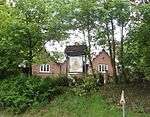 Bradley Hall | [120] | |
| Church of All Saints | Wallgate, Wigan | Parish Church | 15th century | 24 October 1951 | SD5818005674 53°32′46″N 2°37′57″W |
1384556 | 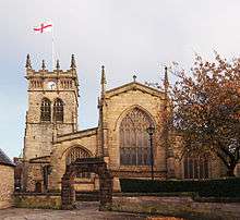 Church of All Saints | [121] | |
| Church of St James with St Thomas | Poolstock | Church | E. G. Paley | 1863-6 | 11 July 1983 | SD5782004545 53°32′09″N 2°38′16″W |
1384468 | 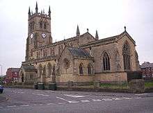 Church of St James with St Thomas | [122] |
| Church of St John | Standishgate, Wigan | Roman Catholic Church | 1819 | 24 October 1951 | SD5848906039 53°32′58″N 2°37′41″W |
1384523 | [123] | ||
| Church of St Mary | St Mary's Way, Leigh | Church | Paley and Austin | 1873 | 7 November 1966 | SD6562300302 53°29′54″N 2°31′11″W |
1356221 | [124][125] | |
| Church of St Mary | Standishgate, Wigan | Roman Catholic Church | 1818 | 24 October 1951 | SD5851306150 53°33′01″N 2°37′39″W |
1384525 | [126] | ||
| Church of St Matthew | Billinge Road, Wigan | Church | Paley, Austin and Paley | 1892–94 | 11 July 1983 | SD5552303830 53°31′45″N 2°40′21″W |
1384453 | [127] | |
| Church of St Michael | Swinley | Church | George Edmund Street | 1875–1878 | 11 July 1983 | SD5837706555 53°33′14″N 2°37′47″W |
1384535 | 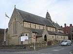 Church of St Michael | [128] |
| Church of St Peter | Firs Lane, Westleigh, Leigh | Church | Paley and Austin | 1880-1 | 27 July 1987 | SD6442800327 53°29′54″N 2°32′16″W |
1068481 | [124][129] | |
| Giant's Hall Farmhouse | Standish Wood Lane, Standish | Farmhouse | 1675 | 9 August 1966 | SD5668207761 53°33′53″N 2°39′20″W |
1287164 | 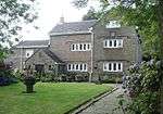 Giant's Hall Farmhouse | [130] | |
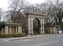
| Gateway and Lodges to Haigh Hall Park | Wigan Lane, Wigan | Gate Lodge | c. 1840 | 24 October 1951 | SD5849407164 53°33′34″N 2°37′41″W |
1384570 | [131] | ||
| Haigh Hall | School Lane, Haigh | House | 1827–40 | 19 November 1951 | SD5975208515 53°34′18″N 2°36′33″W |
1228292 | |||
| Kirkless Hall and Kirkless Hall Farmhouse | Whelley, Wigan | House | 1663 | 9 June 1966 | SD6034006359 53°33′08″N 2°36′00″W |
1068423 | 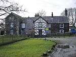 Kirkless Hall and Kirkless Hall Farmhouse | [132] | |
| Leigh Spinners | Bedford, Leigh | Boiler House | Bradshaw Gass & Hope | 1913 | 25 April 1990 | SJ6737999725 53°29′36″N 2°29′35″W |
1253119 | [133] | |
| Light Oaks Hall | Glazebury, Wigan | House | Early 17th century | 7 November 1966 | SJ6755896706 53°27′58″N 2°29′25″W |
1068483 | .jpg) Light Oaks Hall | [134] | |
| Lightshaw Hall | Golborne, Wigan | Farmhouse | 16th century | 15 November 1966 | SJ6148399546 53°29′28″N 2°34′55″W |
1261780 | 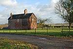 Lightshaw Hall | [135] | |
| Mab's Cross | Standishgate, Wigan | Boundary Cross | 13th century | 11 July 1983 | SD5852706268 53°33′05″N 2°37′39″W |
1384526 | [136] | ||
| Manor House | Chorley Lane, Worthington | House | 17th century | 22 February 1967 | SD5789510213 53°35′12″N 2°38′15″W |
1228480 | 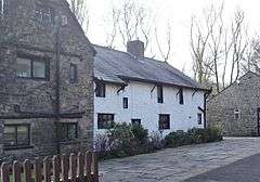 Manor House | [137] | |
| Morleys Hall | Morleys Lane, Astley | House | 16th century | 18 July 1966 | SJ6895899261 53°29′21″N 2°28′10″W |
1318255 | [138] | ||
| War Memorial South of Church of All Saints with Encircling Railings | Wallgate, Wigan | War Memorial | Sir Giles Gilbert Scott | 1925 | 24 October 1951 | SD5818505640 53°32′45″N 2°37′57″W |
1384562 | 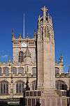 War Memorial South of Church of All Saints with Encircling Railings | [124][139] |
| Winstanley Hall | Winstanley, Greater Manchester | House | c. 1573 | 23 August 1966 | SD5451803107 53°31′22″N 2°41′15″W |
1287365 | [140] | ||
| Worthington Hall | Chorley Lane, Worthington | Farmhouse | 1577 | 19 November 1951 | SD5808910942 53°35′36″N 2°38′05″W |
1228585 | | [141] |
.JPG)

See also
- Architecture of Manchester
- Conservation in the United Kingdom
- Grade I listed buildings in Greater Manchester
- Grade II listed buildings in Manchester
- List of tallest buildings in Manchester
- Scheduled Monuments in Greater Manchester
Notes
- The date given is the date used by Historic England as significant for the initial building or that of an important part in the structure's description.
- Sometimes known as OSGB36, the grid reference is based on the British national grid reference system used by the Ordnance Survey.
- The "List Entry Number" is a unique number assigned to each listed building and scheduled monument by Historic England.
References
- "What is a listed building?". Manchester City Council. Retrieved 8 December 2007.
- "Planning (Listed Buildings and Conservation Areas) Act 1990 (c. 9)". Ministry of Justice. Archived from the original on 2010-04-18. Retrieved 2007-12-17.
- Kidd, Alan (2006). Manchester: A History. Lancaster, Lancashire: Carnegie Publishing Ltd. ISBN 1-85936-128-5.
- McNeil and Nevell (2000), A Guide to the Industrial Archaeology of Greater Manchester, p. 2.
- Cowhig, W.T. (1976). It Happened Round Greater Manchester; Textiles. Greater Manchester Council.
- McNeil and Nevell (2000), A Guide to the Industrial Archaeology of Greater Manchester, p. 2–3.
- "Brandlesholme Old Hall, Bury". historicengland.org.uk. Retrieved 2008-07-06.
- "Church of St Chad, Rochdale". historicengland.org.uk. Retrieved 2008-07-06.
- "Mab's Cross, Wigan". historicengland.org.uk. Retrieved 2008-07-06.
- "Daily Express Building, Manchester". historicengland.org.uk. Retrieved 2008-07-06.
- "Brandlesholme Old Hall". historicengland.org.uk. Retrieved 2008-02-23.
- "Christ Church, Walshaw". historicengland.org.uk. Retrieved 2008-02-23.
- "Dearden Fold Farmhouse". historicengland.org.uk. Retrieved 2008-02-23.
- Historic England. "Hey House (44308)". PastScape. Retrieved 2008-02-23.
- "Lower Chesham". historicengland.org.uk. Retrieved 2008-02-23.
- "Presbyterian Chapel, Radcliffe". historicengland.org.uk. Retrieved 2008-02-23.
- "Radcliffe Cenotaph". historicengland.org.uk. Retrieved 2008-02-23.
- "25 St Ann Street, Manchester". historicengland.org.uk. Retrieved 2008-05-30.
- "38 and 42 Mosley Street, Manchester". historicengland.org.uk. Retrieved 2008-05-28.
- "Mrs Gaskell's House, 84 Plymouth Grove, Manchester". historicengland.org.uk. Retrieved 2008-05-29.
- "Midland Bank, Manchester". historicengland.org.uk. Retrieved 2008-05-27.
- "Asia House, Manchester". historicengland.org.uk. Retrieved 2008-05-29.
- "The Athenaeum, Manchester". historicengland.org.uk. Retrieved 2008-05-29.
- "Barton's Building including Barton Arcade, Manchester". historicengland.org.uk. Retrieved 2008-05-24.
- "Beehive Mill, Manchester". historicengland.org.uk. Retrieved 2008-05-27.
- "Britannia Hotel, Manchester". historicengland.org.uk. Retrieved 2008-05-29.
- "GMB National College, Manchester". historicengland.org.uk. Retrieved 2008-05-24.
- "Brookfield Unitarian Church, Manchester". historicengland.org.uk. Retrieved 2008-05-24.
- "Brownfield Mill, Manchester". historicengland.org.uk. Retrieved 2008-05-24.
- "Christ Church, Moss Side, Manchester". historicengland.org.uk. Retrieved 2008-05-28.
- "Church and Friary of St Francis, Manchester". historicengland.org.uk. Retrieved 2008-05-24.
- "Church of St. Cross, Manchester". historicengland.org.uk. Retrieved 2008-05-24.
- "Church of St. George, Chester Road, Hulme". historicengland.org.uk. Retrieved 2008-05-24.
- "Church of St James, Manchester". historicengland.org.uk. Retrieved 2008-05-30.
- "Church of St John the Evangelist, Manchester". historicengland.org.uk. Retrieved 2008-05-30.
- "Church of St Mary, Manchester". historicengland.org.uk. Retrieved 2008-05-30.
- "Church of St. Michael and All Angels, Manchester". historicengland.org.uk. Retrieved 2008-05-29.
- "Church of St Nicholas, Manchester". historicengland.org.uk. Retrieved 2008-05-27.
- "Listed buildings in Manchester by street (O)". Manchester City Council. Retrieved 2008-07-02.
- "Church of St Peter, Manchester". historicengland.org.uk. Retrieved 2008-07-02.
- "Church of St. Wilfrid, Northenden". historicengland.org.uk. Retrieved 2008-05-24.
- "City Police Courts, Manchester". historicengland.org.uk. Retrieved 2008-05-28.
- "Clayton Hall, Manchester". historicengland.org.uk. Retrieved 2008-05-24.
- "Colonnade by lake to south of Heaton Hall, Manchester". historicengland.org.uk. Retrieved 2008-05-24.
- "County Court, Manchester". historicengland.org.uk. Retrieved 2008-05-29.
- "Daily Express Building, Manchester". historicengland.org.uk. Retrieved 2008-05-24.
- "Dale Warehouse, Manchester". historicengland.org.uk. Retrieved 2008-05-24.
- "Manchester Polytechnic, Didsbury School of Education, Manchester". historicengland.org.uk. Retrieved 2008-05-30.
- "Doubling Mill and Fireproof Mill, Manchester". historicengland.org.uk. Retrieved 2008-05-29.
- "Brookfield Unitarian Church, Manchester". historicengland.org.uk. Retrieved 2008-05-24.
- "Church of St. Wilfrid, Manchester". historicengland.org.uk. Retrieved 2008-05-24.
- "Former National Westminster Bank, Manchester". historicengland.org.uk. Retrieved 2008-05-30.
- "Free Trade Hall, Manchester". historicengland.org.uk. Retrieved 2008-05-29.
- "Deansgate Goods Station And attached carriage Ramp, Manchester". historicengland.org.uk. Retrieved 2008-05-30.
- "Student Health Centre, Manchester". historicengland.org.uk. Retrieved 2008-05-29.
- "Grand Lodge, Manchester". historicengland.org.uk. Retrieved 2008-05-24.
- "Temple north east of Heaton Hall, Manchester". historicengland.org.uk. Retrieved 2008-05-24.
- "Church of Holy Trinity, Manchester". historicengland.org.uk. Retrieved 2008-05-29.
- "Hough End Hall, Manchester". historicengland.org.uk. Retrieved 2008-05-28.
- "India House, Manchester". historicengland.org.uk. Retrieved 2008-05-30.
- "Former Rochdale Canal Warehouse". historicengland.org.uk. Retrieved 2011-05-14.
- "Lancaster House, Manchester". historicengland.org.uk. Retrieved 2008-05-30.
- "Lawrence Buildings, Manchester". historicengland.org.uk. Retrieved 2008-05-28.
- "London Road Fire Station, Manchester". historicengland.org.uk. Retrieved 2008-05-28.
- "War Memorial, Manchester". historicengland.org.uk. Retrieved 2008-05-30.
- "Manchester Central Library, Manchester". historicengland.org.uk. Retrieved 2008-05-30.
- "G-Mex, Manchester". historicengland.org.uk. Retrieved 2008-05-30.
- "Manchester Jewish Museum, Manchester". historicengland.org.uk. Retrieved 2008-05-24.
- "Manchester Law Library, Manchester". historicengland.org.uk. Retrieved 2008-05-27.
- "Former Reform Club, Manchester". historicengland.org.uk. Retrieved 2008-05-27.
- "Manchester Town Hall Extension, Manchester". historicengland.org.uk. Retrieved 2008-05-27.
- "103 Princess Street, Manchester". historicengland.org.uk. Retrieved 2008-05-29.
- "Memorial Hall, Manchester". historicengland.org.uk. Retrieved 2008-05-30.
- "Midland Hotel, Manchester". historicengland.org.uk. Retrieved 2008-05-29.
- "New Mill, Manchester". historicengland.org.uk. Retrieved 2008-05-27.
- "Doubling Mill and Fireproof Mill, Manchester". historicengland.org.uk. Retrieved 2008-05-29.
- "The Pankhurst Centre, Manchester". historicengland.org.uk. Retrieved 2008-05-28.
- "New Mill, Manchester". historicengland.org.uk. Retrieved 2008-05-27.
- "Parrs Wood House, Manchester". historicengland.org.uk. Retrieved 2008-05-30.
- "Peacock Mausoleum, Manchester". historicengland.org.uk. Retrieved 2008-05-27.
- "Platt Hall, Manchester". historicengland.org.uk. Retrieved 2008-05-29.
- "Portico Library, Manchester". historicengland.org.uk. Retrieved 2008-05-28.
- "Refuge Assurance Company Offices, Manchester". historicengland.org.uk. Retrieved 2008-05-29.
- "Rose Hill, Manchester". historicengland.org.uk. Retrieved 2008-05-28.
- "Royal Mill, Manchester". historicengland.org.uk. Retrieved 2008-05-30.
- "Slade Hall, Manchester". historicengland.org.uk. Retrieved 2008-05-30.
- "Smithy Lodge, Manchester". historicengland.org.uk. Retrieved 2008-05-24.
- "Church of St James, Manchester". historicengland.org.uk. Retrieved 2008-05-30.
- "The Towers (Shirley Institute), Manchester". historicengland.org.uk. Retrieved 2008-05-30.
- "Tootal, Broadhurst and Lee Building, Manchester". historicengland.org.uk. Retrieved 2008-05-29.
- "Islamic Academy, Manchester". historicengland.org.uk. Retrieved 2008-05-30.
- "Victoria Baths, Manchester". historicengland.org.uk. Retrieved 2008-05-24.
- "Victoria Mill, Manchester". historicengland.org.uk. Retrieved 2008-05-28.
- "Victoria University of Manchester including Christie Library, Whitworth Hall, Manchester". historicengland.org.uk. Retrieved 2008-05-29.
- The Buildings of England - Lancashire: Manchester and the South-East, p. 498
- "Wythenshawe Hall, Manchester". historicengland.org.uk. Retrieved 2008-05-30.
- "Church of St Chad, Uppermill". historicengland.org.uk. Retrieved 2008-02-24.
- Oldham Metropolitan Borough Council. "Church of St Chad, Uppermill". Oldham.gov.uk. Retrieved 2008-02-24.
- "Heights Chapel, Saddleworth". historicengland.org.uk. Retrieved 2008-02-24.
- "Higher Kinders". historicengland.org.uk. Retrieved 2008-02-24.
- Oldham Metropolitan Borough Council. "Higher Kinders". Oldham.gov.uk. Retrieved 2008-02-24.
- "Shore Mill". historicengland.org.uk. Retrieved 2008-02-24.
- "Church of St Anne's, Royton". historicengland.org.uk. Retrieved 2008-02-24.
- Oldham Metropolitan Borough Council. "Church of St Anne, Royton". Oldham.gov.uk. Retrieved 2008-02-24.
- "Church of St Mary and St Peter, Oldham". historicengland.org.uk. Retrieved 2008-02-24.
- "Church of St Thomas, Lees". historicengland.org.uk. Retrieved 2008-02-24.
- "Foxdenton Hall". historicengland.org.uk. Retrieved 2008-02-24.
- "Independent Methodist Chapel, Oldham". historicengland.org.uk. Retrieved 2008-02-24.
- "1-5 Hollins Road, previously Hathershaw Hall". historicengland.org.uk. Retrieved 2008-02-24.
- The Barton Swing Aqueduct crosses the Manchester Ship Canal and is in the boroughs of both Salford and Trafford. "Barton Swing Aqueduct". historicengland.org.uk. Retrieved 2008-02-23.
- "Ackhurst Hall, Wigan". historicengland.org.uk. Retrieved 2008-05-18.
- "Administration block at Astley Hospital, Wigan". historicengland.org.uk. Retrieved 2008-05-18.
- "Astley Vicarage, Wigan". historicengland.org.uk. Retrieved 2008-05-23.
- "Alder House, Wigan". historicengland.org.uk. Retrieved 2008-05-18.
- "Chanters Farmhouse, Wigan". historicengland.org.uk. Retrieved 2008-05-18.
- "Church of St Michael and All Angels, Wigan". historicengland.org.uk. Retrieved 2008-05-18.
- "Chowbent Unitarian Chapel, Wigan". historicengland.org.uk. Retrieved 2008-05-18.
- "Barn and stable to east of Winstanley Hall and two attached gateways, Wigan". historicengland.org.uk. Retrieved 2008-05-23.
- "Bispham Hall, Wigan". historicengland.org.uk. Retrieved 2008-05-23.
- "Bradley Hall Public House, Wigan". historicengland.org.uk. Retrieved 2008-05-18.
- "Church of All Saints, Wigan". historicengland.org.uk. Retrieved 2008-05-18.
- "Church of St James with St Thomas, Wigan". historicengland.org.uk. Retrieved 2008-05-23.
- "Church of St John, Wigan". historicengland.org.uk. Retrieved 2008-05-18.
- "Listed Buildings in Wigan Metropolitan Borough Council" (PDF). Wigan Metropolitan Borough Coulcil. Archived from the original (PDF) on 2009-03-27. Retrieved 2007-12-14.
- "Church of St Mary, Wigan". historicengland.org.uk. Retrieved 2008-05-18.
- "Church of St Mary, Wigan". historicengland.org.uk. Retrieved 2008-05-18.
- "Church of St Matthew, Wigan". historicengland.org.uk. Retrieved 2008-05-23.
- "Church of St Michael, Wigan". historicengland.org.uk. Retrieved 2008-05-18.
- "Church of St Peter, Wigan". historicengland.org.uk. Retrieved 2008-05-18.
- "Giant's Hall Farmhouse, Wigan". historicengland.org.uk. Retrieved 2008-05-18.
- "Gateway and Lodges to Haigh Hall Park, Wigan". historicengland.org.uk. Retrieved 2008-05-18.
- "Kirkless Hall and Kirkless Hall farmhouse, Wigan". historicengland.org.uk. Retrieved 2008-05-18.
- "Leigh Mill, Wigan". historicengland.org.uk. Retrieved 2008-05-18.
- "Light Oaks Hall, Wigan". historicengland.org.uk. Retrieved 2008-05-18.
- "Lightshaw Hall, Wigan". historicengland.org.uk. Retrieved 2008-05-18.
- "Mab's Cross, Wigan". historicengland.org.uk. Retrieved 2008-05-18.
- "Manor House, Wigan". historicengland.org.uk. Retrieved 2008-05-18.
- "Morley's Hall, Wigan". historicengland.org.uk. Retrieved 2008-05-23.
- "War Memorial south of Church of All Saints with encircling railings, Wigan". historicengland.org.uk. Retrieved 2008-05-18.
- "Winstanley Hall, Wigan". historicengland.org.uk. Retrieved 2008-05-23.
- "Worthington Hall, Wigan". historicengland.org.uk. Retrieved 2008-05-18.
External links

Buildings and structures in Manchester, England | ||
|---|---|---|
| Skyscrapers (over 150 metres) |
|          |
| Highrises (over 100 metres) |
| |
| Highrises (over 50 metres) |
| |
| Notable lowrises (city centre or Grade II* listed) |
| |
| Mills and warehouses |
| |
| Religious (Grade I or II* listed) |
| |
| Transportation | ||
| Entertainment | ||
| Sports venues | ||
| Memorials and sculptures | ||
| Bridges | ||
Italics denote building under construction | ||