Grade I listed buildings in Merseyside
There are over 9,000 Grade I listed buildings in England. This page is a list of these buildings in the county of Merseyside.
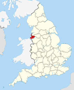
Merseyside shown in England
Knowsley
| Name | Location | Type | Completed [note 1] | Date designated | Grid ref.[note 2] Geo-coordinates |
Entry number [note 3] | Image |
|---|---|---|---|---|---|---|---|
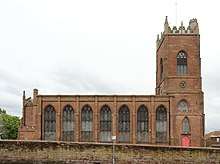
| Church of St Mary | Prescot, Knowsley | Church | 14th century | 19 March 1951 | SJ4653192704 53°25′42″N 2°48′22″W |
1199139 |

Liverpool
| Name | Location | Type | Completed [note 1] | Date designated | Grid ref.[note 2] Geo-coordinates |
Entry number [note 3] | Image |
|---|---|---|---|---|---|---|---|
| Anglican Cathedral Church of Christ | Liverpool | Anglican Cathedral | 1904 | 28 June 1952 | SJ3538289397 53°23′51″N 2°58′24″W |
1361681 | |
| Bank of England building | Liverpool | Bank (financial) | 1845-8 | 28 June 1952 | SJ3426290392 53°24′22″N 2°59′25″W |
1205904 | |
| Bluecoat Chambers | Liverpool | Offices | 1717 | 28 June 1952 | SJ3468590149 53°24′15″N 2°59′02″W |
1292322 | |
| Church of All Hallows, Allerton | Liverpool | Church | 1872-6 | 28 June 1952 | SJ3998487473 53°22′50″N 2°54′13″W |
1068414 | |
| All Saints' Church, Childwall | Liverpool | Church | 14th century | 28 June 1952 | SJ4147689079 53°23′43″N 2°52′54″W |
1356299 | |
| Church of St. Agnes and St. Pancras, Toxteth Park | Liverpool | Church | 1883-5 | 14 March 1975 | SJ3759188494 53°23′22″N 2°56′24″W |
1359871 |  Church of St. Agnes and St. Pancras, Toxteth Park |
| Church of St Clare | Liverpool | Church | 1888-90 | 28 June 1952 | SJ3779688649 53°23′28″N 2°56′13″W |
1205333 |  Church of St Clare |
| Church of St George | Liverpool | Church | 1812-14 | 12 July 1966 | SJ3554492489 53°25′31″N 2°58′17″W |
1075216 | |
| Church of St John Baptist | Liverpool | Church | 1868-70 | 28 June 1952 | SJ3829792406 53°25′29″N 2°55′48″W |
1063778 | |
| St Michael's Church, Aigburth | Liverpool | Church | 1814 | 28 June 1952 | SJ3690887058 53°22′36″N 2°56′59″W |
1209945 | |
| Oriel Chambers | Liverpool | Date Stone | 1864 | 12 July 1966 | SJ3406790429 53°24′24″N 2°59′36″W |
1291943 | |
| Princes Road Synagogue | Liverpool | Synagogue | Built 1872-4 | 14 March 1975 | SJ3592689133 53°23′42″N 2°57′54″W |
1072969 | |
| Railings Gates and Gate Piers Old Bluecoat School | Liverpool | Gate | c. 1717 | 14 March 1975 | SJ3469090180 53°24′16″N 2°59′02″W |
1073446 | 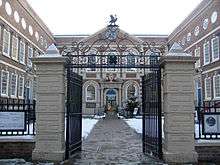 Railings Gates and Gate Piers Old Bluecoat School |
| Royal Liver Building, Iron Railings and Stone Piers Surrounding Royal Liver Building | Georges Pier Head, Liverpool | Office | 1908-10 | 12 July 1966 | SJ3388090329 53°24′20″N 2°59′46″W |
1356370 | 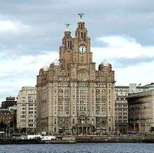 Royal Liver Building, Iron Railings and Stone Piers Surrounding Royal Liver Building |
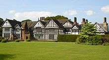
| Speke Hall | Liverpool | House | 1540-1560 | 28 June 1952 | SJ4186582568 53°20′13″N 2°52′28″W |
1359837 | |
| St George's Hall | Liverpool | Concert Hall | 1841-5 | 28 June 1952 | SJ3493190656 53°24′31″N 2°58′49″W |
1361677 | |
| The Oratory | Liverpool | Hall | 1829 | 28 June 1952 | SJ3538689543 53°23′55″N 2°58′24″W |
1063282 | |
| Town Hall | Liverpool | Loggia | 1749-54 | 28 June 1952 | SJ3417590496 53°24′26″N 2°59′30″W |
1360219 | |
| Toxteth Unitarian Chapel | Liverpool | Manor House | Post 1618 | 28 June 1952 | SJ3637787590 53°22′53″N 2°57′29″W |
1072991 | |
| Unitarian Chapel | Liverpool | Chapel | 1898 | 14 March 1975 | SJ3771388521 53°23′23″N 2°56′17″W |
1218227 |  Unitarian Chapel |
| Unitarian Church Hall | Liverpool | Church Hall | 1901 | 14 March 1975 | SJ3773988504 53°23′23″N 2°56′16″W |
1359872 |  Unitarian Church Hall |
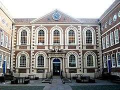
| Albert Dock Traffic Office | Albert Dock, Liverpool | Dock | 1846-7 | 28 June 1952 | SJ3413789864 53°24′05″N 2°59′31″W |
1356264 | .JPG) Albert Dock Traffic Office |
| Warehouse A | Albert Dock, Liverpool | Fireproof Building | 1841-5 | 28 June 1952 | SJ3419789710 53°24′00″N 2°59′28″W |
1205175 |  Warehouse A |
| Warehouses B and C | Albert Dock, Liverpool | Warehouses | 1841-5 | 28 June 1952 | SJ3405689591 53°23′56″N 2°59′36″W |
1068409 |  Warehouses B and C |
| Warehouse D | Albert Dock, Liverpool | Fireproof Building (Museum) | 1841-5 | 28 June 1952 | SJ3407989840 53°24′04″N 2°59′35″W |
1280847 |  Warehouse D |
| Warehouse E | Albert Dock, Liverpool | Apartment | 1985 | 28 June 1952 | SJ3415389833 53°24′04″N 2°59′31″W |
1068410 |  Warehouse E |
| Woolton Hall | Liverpool | House | 1704 | 28 June 1982 | SJ4254886416 53°22′17″N 2°51′54″W |
1217943 |

.jpg)

.JPG)


.jpg)


Sefton
| Name | Location | Type | Completed [note 1] | Date designated | Grid ref.[note 2] Geo-coordinates |
Entry number [note 3] | Image |
|---|---|---|---|---|---|---|---|
| Church of St Helen | Sefton, Sefton | Church | Early 14th century | 11 October 1968 | SD3568301295 53°30′16″N 2°58′16″W |
1075852 | |
| Church of St Monica | Bootle | Church | 1936 | 19 March 1981 | SJ3503495685 53°27′14″N 2°58′47″W |
1283647 |


St. Helens
| Name | Location | Type | Completed [note 1] | Date designated | Grid ref.[note 2] Geo-coordinates |
Entry number [note 3] | Image |
|---|---|---|---|---|---|---|---|
| Sankey Viaduct over Sankey Brook (that Part in St Helens District) | St Helens | Railway Viaduct | 1830 | 3 February 1966 | SJ5688294719 53°26′51″N 2°39′02″W |
1075927 |  Sankey Viaduct over Sankey Brook (that Part in St Helens District) |
Wirral
| Name | Location | Type | Completed [note 1] | Date designated | Grid ref.[note 2] Geo-coordinates |
Entry number [note 3] | Image |
|---|---|---|---|---|---|---|---|
| Brimstage Hall and Tower | Brimstage, Wirral | House | c. 1398 | 27 December 1962 | SJ3042482699 53°20′12″N 3°02′47″W |
1183702 | |
| Church of St. Andrew | Lower Bebington, Wirral | Church | 12th century | 27 December 1962 | SJ3330183908 53°20′52″N 3°00′12″W |
1075462 | |
| Numbers 1 to 18 (consecutive), Hamilton Square - with Railings to Front | Birkenhead, Wirral | Model Dwelling | c. 1825 | 29 July 1950 | SJ3258789088 53°23′39″N 3°00′55″W |
1201580 |  Numbers 1 to 18 (consecutive), Hamilton Square - with Railings to Front |
| Numbers 19 to 34 (consecutive), Hamilton Square - with Railings to Front | Birkenhead, Wirral | Model Dwelling | 1839-44 | 29 July 1950 | SJ3245089045 53°23′38″N 3°01′02″W |
1292180 | .jpg) Numbers 19 to 34 (consecutive), Hamilton Square - with Railings to Front |
| Numbers 35 to 51 (consecutive), Hamilton Square - with Railings to Front | Birkenhead, Wirral | Model Dwelling | 1839-44 | 29 July 1950 | SJ3250088927 53°23′34″N 3°00′59″W |
1292148 |  Numbers 35 to 51 (consecutive), Hamilton Square - with Railings to Front |
| Numbers 52 to 57 (consecutive), Hamilton Square - with Railings to Front | Birkenhead, Wirral | Model Dwelling | c. 1844 | 29 July 1950 | SJ3260488927 53°23′34″N 3°00′54″W |
1282616 |  Numbers 52 to 57 (consecutive), Hamilton Square - with Railings to Front |
| Numbers 58 to 63 (consecutive), Hamilton Square - with Railings to Front, Flanking Wall and Gatepiers to East | Birkenhead, Wirral | Model Dwelling | c. 1825 | 29 July 1950 | SJ3268189036 53°23′38″N 3°00′50″W |
1218048 | .jpg) Numbers 58 to 63 (consecutive), Hamilton Square - with Railings to Front, Flanking Wall and Gatepiers to East |
| Remains of Birkenhead Priory | Birkenhead, Wirral | Church | 1150-1400 | 29 July 1950 | SJ3280788542 53°23′22″N 3°00′42″W |
1201757 | |
| Port Sunlight War Memorial | Port Sunlight, Wirral | War memorial | 1919-21 | 28 October 2014 | SJ3367484480 53°21′11″N 2°59′52″W |
1343491 |


Notes
- The date given is the date used by Historic England as significant for the initial building or that of an important part in the structure's description.
- Sometimes known as OSGB36, the grid reference is based on the British national grid reference system used by the Ordnance Survey.
- The "List Entry Number" is a unique number assigned to each listed building and scheduled monument by Historic England.
References
External links
![]()
This article is issued from Wikipedia. The text is licensed under Creative Commons - Attribution - Sharealike. Additional terms may apply for the media files.