Blackstone Edge
Blackstone Edge is a gritstone escarpment at 1,549 feet (472 m) above sea level in the Pennine hills surrounded by moorland on the boundary between Greater Manchester and West Yorkshire in England.[1]
| Blackstone Edge | |
|---|---|
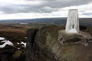 The highest point of Blackstone Edge | |
| Highest point | |
| Elevation | 1,549 ft (472 m) |
| Coordinates | 53°38′24″N 2°02′35″W |
| Geography | |
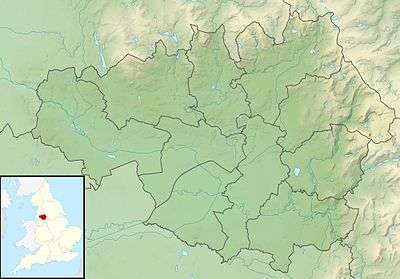 Blackstone Edge Location of Blackstone Edge in Greater Manchester | |
| Location | Littleborough, Greater Manchester, England |
| Parent range | Pennines |
| OS grid | SD977163 |
History
Passing the crag is Blackstone Edge Long Causeway, also known as Blackstone Edge Roman Road, a paved road originally thought to be of Roman origin. After investigations by James Maxim it is now considered to be a 1735 turnpike or packhorse route.[2] The Aiggin Stone, a gritstone pillar, possibly a way-marker, stands alongside the packhorse route and marks the county boundary. The stone has a cross and the letters I and T cut into it. Its name is said to derive from the French aiguille for a needle or aigle for an eagle.[3]
Much of the surrounding area was within the ancient parish of Hundersfield, although some parts lay within Butterworth township. In the English Civil War the Parliamentarians sent 800 men to fortify Blackstone Edge; John Rosworm came from Manchester to direct the construction of defences. It was successfully held against an attack by Royalist cavalry.[4] In 1660 the churchwardens of St Chad's paid 24 shillings for eight loads of "great stones from Blackstoneedge" for Rochdale church steps. Celia Fiennes travelled over Blackstone Edge and described her journey in about 1700.[5] A meeting of supporters of Chartism from the surrounding industrial towns of Lancashire and Yorkshire was held in 1846, attracting up to 30,000 people.[6]
Sport
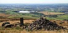
Blackstone Edge is frequented by walkers and rock climbers who use its traditional climbing and bouldering routes.[7][8] The crag was featured in Some Gritstone Climbs, a pioneering 1913 guide to rock-climbing in the Peak District, by John Laycock. One walking route is a circular walk from Hollingworth Lake in Smithy Bridge near Littleborough up to Blackstone Edge, and another route links Blackstone Edge to Hebden Bridge in the Calder Valley. The Pennine Way long-distance footpath from Edale in the Derbyshire Peak District to Kirk Yetholm in Scotland passes along the top of the outcrop. It is also an alternative route of the Rochdale Way.
From the summit one can see Manchester city centre, Winter Hill in the West Pennine Moors, and the mountains in North Wales in clear weather.
Halifax Road, which goes up towards Blackstone Edge reservoir, provides a popular cycling ascent. With 240m of ascent from the centre of Littleborough, at an average gradient of 5%, it is recognised as a category 3 climb on Strava.[9]
References
Notes
- Greater Manchester (including: Wigan, Bolton, Salford, Trafford, Bury, Rochdale, Stockport, Manchester, Tameside and Oldham), Natural England, archived from the original on 27 March 2012, retrieved 17 January 2011
- Roman Roads, Lancashire County Council, archived from the original on 2 October 2013, retrieved 29 September 2013
- Aigin Stone, Calderdale Council, retrieved 2 October 2013
- Broxap 1973, p. 9
- "The parish of Rochdale", A History of the County of Lancaster, 5, British History Online, 1911, pp. 187–201, retrieved 2 October 2013
- Chartism, Calderdale Council, retrieved 2 October 2013
- Blackstone Edge, UK Climbing, retrieved 2 October 2013
- Blackstone Edge – Gritstone, Peak District Bouldering, retrieved 2 October 2013
- "Blackstone Edge". Strava. Retrieved 15 April 2019.
Bibliography
- Broxap, Ernest (1973), The Great Civil War in Lancashire, 1642–1651, Manchester University Press, ISBN 9780719005398