Emporium, Pennsylvania
Emporium is a borough and the county seat of Cameron County in the U.S. state of Pennsylvania.[3] It is located 100 miles (160 km) west-northwest of Williamsport. Early in the twentieth century, there were large powder plants and manufacturers of radio tubes and incandescent lamps (Sylvania Electric Products), paving brick, flour, iron, lumber, and sole leather.[4][5] In 1900, 2,463 people lived in Emporium, and in 1910, the population was 2,916. By 2000 the population had dropped to 2,526, and at the 2010 census, the population was 2,073.[6]
Emporium, Pennsylvania | |
|---|---|
 Emporium and the Cameron County Courthouse from the Whitmore Road vista | |
| Nickname(s): Empo | |
| Motto(s): Land of the Endless Mountains | |
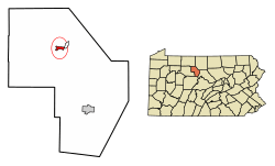 Location of Emporium in Cameron County, Pennsylvania. | |
 Emporium Location within the U.S. state of Pennsylvania  Emporium Emporium (the United States) | |
| Coordinates: 41°30′41″N 78°14′11″W | |
| Country | United States |
| State | Pennsylvania |
| County | Cameron |
| Settled | 1810 |
| Incorporated (borough) | 1864 |
| Government | |
| • Type | Borough Council |
| • Mayor | Justin M. Zimmer |
| Area | |
| • Total | 0.75 sq mi (1.95 km2) |
| • Land | 0.71 sq mi (1.84 km2) |
| • Water | 0.04 sq mi (0.11 km2) |
| Elevation | 1,031 ft (314 m) |
| Population (2010) | |
| • Total | 2,073 |
| • Estimate (2018)[2] | 1,833 |
| • Density | 2,643.66/sq mi (1,021.08/km2) |
| Time zone | Eastern (EST) |
| • Summer (DST) | EDT |
| Zip code | 15834 |
| Area code(s) | 814 |
| FIPS code | 42-23600 |
| Website | emporiumborough |
Geography
Emporium is located in northern Cameron County at 41°30′41″N 78°14′11″W (41.511288, -78.236418).[7] It is in the valley of the Driftwood Branch of Sinnemahoning Creek, flowing southeast towards the West Branch Susquehanna River. Pennsylvania Route 120 passes through the borough, leading southeast 18 miles (29 km) to Driftwood and eventually Lock Haven and Williamsport, and west 19 miles (31 km) to St. Marys on the Eastern Continental Divide. Pennsylvania Route 46 leads northwest from Emporium 27 miles (43 km) to Smethport, and Pennsylvania Route 155 leads north 24 miles (39 km) to Port Allegany, both of which communities are in the Allegheny River basin.
According to the United States Census Bureau, Emporium has a total area of 0.73 square miles (1.9 km2), of which 0.69 square miles (1.8 km2) is land and 0.04 square miles (0.1 km2), or 5.51%, is water.[6]
Demographics
| Historical population | |||
|---|---|---|---|
| Census | Pop. | %± | |
| 1870 | 898 | — | |
| 1880 | 1,156 | 28.7% | |
| 1890 | 2,147 | 85.7% | |
| 1900 | 2,463 | 14.7% | |
| 1910 | 2,916 | 18.4% | |
| 1920 | 3,036 | 4.1% | |
| 1930 | 2,929 | −3.5% | |
| 1940 | 3,775 | 28.9% | |
| 1950 | 3,646 | −3.4% | |
| 1960 | 3,397 | −6.8% | |
| 1970 | 3,074 | −9.5% | |
| 1980 | 2,837 | −7.7% | |
| 1990 | 2,513 | −11.4% | |
| 2000 | 2,526 | 0.5% | |
| 2010 | 2,073 | −17.9% | |
| Est. 2018 | 1,833 | [2] | −11.6% |
| Sources:[8][9][10] | |||
As of the census[11] of 2010, there were 2,073 people, 956 households, and 498 families residing in the borough. The population density was 2,961.4 people per square mile (1,156.8/km²). There were 1,140 housing units at an average density of 1,628.6 per square mile (636.2/km²). The racial makeup of the borough was 98.1% White, 0.5% African American, 0.4% Native American, 0.4% Asian, and 0.6% from two or more races. Hispanic or Latino of any race were 0.6% of the population.
There were 956 households, out of which 25.7% had children under the age of 18 living with them, 34.9% were married couples living together, 11.8% had a female householder with no husband present, and 47.9% were non-families. 42.4% of all households were made up of individuals, and 19.6% had someone living alone who was 65 years of age or older. The average household size was 2.09 and the average family size was 2.87.
In the borough the population was spread out, with 21.8% under the age of 18, 57.4% from 18 to 64, and 20.8% who were 65 years of age or older. The median age was 44 years.
The median income for a household in the borough was $32,468, and the median income for a family was $46,544. Males had a median income of $32,473 versus $29,489 for females. The per capita income for the borough was $18,713. About 10.7% of families and 16.3% of the population were below the poverty line, including 27.7% of those under age 18 and 11.9% of those age 65 or over.
Notable people
- Joseph T. McNarney, World War I flying ace, four-star general, Deputy Chief of Staff of the U.S. Army during World War II, Supreme Allied Commander of the Mediterranean Theater, a Military Governor of the U.S. Occupation Zone in Germany. Was appointed Knight Commander of the Order of the Bath by King George VI of England.
 First Baptist Church
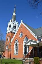 First United Methodist Church
 St. Mark's Catholic Church
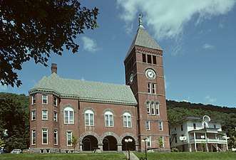
References
- "2017 U.S. Gazetteer Files". United States Census Bureau. Retrieved Mar 24, 2019.
- Bureau, U. S. Census. "U.S. Census website". United States Census Bureau. US Census Bureau. Retrieved 14 August 2019.
- "Find a County". National Association of Counties. Archived from the original on 2011-05-31. Retrieved 2011-06-07.
- "Sylvania". Archived from the original on 30 March 2013. Retrieved 12 July 2013.
- "Vintage Sylvania". Retrieved 12 July 2013.
- "Geographic Identifiers: 2010 Demographic Profile Data (G001): Emporium borough, Pennsylvania". U.S. Census Bureau, American Factfinder. Archived from the original on February 13, 2020. Retrieved April 1, 2015.
- "US Gazetteer files: 2010, 2000, and 1990". United States Census Bureau. 2011-02-12. Retrieved 2011-04-23.
- "Census of Population and Housing". U.S. Census Bureau. Retrieved 11 December 2013.
- "U.S. Census website". United States Census Bureau. Retrieved 2008-01-31.
- "Incorporated Places and Minor Civil Divisions Datasets: Subcounty Resident Population Estimates: April 1, 2010 to July 1, 2012". Population Estimates. U.S. Census Bureau. Archived from the original on 17 June 2013. Retrieved 11 December 2013.
- "U.S. Census website". United States Census Bureau. Retrieved 2011-05-14.
Further reading
- A History of Cameron County, Pennsylvania. (1991). Dallas, Texas: Curtis Media Corp.
External links
Municipalities and communities of Cameron County, Pennsylvania, United States | ||
|---|---|---|
| Boroughs | 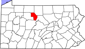 | |
| Townships | ||
| CDP | ||
| Unincorporated communities | ||
| Authority control |
|
|---|