McConnellsburg, Pennsylvania
McConnellsburg is a borough in Fulton County, Pennsylvania, United States. The population was 1,220 at the 2010 census.[3] It is the county seat of Fulton County.
McConnellsburg, Pennsylvania | |
|---|---|
 Stoner's Store in the historic district | |
| Etymology: Daniel McConnell | |
 Location of McConnellsburg in Fulton County, Pennsylvania. | |
 McConnellsburg Location of McConnellsburg in Fulton County, Pennsylvania.  McConnellsburg McConnellsburg (the United States) | |
| Coordinates: 39°55′58″N 77°59′46″W | |
| Country | United States |
| State | Pennsylvania |
| County | Fulton County |
| Founded | 1786-04-20 |
| Government | |
| • Mayor | Michael Chilcote, Sr. |
| Area | |
| • Total | 0.34 sq mi (0.89 km2) |
| • Land | 0.34 sq mi (0.89 km2) |
| • Water | 0.00 sq mi (0.00 km2) |
| Elevation | 892 ft (272 m) |
| Population (2010) | |
| • Total | 1,220 |
| • Estimate (2018)[2] | 1,009 |
| • Density | 3,011.59/sq mi (1,163.29/km2) |
| Time zone | UTC-4 (EST) |
| • Summer (DST) | UTC-5 (EDT) |
| ZIP code | 17233 |
| Area code(s) | 717 Exchanges: 485, 987 |
| FIPS code | 42-46000 |
History
The McConnellsburg Historic District was recognized by the United States Department of the Interior in 1993 when it was listed in the National Register of Historic Places. The district consists of 144 structures that contribute to its historic character. Of notable meaning are the numerous taverns, inns, automotive garages and other travel-related structures still in existence today, which includes the Fulton House, the Fulton County Courthouse, and the log cabin of Daniel McConnell, who laid out the borough on April 20, 1786. It was further incorporated on March 26, 1814.
Economy
Currently McConnellsburg's largest economic driver is Oshkosh Corporation-owned JLG Industries, a major manufacturer of construction and maintenance access-related lifting equipment such as boomlifts, etc.
Geography
McConnellsburg is located in eastern Fulton County at 39°55′58″N 77°59′46″W (39.932673, -77.995986).[4]
According to the United States Census Bureau, the borough has a total area of 0.35 square miles (0.9 km2), all of it land.[3] The elevation in the center of town is 896 feet (273 m) above sea level.
The borough is located in the Ridge and Valley section of the Appalachian Mountains in southern Pennsylvania. It is situated in a 2-mile-wide (3 km) valley between Tuscarora Mountain to the east and Little Scrub Ridge and Meadow Grounds Mountain to the west.
U.S. Route 522 passes north-south through the center of town as Second Street. The main east-west street through the town center is Lincoln Way, or old U.S. Route 30 (the Lincoln Highway). U.S. Route 30 now bypasses the borough on a limited access highway to the north. The west end of Pennsylvania Route 16 is in McConnellsburg, following Lincoln Way and then the Buchanan Trail southeast out of town.
Via US 522 it is 24 miles (39 km) south to Hancock, Maryland, and 9 miles (14 km) north to the Pennsylvania Turnpike. US 30 leads east 21 miles (34 km) to Chambersburg and 19 miles (31 km) west to Breezewood. PA 16 leads southeast 10 miles (16 km) to Mercersburg and 20 miles (32 km) to Greencastle.
Demographics
| Historical population | |||
|---|---|---|---|
| Census | Pop. | %± | |
| 1850 | 477 | — | |
| 1860 | 556 | 16.6% | |
| 1870 | 552 | −0.7% | |
| 1880 | 584 | 5.8% | |
| 1890 | 594 | 1.7% | |
| 1900 | 576 | −3.0% | |
| 1910 | 579 | 0.5% | |
| 1920 | 689 | 19.0% | |
| 1930 | 768 | 11.5% | |
| 1940 | 1,055 | 37.4% | |
| 1950 | 1,136 | 7.7% | |
| 1960 | 1,245 | 9.6% | |
| 1970 | 1,228 | −1.4% | |
| 1980 | 1,178 | −4.1% | |
| 1990 | 1,106 | −6.1% | |
| 2000 | 1,073 | −3.0% | |
| 2010 | 1,220 | 13.7% | |
| Est. 2018 | 1,009 | [2] | −17.3% |
| Sources:[5][6][7] | |||
At the 2000 census there were 1,073 people, 506 households, and 271 families residing in the borough. The population density was 2,998.2 people per square mile (1,150.8/km²). There were 551 housing units at an average density of 1,539.6 per square mile (591.0/km²). The racial makeup of the borough was 97.02% White, 0.84% African American, 0.19% Native American, 0.09% Asian, 0.09% Pacific Islander, and 1.77% from two or more races. Hispanic or Latino of any race were 0.56%.[6]
There were 506 households, 22.9% had children under the age of 18 living with them, 37.7% were married couples living together, 12.1% had a female householder with no husband present, and 46.4% were non-families. 42.1% of households were made up of individuals, and 21.3% were one person aged 65 or older. The average household size was 2.01 and the average family size was 2.72.
In the borough the population was spread out, with 19.9% under the age of 18, 6.9% from 18 to 24, 24.9% from 25 to 44, 20.4% from 45 to 64, and 28.0% 65 or older. The median age was 44 years. For every 100 females there were 80.0 males. For every 100 females age 18 and over, there were 75.9 males.
The median household income was $25,987 and the median family income was $33,125. Males had a median income of $28,478 versus $20,577 for females. The per capita income for the borough was $16,884. About 14.9% of families and 17.3% of the population were below the poverty line, including 31.7% of those under age 18 and 14.9% of those age 65 or over.
Notable people
- Toby Shaw, news presenter
References
| Wikimedia Commons has media related to McConnellsburg, Pennsylvania. |
- "2017 U.S. Gazetteer Files". United States Census Bureau. Retrieved Mar 24, 2019.
- "Population and Housing Unit Estimates". Retrieved February 9, 2020.
- "Geographic Identifiers: 2010 Demographic Profile Data (G001): McConnellsburg borough, Pennsylvania". U.S. Census Bureau, American Factfinder. Archived from the original on February 12, 2020. Retrieved January 18, 2013.
- "US Gazetteer files: 2010, 2000, and 1990". United States Census Bureau. 2011-02-12. Retrieved 2011-04-23.
- "Census of Population and Housing". U.S. Census Bureau. Retrieved 11 December 2013.
- "U.S. Census website". United States Census Bureau. Retrieved 2008-01-31.
- "Incorporated Places and Minor Civil Divisions Datasets: Subcounty Resident Population Estimates: April 1, 2010 to July 1, 2012". Population Estimates. U.S. Census Bureau. Archived from the original on 11 June 2013. Retrieved 11 December 2013.
External links
Municipalities and communities of Fulton County, Pennsylvania, United States | ||
|---|---|---|
| Boroughs | 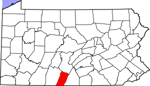 | |
| Townships | ||
| CDP | ||
| Unincorporated communities | ||
| Footnotes | ‡This populated place also has portions in an adjacent county or counties | |
| Authority control |
|
|---|