Driftwood, Pennsylvania
Driftwood is a borough in Cameron County, Pennsylvania, United States. The population was 67 at the 2010 census.[3]
Driftwood, Pennsylvania | |
|---|---|
Part of the former Castle Garden Bridge in southern Driftwood | |
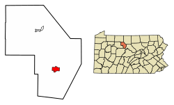 Location of Driftwood in Cameron County, Pennsylvania. | |
 Driftwood Location of Driftwood in Cameron County, Pennsylvania.  Driftwood Driftwood (the United States) | |
| Coordinates: 41°20′20″N 78°08′08″W | |
| Country | United States |
| State | Pennsylvania |
| County | Cameron |
| Settled | 1804 |
| Incorporated (borough) | 1872 |
| Area | |
| • Total | 2.56 sq mi (6.62 km2) |
| • Land | 2.49 sq mi (6.45 km2) |
| • Water | 0.07 sq mi (0.18 km2) |
| Elevation | 850 ft (260 m) |
| Population (2010) | |
| • Total | 67 |
| • Estimate (2018)[2] | 59 |
| • Density | 24.11/sq mi (9.31/km2) |
| Time zone | Eastern (EST) |
| • Summer (DST) | EDT |
| ZIP code | 15832 |
| Area code(s) | 814 |
| FIPS code | 42-19976 |
History
Driftwood was incorporated as the second and last borough in Cameron County (the other being Emporium, the county seat) on January 17, 1872. The tracks of the Philadelphia & Erie Railroad, however, had been laid through Driftwood in 1863. Around the time of its incorporation Driftwood was at the center of the lumber industry and was a boomtown, with three hotels, two banks, two churches, and numerous places of business, including a weekly newspaper, the Driftwood Gazette, owned by John T. Earl, who was also the editor.
Geography
Driftwood is located in southern Cameron County at 41°20′20″N 78°8′8″W (41.338836, -78.135535),[4] at the confluence of the Bennett Branch and the Driftwood Branch of Sinnemahoning Creek, an east-flowing tributary of the West Branch Susquehanna River. The community is at the bottom of a gorge carved 1,200 feet (370 m) deep or more into the Allegheny Plateau by the creek and its branches.
Pennsylvania Route 120 passes through Driftwood, following the Driftwood Branch north (upstream) 18 miles (29 km) to Emporium, the Cameron County seat, and following Sinnemahoning Creek and the West Branch of the Susquehanna east (downstream) 27 miles (43 km) to Renovo. Pennsylvania Route 555 leads west from Driftwood up the Bennett Branch 25 miles (40 km) to Weedville.
According to the United States Census Bureau, the borough of Driftwood has a total area of 2.5 square miles (6.6 km2), of which 2.5 square miles (6.4 km2) is land and 0.08 square miles (0.2 km2), or 2.66%, is water.[3]
Demographics
| Historical population | |||
|---|---|---|---|
| Census | Pop. | %± | |
| 1880 | 504 | — | |
| 1890 | 628 | 24.6% | |
| 1900 | 509 | −18.9% | |
| 1910 | 517 | 1.6% | |
| 1920 | 478 | −7.5% | |
| 1930 | 282 | −41.0% | |
| 1940 | 293 | 3.9% | |
| 1950 | 289 | −1.4% | |
| 1960 | 203 | −29.8% | |
| 1970 | 184 | −9.4% | |
| 1980 | 163 | −11.4% | |
| 1990 | 116 | −28.8% | |
| 2000 | 103 | −11.2% | |
| 2010 | 67 | −35.0% | |
| Est. 2018 | 59 | [2] | −11.9% |
| Sources:[5][6][7] | |||
2000 census
At the 2000 census there were 103 people in 49 households, including 27 families, in the borough. The population density was 57.5 people per square mile (22.2/km²). There were 88 housing units at an average density of 49.1/sq mi (19.0/km²). The racial makeup of the borough was 100.00% White.[6] There were 49 households, 18.4% had children under the age of 18 living with them, 49.0% were married couples living together, 6.1% had a female householder with no husband present, and 42.9% were non-families. 36.7% of households were made up of individuals, and 16.3% were one person aged 65 or older. The average household size was 2.10 and the average family size was 2.82.
The age distribution was 19.4% under the age of 18, 5.8% from 18 to 24, 26.2% from 25 to 44, 29.1% from 45 to 64, and 19.4% 65 or older. The median age was 44 years. For every 100 females there were 102.0 males. For every 100 females age 18 and over, there were 88.6 males.
The median household income was $21,458 and the median family income was $44,167. Males had a median income of $32,250 versus $28,333 for females. The per capita income for the borough was $16,708. There were no families and 8.9% of the population living below the poverty line, including no under eighteens and 33.3% of those over 64.
2010 census
At the 2010 census there were 67 people in 35 households, including 19 families, in the borough. The population density was 26.8 people per square mile (10.4/km²). There were 93 housing units at an average density of 37.2 per square mile (14.5/km²). The racial makeup of the borough was 94% White, 1.5% Black, and 4.5% two or more races.[8] There were 35 households, 17.1% had children under the age of 18 living with them, 42.9% were married couples living together, 5.7% had a female householder with no husband present, and 45.7% were non-families. 40% of households were made up of individuals, and 11.5% were one person aged 65 or older. The average household size was 1.91 and the average family size was 2.58.
The age distribution was 10.4% under the age of 18, 65.7% from 18 to 64, and 23.9% 65 or older. The median age was 51.3 years.
The median household income was $45,417 and the median family income was $50,536. The per capita income for the borough was $22,060. There were 9.5% families and 9.8% of the population living below the poverty line, including none under eighteens and 10% of those over 64.
Notable people
- Garrett Cochran's birthplace
- Tom Mix's birthplace, though miles away, had an address of Driftwood
References
- "2017 U.S. Gazetteer Files". United States Census Bureau. Retrieved March 24, 2019.
- Bureau, U. S. Census. "U.S. Census website". United States Census Bureau. US Census Bureau. Retrieved 14 August 2019.
- "Geographic Identifiers: 2010 Demographic Profile Data (G001): Driftwood borough, Pennsylvania". U.S. Census Bureau, American Factfinder. Archived from the original on April 6, 2015. Retrieved March 31, 2015.
- "US Gazetteer files: 2010, 2000, and 1990". United States Census Bureau. 2011-02-12. Retrieved 2011-04-23.
- "Census of Population and Housing". U.S. Census Bureau. Retrieved 11 December 2013.
- "U.S. Census website". United States Census Bureau. Retrieved 2008-01-31.
- "Incorporated Places and Minor Civil Divisions Datasets: Subcounty Resident Population Estimates: April 1, 2010 to July 1, 2012". Population Estimates. U.S. Census Bureau. Archived from the original on 11 June 2013. Retrieved 11 December 2013.
- "U.S. Census website". United States Census Bureau. Retrieved 2011-05-14.
Municipalities and communities of Cameron County, Pennsylvania, United States | ||
|---|---|---|
| Boroughs | 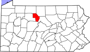 | |
| Townships | ||
| CDP | ||
| Unincorporated communities | ||