Douglas County, Kansas
Douglas County (county code DG) is a county located in the U.S. state of Kansas. As of the 2010 census, the county population was 110,826,[1] making it the fifth-most populous county in Kansas. Its county seat and most populous city is Lawrence.[2]
Douglas County | |
|---|---|
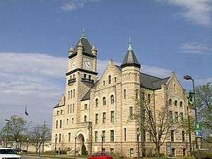 Douglas County Courthouse in Lawrence | |
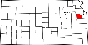 Location within the U.S. state of Kansas | |
 Kansas's location within the U.S. | |
| Coordinates: | |
| Country | |
| State | |
| Founded | August 25, 1855 |
| Named for | Stephen Douglas |
| Seat | Lawrence |
| Largest city | Lawrence |
| Area | |
| • Total | 475 sq mi (1,230 km2) |
| • Land | 456 sq mi (1,180 km2) |
| • Water | 19 sq mi (50 km2) 4.0%% |
| Population | |
| • Estimate (2019) | 122,259 |
| • Density | 243/sq mi (94/km2) |
| Time zone | UTC−6 (Central) |
| • Summer (DST) | UTC−5 (CDT) |
| Area code | 785 |
| Congressional district | 2nd |
| Website | douglascountyks.org |
History
Early history
For millennia, the Great Plains of North America was inhabited by nomadic Native Americans. From the 16th century to 18th century, the Kingdom of France claimed ownership of large parts of North America. In 1762, after the French and Indian War, France secretly ceded New France to Spain, per the Treaty of Fontainebleau. In 1802, Spain returned most of the land to France via the Third Treaty of San Ildefonso, although the former country kept title to about 7,500 square miles. In 1803, most of the land for modern day Kansas was acquired by the United States from France as part of the 828,000 square mile Louisiana Purchase for 2.83 cents per acre.
19th century
In 1854, the Kansas Territory was organized, then in 1861 Kansas became the 34th U.S. state. In 1855, Douglas County was established. Douglas County was opened for settlement on May 15, 1854, and was named for Stephen A. Douglas,[3] a senator from Illinois. The county was practically at the center of the Bleeding Kansas years as leaders in Lecompton (the territorial capital) wanted Kansas to be a slave state, whereas leaders in Lawrence wanted Kansas to be a free state. The pro- and anti-slavery settlers held great animosity towards one another, leading to many events, such as the drafting of the Lecompton Constitution (which would have admitted Kansas into the Union as a slave state), the Wakarusa War (1855), the Sack of Lawrence (1856), Battle of Black Jack (1856), and the Lawrence Massacre (1863).
The first railroad in Douglas County, the Kansas Pacific, was built through that territory in 1864.[4]
Geography

According to the U.S. Census Bureau, the county has a total area of 475 square miles (1,230 km2), of which 456 square miles (1,180 km2) is land and 19 square miles (49 km2) (4.0%) is water.[5] It is the fifth-smallest county in Kansas by land area. Much of its northern boundary is defined by the Kansas River, which flows through Lawrence and provides hydropower at the Bowersock Dam.
Lakes
Adjacent counties
- Jefferson County (north)
- Leavenworth County (northeast)
- Johnson County (east)
- Miami County (southeast)
- Franklin County (south)
- Osage County (southwest)
- Shawnee County (northwest)
Demographics
| Historical population | |||
|---|---|---|---|
| Census | Pop. | %± | |
| 1860 | 8,637 | — | |
| 1870 | 20,592 | 138.4% | |
| 1880 | 21,700 | 5.4% | |
| 1890 | 23,961 | 10.4% | |
| 1900 | 25,096 | 4.7% | |
| 1910 | 24,724 | −1.5% | |
| 1920 | 23,998 | −2.9% | |
| 1930 | 25,143 | 4.8% | |
| 1940 | 25,171 | 0.1% | |
| 1950 | 34,086 | 35.4% | |
| 1960 | 43,720 | 28.3% | |
| 1970 | 57,932 | 32.5% | |
| 1980 | 67,640 | 16.8% | |
| 1990 | 81,798 | 20.9% | |
| 2000 | 99,962 | 22.2% | |
| 2010 | 110,826 | 10.9% | |
| Est. 2019 | 122,259 | [6] | 10.3% |
| U.S. Decennial Census[7] 1790-1960[8] 1900-1990[9] 1990-2000[10] 2010-2019[1] | |||

Douglas County comprises the Lawrence, KS Metropolitan Statistical Area, which is also included in the Kansas City-Overland Park-Kansas City, MO-KS Combined Statistical Area.
As of the 2000 census,[11] there were 99,962 people, 38,486 households, and 21,167 families residing in the county. The population density was 219 people per square mile (84/km²). There were 40,250 housing units at an average density of 88 per square mile (34/km²). The racial makeup of the county was 86.1% White, 4.2% Black or African American, 2.6% Native American, 3.1% Asian, 0.1% Pacific Islander, 1.2% from other races, and 2.7% from two or more races. Hispanic or Latino of any race were 3.3% of the population.
There were 38,486 households out of which 27.4% had children under the age of 18 living with them, 43.1% were married couples living together, 8.5% had a female householder with no husband present, and 45.0% were non-families. 28.5% of all households were made up of individuals and 5.8% had someone living alone who was 65 years of age or older. The average household size was 2.37 and the average family size was 2.97.
In the county, the population was spread out with 20.4% under the age of 18, 26.4% from 18 to 24, 28.3% from 25 to 44, 16.9% from 45 to 64, and 7.9% who were 65 years of age or older. The median age was 27 years. For every 100 females there were 98.70 males. For every 100 females age 18 and over, there were 97.70 males.
The median income for a household in the county was $37,547, and the median income for a family was $53,991. Males had a median income of $35,577 versus $27,225 for females. The per capita income for the county was $19,952. About 6.2% of families and 15.9% of the population were below the poverty line, including 9.0% of those under age 18 and 7.3% of those age 65 or over.
Government
County
In recent years, since the 1990s, the Democratic Party has been dominant in Douglas County. Democrats control all County-wide offices in the County, except for the position of Sheriff. Douglas County is currently served by county commissioners Mike Gaughan, Nancy Thellman, and Michelle Derusseau. Gaughan and Thellman are Democrats, while Derusseau is the lone Republican on the commission.
State
Democratic state representatives representing portions of the county include John Wilson (10th District), Barbara Ballard (44th District), and Dennis Highberger (46th District); Republican state representatives include Jim Karleskint (42nd District), Tom Sloan (45th District) and Ken Corbet (54th District). The three state senators representing the county, Marci Francisco (2nd District), Tom Holland (3rd District), and Anthony Hensley (19th District), are all Democrats.[12]
Presidential elections
| Year | Republican | Democratic | Third Parties |
|---|---|---|---|
| 2016 | 29.3% 14,688 | 62.3% 31,195 | 8.4% 4,204 |
| 2012 | 35.9% 17,401 | 60.4% 29,267 | 3.7% 1,796 |
| 2008 | 33.4% 17,929 | 64.1% 34,398 | 2.5% 1,314 |
| 2004 | 41.0% 20,544 | 57.1% 28,634 | 1.9% 933 |
| 2000 | 42.8% 17,062 | 45.8% 18,249 | 11.4% 4,527 |
| 1996 | 42.6% 16,116 | 47.9% 18,116 | 9.4% 3,568 |
| 1992 | 30.6% 12,949 | 46.0% 19,439 | 23.4% 9,877 |
| 1988 | 49.9% 16,149 | 48.7% 15,752 | 1.4% 460 |
| 1984 | 58.9% 18,975 | 40.0% 12,880 | 1.2% 378 |
| 1980 | 49.0% 14,106 | 32.5% 9,360 | 18.5% 5,318 |
| 1976 | 51.3% 14,277 | 42.8% 11,922 | 5.9% 1,643 |
| 1972 | 55.6% 15,316 | 42.3% 11,646 | 2.1% 565 |
| 1968 | 53.8% 10,533 | 35.4% 6,936 | 10.8% 2,114 |
| 1964 | 45.1% 7,825 | 54.3% 9,416 | 0.7% 112 |
| 1960 | 66.4% 11,337 | 33.3% 5,690 | 0.2% 38 |
| 1956 | 71.9% 11,029 | 27.9% 4,283 | 0.3% 39 |
| 1952 | 74.3% 11,095 | 25.2% 3,765 | 0.4% 64 |
| 1948 | 64.3% 9,287 | 33.1% 4,778 | 2.7% 389 |
| 1944 | 67.5% 8,224 | 31.9% 3,886 | 0.7% 79 |
| 1940 | 70.3% 9,146 | 28.6% 3,727 | 1.1% 141 |
| 1936 | 62.2% 8,324 | 37.1% 4,961 | 0.7% 96 |
| 1932 | 58.7% 7,346 | 38.6% 4,833 | 2.7% 342 |
| 1928 | 78.7% 8,887 | 20.3% 2,297 | 1.0% 108 |
| 1924 | 75.3% 8,052 | 18.0% 1,922 | 6.8% 726 |
| 1920 | 73.2% 6,266 | 25.7% 2,197 | 1.1% 94 |
| 1916 | 53.9% 4,975 | 41.5% 3,834 | 4.6% 426 |
| 1912 | 21.8% 1,133 | 36.3% 1,888 | 41.9% 2,182 |
| 1908 | 60.6% 3,279 | 37.2% 2,010 | 2.2% 119 |
| 1904 | 74.3% 3,574 | 20.6% 989 | 5.2% 249 |
| 1900 | 58.6% 3,453 | 39.6% 2,333 | 1.9% 111 |
| 1896 | 57.4% 3,582 | 41.2% 2,573 | 1.4% 85 |
| 1892 | 57.3% 3,114 | 42.7% 2,320 | |
| 1888 | 60.0% 3,189 | 31.4% 1,669 | 8.6% 455 |
Douglas County has a political history more typical of Vermont and Maine than of the Great Plains. This is due to the county's strong New England roots. It voted for the Republican candidate in every Presidential election between 1864 and 1960, except in 1912 when the GOP was mortally divided and the county supported Progressive Theodore Roosevelt. Roosevelt would later rejoin the GOP. The county reverted to form and gave Republican presidential nominees over 60 percent of the vote in every election between 1920 and 1960 (except 1932 when Herbert Hoover received 58.7 percent). As a measure of how deeply the county's Republican roots ran, even when Kansas was swept up in Franklin D. Roosevelt's landslide victories of 1932 and 1936, Republican candidates carried the county easily.
This tradition was broken in 1964, when the anti-Yankee sentiment and Southern leanings of Barry Goldwater drove the county into Lyndon B. Johnson's hands, making Johnson the first Democrat ever to carry the county. Even then, however, Goldwater managed 45 percent of the county's vote. With more moderate GOP candidates, the GOP carried the county in every election between 1968 and 1988. However, the growing transformation of Lawrence into a liberal academic center has pulled the county into the Democratic column in every election since 1992. This was typical of many counties around the country dominated by college towns. In 2004, John Kerry became only the second Democrat to win a majority of the county's vote. Since then, Douglas County has been one of the most Democratic counties in Kansas. In 2016, for instance, Donald Trump turned in the worst showing on record for a Republican in the county without the presence of a credible third-party challenger on the ballot. In most elections, only Wyandotte County is more Democratic. In the 2018 governor's race, however, Douglas County was Democratic nominee Laura Kelly's strongest county.
Since the 1990s, Douglas and Wyandotte have frequently been the only two counties in the state to vote for Democratic presidential candidates.
Education

Unified school districts
Douglas County is served by seven school districts.
- Lawrence USD 497 serves Lawrence, the Clinton Lake area, and parts of rural Douglas County that surround Lawrence.
- Baldwin City USD 348 serves Baldwin City and most of southern Douglas County.
- Perry-Lecompton USD 343 serves Lecompton and most of northwest Douglas County.
- Eudora USD 491 serves Eudora and the northeast part of the county.
- Santa Fe Trail USD 434 An Osage County school that covers the far southwest part of the county.
- Wellsville USD 289 covers extreme southeast Douglas County.
- Shawnee Heights USD 450 services the extreme western part of the county including Big Springs.
Universities and colleges
The University of Kansas's main campus is located in Lawrence as is Haskell Indian Nations University. Baker University, the state's oldest university, is located in Baldwin City.
Parks
Clinton Lake, completed in 1980, offers boating, fishing and other water sports and various parks surrounding the lake provides camping and trails for mountain biking, hiking and horseback riding.[14]
Lone Star Lake is a small country lake to the southwest of Lawrence offers fishing, boating and camping. Just northwest of Baldwin City is Douglas State Fishing Lake which provides hunting, fishing and limited camping. Other parks around the county include Black Jack Park which includes the Ivan Boyd Prairie Preserve and Robert Hall Pearson Memorial Park, Broken Arrow Park in Lawrence and Wells Overlook Park just south of Lawrence.[15]
Events
Major events in the county include the Maple Leaf Festival in Baldwin City every third full weekend in October.[16] Lecompton's Territorial Days take place every year in June[17] and Lawrence has many parades throughout the year including Christmas and St. Patrick's Day.[18][19]
Transportation
Major highways


Other major highways include:
County Highways
Douglas County also maintains an extensive network of county highways to serve the rural areas of the county. None of these county highways is in the Lawrence city limits.
Communities
Incorporated cities
Unincorporated communities
Townships
Douglas County is divided into nine townships. The city of Lawrence is considered governmentally independent and is excluded from the census figures for the townships. In the following table, the population center is the largest city (or cities) of significant size included in that township's population total.
| Township | FIPS | Population center |
Population | Population density /km² (/sq mi) |
Land area km² (sq mi) | Water area km² (sq mi) | Water % | Geographic coordinates |
|---|---|---|---|---|---|---|---|---|
| Clinton | 14325 | 531 | 7 (17) | 80 (31) | 26 (10) | 24.41% | 38°54′18″N 95°24′20″W | |
| Eudora | 21700 | Eudora | 5,571 | 43 (113) | 128 (49) | 2 (1) | 1.57% | 38°55′42″N 95°6′15″W |
| Grant | 27650 | 442 | 10 (27) | 43 (16) | 0 (0) | 0.74% | 39°0′8″N 95°13′19″W | |
| Kanwaka | 36075 | 1,317 | 12 (30) | 114 (44) | 8 (3) | 6.69% | 38°57′37″N 95°23′16″W | |
| Lecompton | 39175 | Lecompton | 1,761 | 20 (51) | 90 (35) | 2 (1) | 2.45% | 39°2′31″N 95°24′27″W |
| Marion | 44700 | 836 | 5 (12) | 185 (72) | 1 (0) | 0.52% | 38°49′4″N 95°24′35″W | |
| Palmyra | 54225 | Baldwin City | 5,760 | 27 (70) | 212 (82) | 2 (1) | 0.79% | 38°47′0″N 95°10′40″W |
| Wakarusa | 74400 | 2,237 | 19 (49) | 119 (46) | 2 (1) | 1.81% | 38°55′49″N 95°14′43″W | |
| Willow Springs | 79500 | 1,409 | 10 (26) | 141 (54) | 1 (0) | 0.54% | 38°47′23″N 95°18′17″W | |
| Sources: "Census 2000 U.S. Gazetteer Files". U.S. Census Bureau, Geography Division. Archived from the original on 2002-08-02. | ||||||||
Historic Townships

The county originally had only four townships. Lecompton comprised the area of Lecompton, Kanwaka, and Clinton townships; Washington took the place of Marion and Willow Springs townships; Wakarusa comprised both Wakarusa and Eudora townships; and Calhoun was the original name of Palmyra township. Grant township was annexed from Jefferson County in 1874.
Notable people
- Isaac F. Hughes, Douglas County commissioner and City Council member in both Lawrence, Kansas, and Los Angeles, California.
See also
- National Register of Historic Places listings in Douglas County, Kansas
- Kansas River - Natural crossing point for westward wagon trains on the Oregon Trail
- California Road - Cutoff on the Oregon Trail to Lawrence, Kansas from Westport
- Santa Fe Trail Swales - Visible near Black Jack Park
- Geographic Information System Viewers
|
|
References
- "State & County QuickFacts". United States Census Bureau. Archived from the original on August 6, 2011. Retrieved June 16, 2015.
- "Find a County". National Association of Counties. Archived from the original on 2011-05-31. Retrieved 2011-06-07.
- Gannett, Henry (1905). The Origin of Certain Place Names in the United States. Govt. Print. Off. p. 108.
- Blackmar, Frank Wilson (1912). Kansas: A Cyclopedia of State History, Embracing Events, Institutions, Industries, Counties, Cities, Towns, Prominent Persons, Etc. Standard Publishing Company. p. 539.
- "US Gazetteer files: 2010, 2000, and 1990". United States Census Bureau. 2011-02-12. Retrieved 2011-04-23.
- "Population and Housing Unit Estimates". Retrieved May 21, 2020.
- "U.S. Decennial Census". United States Census Bureau. Retrieved July 24, 2014.
- "Historical Census Browser". University of Virginia Library. Retrieved July 24, 2014.
- "Population of Counties by Decennial Census: 1900 to 1990". United States Census Bureau. Retrieved July 24, 2014.
- "Census 2000 PHC-T-4. Ranking Tables for Counties: 1990 and 2000" (PDF). United States Census Bureau. Retrieved July 24, 2014.
- "U.S. Census website". United States Census Bureau. Retrieved 2008-01-31.
- Douglas County - State Officials Archived August 14, 2011, at the Wayback Machine
- http://uselectionatlas.org/RESULTS
- "Archived copy". Archived from the original on 2012-02-15. Retrieved 2012-02-11.CS1 maint: archived copy as title (link)
- http://douglas-county.org/depts/pw/pw_countyparks.aspx?category_id=%5B%5D
- "Archived copy". Archived from the original on 2012-03-27. Retrieved 2012-02-11.CS1 maint: archived copy as title (link)
- http://www.lecomptonterritorialdays.com/
- http://lawrencestpatricksdayparade.com/
- http://www.lawrencechristmasparade.org/
Further reading
- Nowak, David. J. Assessing Urban Forest Effects and Values, Douglas County, Kansas. Newtown Square, PA: United States Forest Service, Northern Research Station, 2014.
- Armitage, Katie H., “‘Seeking a Home Where He Himself Is Free’: African Americans Build a Community in Douglas County, Kansas,” Kansas History, 31 (Autumn 2008), 154–75
- Standard Atlas of Douglas County, Kansas; Geo. A. Ogle & Co; 53 pages; 1921.
- Plat Book and Complete Survey of Douglas County, Kansas; Kenyon Co; 44 pages; 1909.
- Standard Atlas of Douglas County, Kansas; Geo. A. Ogle & Co; 43 pages; 1902.
- Standard Atlas of Douglas County, Kansas; F.W. Beers & Co; 25 pages; 1873.
External links
| Wikimedia Commons has media related to Douglas County, Kansas. |
- County
- Douglas County - Official
- Douglas County - Directory of Public Officials
- Douglas County - Law Library
- Other
- Aerial Photography from Multiple Decades
- Daily World, Google news archive. —PDFs for 1,062 issues, dating from 1892 through 1895.
- Daily Record, Google news archive. —PDFs for 998 issues, dating from 1889 through 1893.
- Maps
- Douglas County Maps: Current, Historic, KDOT
- Kansas Highway Maps: Current, Historic, KDOT
- Kansas Railroad Maps: Current, 1996, 1915, KDOT and Kansas Historical Society
Places adjacent to Douglas County, Kansas | ||||||||||
|---|---|---|---|---|---|---|---|---|---|---|
| ||||||||||
Municipalities and communities of Douglas County, Kansas, United States | ||
|---|---|---|
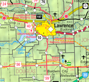
| Cities | Map of Kansas highlighting Douglas County | |
| Unincorporated communities | ||
| Ghost towns | ||
| Townships | ||
| Authority control |
|
|---|