Parsons, Kansas
Parsons is a city in Labette County, Kansas, United States. As of the 2010 census, the city population was 10,500.[6] It is the most populous city of Labette County, and after Pittsburg, is the second-most populous city in the southeastern region of Kansas.
Parsons, Kansas | |
|---|---|
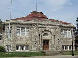 Former Parsons Carnegie Library, now Parsons Carnegie Arts Center (2013) | |
 Seal | |
 Location within Labette County and Kansas | |
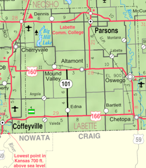 KDOT map of Labette County (legend) | |
| Coordinates: 37°20′21″N 95°16′11″W | |
| Country | United States |
| State | Kansas |
| County | Labette |
| Founded | 1870 |
| Incorporated | 1871 |
| Government | |
| • Mayor | Kevin Cruse |
| Area | |
| • Total | 10.70 sq mi (27.71 km2) |
| • Land | 10.61 sq mi (27.48 km2) |
| • Water | 0.09 sq mi (0.23 km2) |
| Elevation | 902 ft (275 m) |
| Population | |
| • Total | 10,500 |
| • Estimate (2019)[3] | 9,477 |
| • Density | 980/sq mi (380/km2) |
| Time zone | UTC-6 (CST) |
| • Summer (DST) | UTC-5 (CDT) |
| ZIP code | 67357 |
| Area code | 620 |
| FIPS code | 20-54675[4] |
| GNIS ID | 0469782[5] |
| Website | parsonsks.com |
History

Parsons was named after Levi Parsons, president of the Missouri-Kansas-Texas (Katy) Railroad.[7] The town was founded in 1870 and incorporated the following year by the railroad. The location for the town was chosen because it was where the two branches of the railroad being built from Junction City, Kansas and Sedalia, Missouri would meet, and was on a ridge between Labette Creek and Little Labette Creek, which were soon dammed to provide a water source. The railroad commenced building a massive rail yard, foundry, and locomotive shop at Parsons, which for many years was the third largest railroad facility west of the Mississippi River with only Kansas City and Los Angeles being larger. Settlers from nearby towns uprooted and moved to Parsons, and new settlers arrived on every incoming train. Parsons soon became a major hub for several railroads including the Missouri Kansas & Texas Railroad, Parsons & Pacific Railroad, Kansas City & Pacific Railroad, and the Memphis, Kansas & Colorado Railroad. In the early part of the twentieth century, Parsons operated its own street car system, and also had an interurban electric railroad connecting it to the nearby cities of Cherryvale, Independence, Coffeyville, and Nowata. During World War II it was home to the Kansas Ordnance Plant, which later operated for some years as the Kansas Army Ammunition Plant. In Spring of 2005, the munitions plant was placed on the BRAC list for closure. The community has rallied behind the current plant operator, Day and Zimmerman, to keep the company on the grounds after closure and to keep those jobs and more in the Parsons area. (See link to "Great Plains Industrial Park" in "External Links", below) Parsons is also home to the Parsons State Hospital & Training Center, which has been in operation since 1903 when it was opened as the Kansas State Hospital for Epileptics.
In 1957 the hospital was renamed Parsons State Hospital and Training Center. At that time it began providing programs for individuals with developmental disabilities. The Hospital occupies 43 buildings on 163 acres (0.66 km2). The hospital also includes residential services, the University Center on Developmental Disabilities and the Parsons Research Center for the University of Kansas, the Special Purpose School of the Southeast Regional Education Service Center. The Southeast Kansas Agricultural Research Center of Kansas State University is also located on the grounds, as is the Alzheimer's Association, Heart of America Chapter, Southeast Kansas Regional Office.
The first library began as a subscription library in 1904 and was located in city hall. Parsons Public Library, a Carnegie library, opened on May 18, 1909. A new library opened on April 18, 1977,[8] and its former building has since been renovated to become a visual and performing arts center.
The sale of Katy Industries to Union Pacific, in 1988, eventually saw the loss of scores of railroad jobs and, in effect, severed a major part of Parsons' city history which stretched back to its 1871 incorporation. While, in return, the city received a million dollars to help it recover (and so that it would not file lengthy paperwork opposing the sale and thus delaying it), that money is kept in a fund by the city government, which uses the accrued interest on economic development projects. The only reminder of the Katy Railroad is now found in the local historical society's museum, the annual Katy Days Festival [9] and of course the tracks, over which trains now speed through Parsons. The Kansas Army Ammunition Plant also was down scaled in the 1980s.
On April 19, 2000, an F3 tornado cut a devastating path of destruction through the center of Parsons. About 700 homes were damaged and about 100 destroyed, about 60 businesses were damaged and 11 destroyed.[10]
On June 5, 2006 the National Trust for Historic Preservation named Parsons a 2006 Great American Main Street Award winner for its successful efforts in revitalizing its downtown area through historic preservation. The award was presented during the 2006 National Main Streets Conference in New Orleans. Parsons was one of only five cities receiving the 2006 award.[11]
Parsons is the home of Dwayne's Photo, which became the last processor of K-14 Kodachrome film in the world[12][13] and was the location of the final frame taken on the final roll of Kodachrome film produced.[12] Parsons is featured prominently in the plot of the 2018 Netflix movie Kodachrome about a man who takes a road trip to develop a roll of Kodachrome film.[14]
The motion picture ZombieGeddon (2003) was filmed in Parsons in July 2002.[15][16]
Geography
Parsons is located at 37°20′21″N 95°16′11″W (37.339070, -95.269747).[17] The city is at the junction of U.S. Route 59 and U.S. Route 400. Along US-59, the city of Erie (the county seat of Neosho County) is 17 miles (27 km) to the north and Oswego (the county seat of Labette County) is 20 miles (32 km) south and east. Big Hill Lake is several miles to the west of the city, and Lake Parsons is situated northwest of the city.
The Kansas Army Ammunition Plant (KSAAP) is located southeast of the city. The facility was completed in 1942 to support World War II operations and consists of 21 separate facilities over 13,727 acres (55.55 km2). The installation is actively used as a munitions loading, assembly, and packing facility.[18]
According to the United States Census Bureau, the city has a total area of 10.70 square miles (27.71 km2), of which 10.61 square miles (27.48 km2) is land and 0.09 square miles (0.23 km2) is water.[1]
Climate
| Climate data for Parsons, Kansas | |||||||||||||
|---|---|---|---|---|---|---|---|---|---|---|---|---|---|
| Month | Jan | Feb | Mar | Apr | May | Jun | Jul | Aug | Sep | Oct | Nov | Dec | Year |
| Record high °F (°C) | 77 (25) |
85 (29) |
92 (33) |
98 (37) |
95 (35) |
104 (40) |
115 (46) |
110 (43) |
107 (42) |
97 (36) |
83 (28) |
77 (25) |
115 (46) |
| Average high °F (°C) | 42 (6) |
48 (9) |
57 (14) |
67 (19) |
76 (24) |
84 (29) |
90 (32) |
90 (32) |
81 (27) |
70 (21) |
57 (14) |
44 (7) |
67 (20) |
| Average low °F (°C) | 22 (−6) |
26 (−3) |
35 (2) |
45 (7) |
55 (13) |
64 (18) |
69 (21) |
67 (19) |
58 (14) |
46 (8) |
35 (2) |
25 (−4) |
46 (8) |
| Record low °F (°C) | −17 (−27) |
−16 (−27) |
−2 (−19) |
18 (−8) |
31 (−1) |
44 (7) |
49 (9) |
47 (8) |
28 (−2) |
17 (−8) |
6 (−14) |
−17 (−27) |
−17 (−27) |
| Average precipitation inches (mm) | 1.41 (36) |
1.85 (47) |
3.19 (81) |
4.38 (111) |
5.93 (151) |
5.53 (140) |
3.92 (100) |
3.29 (84) |
4.69 (119) |
3.86 (98) |
2.94 (75) |
2.06 (52) |
43.05 (1,094) |
| Source: weather.com[19] | |||||||||||||
Demographics
| Historical population | |||
|---|---|---|---|
| Census | Pop. | %± | |
| 1880 | 4,199 | — | |
| 1890 | 6,736 | 60.4% | |
| 1900 | 7,682 | 14.0% | |
| 1910 | 12,463 | 62.2% | |
| 1920 | 16,028 | 28.6% | |
| 1930 | 14,903 | −7.0% | |
| 1940 | 14,294 | −4.1% | |
| 1950 | 14,750 | 3.2% | |
| 1960 | 13,929 | −5.6% | |
| 1970 | 13,015 | −6.6% | |
| 1980 | 12,898 | −0.9% | |
| 1990 | 11,924 | −7.6% | |
| 2000 | 11,514 | −3.4% | |
| 2010 | 10,500 | −8.8% | |
| Est. 2019 | 9,477 | [3] | −9.7% |
| U.S. Decennial Census[20] | |||
2010 census
As of the census[2] of 2010, there were 10,500 people, 4,351 households, and 2,586 families living in the city. The population density was 989.6 inhabitants per square mile (382.1/km2). There were 5,034 housing units at an average density of 474.5 per square mile (183.2/km2). The racial makeup of the city was 81.3% White, 18.6% African American, 1.4% Native American, 0.6% Asian, 0.8% from other races, and 4.3% from two or more races. Hispanic or Latino of any race were 16.7% of the population.
There were 4,351 households of which 30.7% had children under the age of 18 living with them, 38.1% were married couples living together, 15.7% had a female householder with no husband present, 5.7% had a male householder with no wife present, and 40.6% were non-families. 34.4% of all households were made up of individuals and 12.7% had someone living alone who was 65 years of age or older. The average household size was 2.33 and the average family size was 2.95.
The median age in the city was 37.8 years. 24.7% of residents were under the age of 18; 10.3% were between the ages of 18 and 24; 23.1% were from 25 to 44; 26.4% were from 45 to 64; and 15.4% were 65 years of age or older. The gender makeup of the city was 48.5% male and 51.5% female.
2000 census
As of the U.S. Census in 2000,[4] there were 11,514 people, 4,738 households, and 2,909 families living in the city. The population density was 1,111.2 people per square mile (429.1/km²). There were 5,359 housing units at an average density of 517.2 per square mile (199.7/km²). The racial makeup of the city was 85.54% White, 8.17% Black or African American, 1.12% Native American, 0.42% Asian, 0.01% Pacific Islander, 1.90% from other races, and 2.84% from two or more races. Hispanic or Latino of any race were 4.64% of the population.
There were 4,738 households out of which 30.8% had children under the age of 18 living with them, 43.3% were married couples living together, 13.2% had a female householder with no husband present, and 38.6% were non-families. 33.8% of all households were made up of individuals and 14.8% had someone living alone who was 65 years of age or older. The average household size was 2.32 and the average family size was 2.96.
In the city, the population was spread out with 26.2% under the age of 18, 9.6% from 18 to 24, 26.2% from 25 to 44, 20.4% from 45 to 64, and 17.6% who were 65 years of age or older. The median age was 36 years. For every 100 females, there were 91.5 males. For every 100 females age 18 and over, there were 87.1 males.
The median income for a household in the city was $28,345, and the median income for a family was $36,557. Males had a median income of $28,667 versus $21,558 for females. The per capita income for the city was $15,763. About 9.9% of families and 14.6% of the population were below the poverty line, including 16.3% of those under age 18 and 11.5% of those age 65 or over.
Arts and culture
Events
Katy Days is an annual festival held Memorial Day weekend to celebrate the Missouri–Kansas–Texas Railroad, also known as "the Katy" railroad.[21][22] The founders of the festival are Mary and Pete Hughes. Activities are held in Forest Park, the largest community park in Parsons, and typically include live music, food trucks, and a parade.[23]
Education
Public
USD 503 Parsons District Schools
- Garfield Elementary, grades 2-3
- Guthridge Elementary, grades 4-5
- Lincoln Elementary, grades preK-1
- Parsons Middle School, grades 6-8
- Parsons Senior High School, grades 9-12
USD 506 Labette County District Schools (Serves rural and western Parsons inside Labette County)
- Meadow View Elementary, grades K-8
USD 504 Oswego District Schools (Serves eastern rural Parsons)
- Service Valley Charter Academy, grades K-8
CUSD 101 Erie-Galesburg Public Schools (Serves rural Parsons inside Neosho County)
Private
- St. Patrick Catholic School, grades PK-8
College
Library
The first public library building in Parsons was the Carnegie Library, established in 1909. The Parsons Public Library moved to a modern facility in 1977.[8]
Points of interest
- Parsons Arboretum
- Tri-City Airport
- Big Hill Lake
- Lake Parsons
- Neosho State Fishing Lake
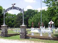
- Oakwood Cemetery
- Parsons Historical Society Museum
- Forest Park
Notable people
- Gilbert Baker, civil rights activist and creator of the pride flag
- Fred Bradley, Major League Baseball pitcher
- Gil Britton, Major League Baseball player
- Jamie Anne (Brown) Allman, actress
- Buck Clayton aka Wilbur Dorsey Clayton, jazz musician
- William Coffin Coleman, founder of the Coleman Company, and mayor of Wichita, Kansas
- Walter Davidson, Sr., co-founder of Harley-Davidson Motor Company[24]
- Fletcher Flora, author
- Derrel Gofourth, NFL offensive lineman
- Bill Guthridge, college basketball coach
- George Harvey, professional football player
- Clancy Hayes, jazz musician
- Shaun Hill, NFL quarterback
- Jeff Kready, Broadway and television actor
- Roland Lakes, Wichita State and NFL lineman
- Deb Miller, Kansas Secretary of Transportation (2003–2012)
- Ajit Pai, FCC Chairman
- George Pepperdine, founder of Western Auto and Pepperdine University
- ZaSu Pitts, film and television actress and comedian
- Payne Harry Ratner, Kansas Governor
- Clyde M. Reed, Kansas Governor and U.S. Senator
- Nell Donnelly Reed, businesswoman
- T. Claude Ryan, aviator, aerospace engineer
- Dan Smith, major league baseball player
- Clark Tippet, ballet dancer and choreographer
- Levi Watkins, heart surgeon and civil rights activist
References
- "US Gazetteer files 2010". United States Census Bureau. Archived from the original on January 12, 2012. Retrieved 2012-07-06.
- "U.S. Census website". United States Census Bureau. Retrieved 2012-07-06.
- "Population and Housing Unit Estimates". Retrieved May 21, 2020.
- "U.S. Census website". United States Census Bureau. Retrieved 2008-01-31.
- "US Board on Geographic Names". United States Geological Survey. 2007-10-25. Retrieved 2008-01-31.
- "2010 City Population and Housing Occupancy Status". U.S. Census Bureau. Retrieved March 6, 2011.
- Kansas State Historical Society (1916). Biennial Report of the Board of Directors of the Kansas State Historical Society. Kansas State Printing Plant. pp. 219.
- "About Us". Parsons Public Library. Retrieved 12 June 2014.
- "KatyDays.com". Katy Days. Retrieved June 22, 2019.
- "Tornado changed face of Parsons". Parsons Sun. 2019-04-19. Retrieved 2019-11-22.
- "Main Street America - Winners". Main Street America. Retrieved 16 December 2018.
- Sulzberger, A. G. (December 29, 2010). "For Kodachrome Fans, Road Ends at Photo Lab in Kansas". The New York Times.
- "Archived copy". Archived from the original on 2014-04-08. Retrieved 2011-11-20.CS1 maint: archived copy as title (link)
- Alanis, Kaitlyn (April 1, 2018). "New Netflix movie 'Kodachrome' brings attention to Kansas". The Wichita Eagle.
- "ZombieGeddon Credits". Retrieved Sep 20, 2019.
- "Google". www.google.com. Archived from the original on Feb 7, 2007. Retrieved Sep 20, 2019.
- "US Gazetteer files: 2010, 2000, and 1990". United States Census Bureau. 2011-02-12. Retrieved 2011-04-23.
- "Interim Soil Removal at Kansas Army Ammunition Plant". ECC. Retrieved 2006-07-22.
- "Monthly Averages for Parsons, Kansas". Weather.com. The Weather Channel. Retrieved August 15, 2013.
- United States Census Bureau. "Census of Population and Housing". Retrieved November 29, 2014.
- "About Katy Days". Katy Days. Retrieved 16 December 2018.
- "MKT Railroad - The Missouri-Kansas-Texas Railroad". The Sedalia Katy Depot. Retrieved 16 December 2018.
- "Forest Park". Parsons Kansas. Retrieved 16 December 2018.
- "This Day in HD History". Harley Davison.
Further reading
External links
| Wikimedia Commons has media related to Parsons, Kansas. |
| Wikisource has the text of the 1911 Encyclopædia Britannica article Parsons. |
- City
- Schools
- USD 503, local school district
- USD 506, local school district
- Labette Community College
- Newspaper
- The Parsons Sun, local newspaper
- Events
- Maps
- Parsons City Map, KDOT
Municipalities and communities of Labette County, Kansas, United States | ||
|---|---|---|
| Cities | 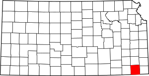 Map of Kansas highlighting Labette County | |
| Unincorporated communities | ||
| Townships |
| |
| Authority control |
|
|---|