Adelaide Hills Council
Adelaide Hills Council is a local government area in the Adelaide Hills of South Australia. It is in the hills east of Adelaide, the capital of South Australia, and extends from the South Para Reservoir in the north to the Mount Bold Reservoir in the south.
| Adelaide Hills Council South Australia | |||||||||||||||
|---|---|---|---|---|---|---|---|---|---|---|---|---|---|---|---|
| Coordinates | 34°57′S 138°53′E | ||||||||||||||
| Population | 38,863 (2016 census)[1] | ||||||||||||||
| • Density | 50/km2 (130/sq mi) | ||||||||||||||
| Established | 1997 | ||||||||||||||
| Area | 795.08 km2 (307.0 sq mi) | ||||||||||||||
| Mayor | Jan-Claire Wisdom [2] | ||||||||||||||
| Council seat | Stirling | ||||||||||||||
| Region | Adelaide Hills[3] | ||||||||||||||
| State electorate(s) | Heysen, Morialta, Kavel, Schubert | ||||||||||||||
| Federal Division(s) | |||||||||||||||
| Website | Adelaide Hills Council | ||||||||||||||
| |||||||||||||||
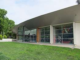
Adelaide Hills Council Head Office, Stirling
The council was established in 1997 by the amalgamation of the District Council of East Torrens, the District Council of Gumeracha, the District Council of Onkaparinga and the District Council of Stirling.[4]
Council
The current council as of November 2018 is:[2]
| Ward | Councillor | Notes |
|---|---|---|
| Mayor | Jan-Claire Wisdom | |
| Valleys | Cr Malcolm Herrmann
Cr Andrew Stratford Cr Linda Green Cr Pauline Gill Cr Chris Grant |
|
| Ranges | Cr Nathan Daniell (Deputy Mayor)
Cr Kirrilee Boyd Cr Ian Bailey Cr John Kemp Cr Leith Mudge Cr Mark Osterstock |
|
Suburbs
The Adelaide Hills Council contains the following suburbs and localities:[5]
- Aldgate
- Ashton
- Balhannah
- Basket Range
- Birdwood (part)
- Bradbury (part)
- Bridgewater (part)
- Carey Gully
- Castambul
- Chain Of Ponds
- Charleston
- Cherryville
- Cleland (part)
- Crafers West (part)
- Crafers
- Cromer (part)
- Cudlee Creek
- Dorset Vale (part)
- Forest Range
- Forreston
- Greenhill
- Gumeracha
- Hay Valley (part)
- Heathfield
- Horsnell Gully
- Houghton (part)
- Hahndorf (part)
- Humbug Scrub (part)
- Inglewood
- Ironbank (part)
- Kenton Valley
- Kersbrook
- Lenswood
- Lobethal
- Longwood
- Lower Hermitage
- Marble Hill
- Millbrook
- Montacute
- Mount Crawford (part)
- Mount George
- Mount Torrens (part)
- Mylor
- Norton Summit
- Oakbank
- Paracombe (part)
- Piccadilly
- Rostrevor (part)
- Scott Creek
- Stirling
- Summertown
- Teringie
- Upper Hermitage (part)
- Upper Sturt (part)
- Uraidla
- Verdun (part)
- Woodforde
- Woodside
References
- Australian Bureau of Statistics (27 June 2017). "Adelaide Hills (DC)". 2016 Census QuickStats. Retrieved 23 November 2017.

- "Council Members". Adelaide Hills Council. Retrieved 3 December 2018.
- "Adelaide Hills SA Government region" (PDF). The Government of South Australia. Retrieved 10 October 2014.
- "Freedom of Information". Adelaide Hills Council. Retrieved 31 March 2016.
- "Search results for 'Cudlee Creek, LOCB' with the following datasets selected - 'Suburbs and Localities' and 'Local Government Areas'". Location SA Map Viewer. Government of South Australia. Retrieved 26 December 2018.
Cudlee Creek selected as the centre of the Adelaide Hills LGA and the view has been set to show the full extent of the LGA
This article is issued from Wikipedia. The text is licensed under Creative Commons - Attribution - Sharealike. Additional terms may apply for the media files.