Regional Council of Goyder
The Regional Council of Goyder is a local government area located in the Mid North region of South Australia.[4] The council area is reliant on agriculture as a mainstay of its economy, with manufacturing and tourism also becoming prominent. The council seat lies at Burra, with a branch office situated at Eudunda.[5]
| Regional Council of Goyder South Australia | |||||||||||||||
|---|---|---|---|---|---|---|---|---|---|---|---|---|---|---|---|
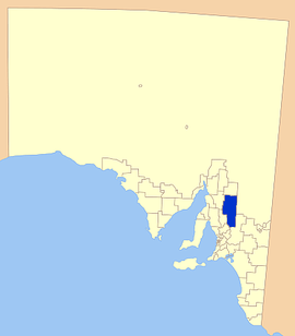 Location of the Regional Council of Goyder | |||||||||||||||
| Population | 4,136 (2016 census)[1] | ||||||||||||||
| • Density | 0.61558/km2 (1.59434/sq mi) | ||||||||||||||
| Established | 23 January 1997[2] | ||||||||||||||
| Area | 6,718.9 km2 (2,594.2 sq mi) | ||||||||||||||
| Mayor | Peter Mattey[3] | ||||||||||||||
| Council seat | Burra | ||||||||||||||
| Region | Yorke and Mid North[4] | ||||||||||||||
| State electorate(s) | Stuart | ||||||||||||||
| Federal Division(s) | Grey | ||||||||||||||
| Website | Regional Council of Goyder | ||||||||||||||
| |||||||||||||||
History
The Regional Council of Goyder was created in 1997, when four municipalities in the region were amalgamated: the District Council of Burra Burra, the District Council of Eudunda, the District Council of Hallett and the District Council of Robertstown.[2] Mining features prominently in the region's history, particularly the mining of copper.[6]
Goyder is named after former Surveyor General George Goyder who mapped Goyder's Line (of rainfall) in 1865. This map is still of great relevance to local cereal cropping as the line dissects the council area.[7] It is also of great cultural importance to whole upper Mid North region of South Australia, with the 150th anniversary of Goyder's Line being celebrated in Orroroo, just north of the Goyder council area, in November 2015.[8]
Economy
In the past, the district was heavily reliant on mining industries as the integral part of its economy, but since the mines shut down many years ago, agriculture has become the prevailing industry.
Agriculture in the Goyder region is primarily associated with cereal crops, such as wheat and barley, as well as sheep grazing for merino wool. Dairy and beef cattle, piggeries, and chicken farms also play a minor part in the economic structure of the region. More recently established industries include viticulture and locally grown and produced food products. Manufacturing interests are increasingly entering the area.
Tourism makes up a part of the economy, with the town of Burra still a major attraction, known for its mining history and rural lifestyle.
Localities
The largest town and council seat of the district is Burra; it also encompasses the towns and localities of Apoinga, Australia Plains, Baldina, Booborowie, Bower, Brady Creek, Bright, Buchanan, Bundey, Burra Eastern Districts, Canowie, Collinsville, Emu Downs, Eudunda, Franklyn, Geranium Plains, Gum Creek, Hampden, Hallelujah Hills, Hallett, Hanson, Julia, Koonoona, Leighton, Mongolata, Mount Bryan, Mount Bryan East, Neales Flat, Ngapala, North Booborowie, Peep Hill, Pine Creek, Point Pass, Porter Lagoon, Robertstown, Rocky Plain, Sutherlands, Terowie, Ulooloo, Whyte Yarcowie, Willalo, Wonna and Worlds End, and part of Brownlow, Canowie Belt, Dutton, Farrell Flat, Frankton, Hansborough and Steinfeld.[9]
The pastoral lease of Ketchowla Station is also located in the council area.[9]
Council
| Ward | Councillor | Notes | |
|---|---|---|---|
| Hallett[3] | Peter Mattey | Mayor | |
| Robertstown[3] | John Neal | ||
| Eudunda[3] | Blake Rule | ||
| Peter Dunn | |||
| Burra[3] | Bill Gebhardt | ||
| Jane Kellock | Deputy Mayor | ||
| Darryl Venning | |||
References
- Australian Bureau of Statistics (27 June 2017). "Goyder (DC)". 2016 Census QuickStats. Retrieved 10 April 2018.

- Ashenden, E.S. (23 January 1997). "LOCAL GOVERNMENT ACT 1934 SECTIONS 7 AND 14: AMALGAMATION OF THE DISTRICT COUNCIL OF BURRA BURRA, THE DISTRICT COUNCIL OF EUDUNDA, THE DISTRICT COUNCIL OF HALLETT AND THE DISTRICT COUNCIL OF ROBERTSTOWN" (PDF). The South Australian Government Gazette. Government of South Australia. pp. 644–645. Retrieved 24 December 2018.
- "Elected Members". Regional Council of Goyder. Retrieved 16 February 2016.
- "Yorke and Mid North SA Government region" (PDF). The Government of South Australia. Retrieved 10 October 2014.
- "Contact Us". District Council of Goyder. Retrieved 3 April 2016.
- "Regional Council of Goyder: Our Region". Regional Council of Goyder. Retrieved 3 December 2015.
- "Regional Council of Goyder: George W Goyder". Retrieved 3 December 2015.
- "150 Years of Goyder's Line" (PDF). Goyder's Line Gazette (245 ed.). District Council of Orroroo Carrieton: 1. November 2015. Retrieved 3 December 2015.
- "Location SA Map Viewer". Government of South Australia. Retrieved 14 February 2016.