Deux-Jumeaux
Deux-Jumeaux is a commune in the Calvados department in the Normandy region in northwestern France.
Deux-Jumeaux | |
|---|---|
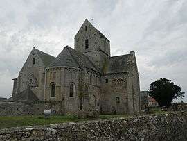 The abbey of Deux-Jumeaux | |
Location of Deux-Jumeaux 
| |
 Deux-Jumeaux  Deux-Jumeaux | |
| Coordinates: 49°20′55″N 0°57′45″W | |
| Country | France |
| Region | Normandy |
| Department | Calvados |
| Arrondissement | Bayeux |
| Canton | Trévières |
| Intercommunality | CC Isigny-Omaha Intercom |
| Government | |
| • Mayor (2008–2014) | Jacques Planchon |
| Area 1 | 4.07 km2 (1.57 sq mi) |
| Population (2017-01-01)[1] | 55 |
| • Density | 14/km2 (35/sq mi) |
| Time zone | UTC+01:00 (CET) |
| • Summer (DST) | UTC+02:00 (CEST) |
| INSEE/Postal code | 14224 /14230 |
| Elevation | 8–47 m (26–154 ft) (avg. 48 m or 157 ft) |
| 1 French Land Register data, which excludes lakes, ponds, glaciers > 1 km2 (0.386 sq mi or 247 acres) and river estuaries. | |
History
World War II
After the liberation of the area by Allied Forces in early June 1944, engineers of the Ninth Air Force IX Engineering Command began construction of a combat Advanced Landing Ground to the northeast of the town. Declared operational on 30 June, the airfield was designated as "A-4", it was used by the 48th Fighter Group which flew P-47 Thunderbolts until the end of August when the unit moved into Central France. Afterward, the airfield was closed.[2][3]
Population
| Historical population | ||
|---|---|---|
| Year | Pop. | ±% |
| 1962 | 152 | — |
| 1968 | 138 | −9.2% |
| 1975 | 102 | −26.1% |
| 1982 | 101 | −1.0% |
| 1990 | 78 | −22.8% |
| 1999 | 69 | −11.5% |
| 2008 | 77 | +11.6% |
See also
References
- "Populations légales 2017". INSEE. Retrieved 6 January 2020.
- Johnson, David C. (1988), U.S. Army Air Forces Continental Airfields (ETO), D-Day to V-E Day; Research Division, USAF Historical Research Center, Maxwell AFB, Alabama.
- Maurer, Maurer. Air Force Combat Units of World War II. Maxwell AFB, Alabama: Office of Air Force History, 1983. ISBN 0-89201-092-4.
| Wikimedia Commons has media related to Deux-Jumeaux. |
| Authority control |
|
|---|
This article is issued from Wikipedia. The text is licensed under Creative Commons - Attribution - Sharealike. Additional terms may apply for the media files.