Cormelles-le-Royal
Cormelles-le-Royal is a commune in the Calvados department in the Normandy region in northwestern France.
Cormelles-le-Royal | |
|---|---|
 The town hall in Cormelles-le-Royal | |
 Coat of arms | |
Location of Cormelles-le-Royal 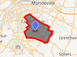
| |
 Cormelles-le-Royal  Cormelles-le-Royal | |
| Coordinates: 49°09′17″N 0°19′45″W | |
| Country | France |
| Region | Normandy |
| Department | Calvados |
| Arrondissement | Caen |
| Canton | Ifs |
| Intercommunality | Caen la Mer |
| Government | |
| • Mayor (2014–2026) | Jean-Marie Guillemin |
| Area 1 | 3.48 km2 (1.34 sq mi) |
| Population (2017-01-01)[1] | 4,898 |
| • Density | 1,400/km2 (3,600/sq mi) |
| Time zone | UTC+01:00 (CET) |
| • Summer (DST) | UTC+02:00 (CEST) |
| INSEE/Postal code | 14181 /14123 |
| Elevation | 13–37 m (43–121 ft) (avg. 30 m or 98 ft) |
| 1 French Land Register data, which excludes lakes, ponds, glaciers > 1 km2 (0.386 sq mi or 247 acres) and river estuaries. | |
History
The territory of La Guérinière was formerly part of Cormelles, the northern limit of the town following the road to the oxen between the Falaise road and the path of Sente-de-Mondeville (currently boulevard de l'Avenir). The family of Guérinière owned a castle, located between the current streets of Charity, Clos-du-Monastère and the Champ-de-Foire. The castle was destroyed during the Battle of Caen. In 1875, the city of Caen bought the 27 hectares of land of the Caen riding academy, located on the grounds of the castle of Guérinière, to develop a field of maneuver for the garrisons of the city. In 1951, this territory was officially attached to the municipality of Caen.
During the Battle of Normandy, the village was fortified by the Germans, shortly before the start of operations Goodwood and Atlantic by the British and Canadians. The village was liberated on July 19, 1944 by Canadian-Scottish battalions and North Nova Scotia Highlanders belonging to the 3rd Canadian infantry division after fighting against the soldiers of the 272nd German infantry division. Three weeks later, Canadian and Polish troops gather there to launch Operation Totalize. On August 8, US aircraft bombed by mistake causing losses. Cormelles-le-Royal is decorated with the Croix de Guerre 1939-1945.[2][3]
Toponymy
The name of the locality is attested in Cormellis forms around 1070 and Cormellae in 1195. The origin of the toponym is not clearly established, but Albert Dauzat and Charles Rostaing put forward the hypothesis of the old French corme, "sorbe" with diminutive -ella. Royal is an allusion to the privileges granted to the inhabitants of this town by Philip VI by letters patent of 22 June 1347.
During the revolutionary period of the National Convention (1792-1795), the commune, created from the parish of Cormelles-le-Royal took the name of Cormelles-le-Libre which was then cut short in Cormelles. The determinant "the Royal" was added again in 1969.[4][5][6]
Geography
Cormelles-le-Royal is located in the plain of Caen, in the southern suburbs of Caen . Its center is 4.5 km from the center of the regional capital. Located in the basin of the Orne, the territory covers an area of 348 hectares and has a population of 4829 inhabitants, a density of 1387 inhabitants / km 2. The highest point (37 m ) is at the southern limit, near the southern ring road interchange. The lowest point (13 m) corresponds to the exit of the only watercourse of the municipality of the territory, to the northeast.[7]
Population
| Historical population | ||
|---|---|---|
| Year | Pop. | ±% |
| 1962 | 1,245 | — |
| 1968 | 1,862 | +49.6% |
| 1975 | 3,099 | +66.4% |
| 1982 | 3,442 | +11.1% |
| 1990 | 4,604 | +33.8% |
| 1999 | 4,599 | −0.1% |
| 2008 | 4,479 | −2.6% |
| 2015 | 4,829 | +7.8% |
The evolution of the number of inhabitants is known throughout the population censuses carried out in the town since 1793. From 2006, the official population of the municipalities are published annually by the INSEE. The census is now based on an annual collection of information, successively covering all municipal territories over a period of five years. For municipalities with fewer than 10,000 inhabitants, a census survey of the entire population is conducted every five years, the official population of middle years themselves being estimated by interpolation or extrapolation. For the commune, the first comprehensive census within the framework of the new mechanism was carried out in 2007.[8][9]
Administration
Mayors of Cormelles-le-Royal
| From | To | Name | Party |
|---|---|---|---|
| Bernard Oblin | Independent | ||
| Jean-Marie Guillemin | Independent | ||
Twinning
See also
References
- "Populations légales 2017". INSEE. Retrieved 6 January 2020.
- "CADASTRE". cormellesleroyal.free.fr. Archived from the original on 2009-02-03. Retrieved 2018-12-26.
- "Cormelle-le-Royal", page 188, in the D-Day Landing Dictionary , edited by Claude Quétel, ed. West-France, 2011.
- Ernest Negro , Toponymie générale de la France , t. 1: Preceltic, Celtic, Romance , Geneva,1998
- Albert Dauzat et Charles Rostaing, Dictionnaire étymologique des noms de lieux en France, Paris, Larousse, 1963
- Gervais de La Rue, Essais historiques sur la ville de Caen et son arrondissement, t. 1, Rouen, 1820
- "ViaMichelin : Itinéraires, Cartes, Info trafic, Météo et Réservation d'hôtels en France et en Europe". www.viamichelin.fr (in French). Retrieved 2018-12-26.
- "Présentation du recensement de la population | Insee". www.insee.fr. Retrieved 2018-12-26.
- "Documentation sur les résultats du recensement | Insee". www.insee.fr. Retrieved 2018-12-26.
| Wikimedia Commons has media related to Cormelles-le-Royal. |
| Authority control |
|
|---|