Desert Uplands
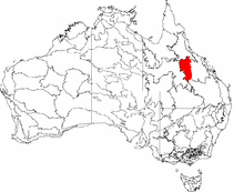
The Desert Uplands is an interim Australian bioregion located in north and central western Queensland which straddles the Great Dividing Range between Blackall and Pentland.[1]
The bioregion contains Lake Galilee, Lake Dunn and Lake Buchanan. The climate is semi-arid with highly variable rainfall. Much of the area is used for cattle grazing and is part of the Great Artesian Basin, lying within both the Galilee and Eromanga Basins. The Brigalow Belt North and Brigalow Belt South are to the east of the bioregion, and the Einasleigh Uplands are located to the north.
Settlements
The two main settlements in the area are at Barcaldine and Aramac.
Vegetation
Spinifex grass is common. More than 80 weeds have been identified in the bioregion.[2]
In 2003, it was estimated that 13 million trees per year were being destroyed in the Desert Uplands.[3] This placed the percentage of land cleared at 6.8%, the third highest for any Queensland bioregion.
Waterways
The main rivers in the bioregion are Belyando, Cape, Campaspe, Barcoo and Alice River and Aramac and Torrens Creeks.[1] Wetlands at shallow salt lakes Lake Galilee and Lake Buchanan are listed on the Directory of Important Wetlands in Australia.
See also
References
- "Rangelands - Overview". Australian Natural Resource Atlas. Department of Sustainability, Environment, Water, Population and Communities. Archived from the original on 28 September 2012. Retrieved 13 November 2012.
- "Weed Identification". Australian Weeds Committee. Archived from the original on 10 April 2011. Retrieved 13 November 2012.
- Lindenmayer, David B.; Mark A. Burgman (2005). Practical Conservation Biology. Csiro Publishing. p. 237. ISBN 0643090894. Retrieved 13 November 2012.