Blackall, Queensland
Blackall is a small town and rural locality in the Blackall-Tambo Region in Central West Queensland, Australia.[3][4] At the 2016 census Blackall had a population of 1,416.[1] It is the service centre for the Blackall-Tambo Region. The dominant industry in the area is grazing.
| Blackall Queensland | |||||||||||||||
|---|---|---|---|---|---|---|---|---|---|---|---|---|---|---|---|
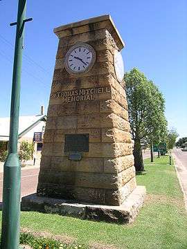 Memorial to Sir Thomas Mitchell | |||||||||||||||
 Blackall | |||||||||||||||
| Coordinates | 24°25′0″S 145°28′0″E | ||||||||||||||
| Population | 1,416 (2016 census)[1] | ||||||||||||||
| Established | 1868 | ||||||||||||||
| Postcode(s) | 4472 | ||||||||||||||
| Elevation | 284 m (932 ft)[2] | ||||||||||||||
| Location | |||||||||||||||
| LGA(s) | Blackall-Tambo Region | ||||||||||||||
| State electorate(s) | Gregory | ||||||||||||||
| Federal Division(s) | Flynn | ||||||||||||||
| |||||||||||||||
| |||||||||||||||
Geography
Blackall is approximately 960 kilometres (600 mi) by road from the state capital, Brisbane. The town is situated on the Barcoo River and Landsborough Highway (Matilda Highway).
Blackall claims to be the home of the original Black Stump, which marks the original Astro Station established in 1887. Places west of this point are said to be 'beyond the black stump'. The Black Stump was moved from its original location to make it more accessible to tourists, and can now be found on the boundary of the Blackall State School grounds, Thistle Street, Blackall. Blackall has many attractions for public use and entertainment, including the Blackall showground, the local pool and the historic Blackall Woolscour.
History
Bidjara (also known as Bidyara, Pitjara, and Peechara) is an Australian Aboriginal language spoken by the Bidjara people. The Bidjara language region includes the local government area of the Shire of Murweh, particularly the towns of Charleville, Augathella and Blackall as well as the properties of Nive Downs and Mount Tabor.[5]
Kuungkari (also known as Kungkari and Koonkerri) is a language of Western Queensland. The Kuungkari language region includes the landscape within the local government boundaries of Longreach Region and Blackall-Tambo Region.[6]
Gungabula (also known as Kongabula and Khungabula) is an Australian Aboriginal language of the headwaters of the Dawson River in Central Queensland. The language region includes areas within the local government area of Maranoa Region, particularly the towns of Charleville, Augathella and Blackall and as well as the Carnarvon Range.[7]
The region was explored in 1846 by explorer Sir Thomas Mitchell and his party.[8] In 1856, Augustus Gregory passed through the area noting that the landscape was a vast plain lacking vegetation in contrast to Mitchell's description of good country.[9] Blackall was named by Surveyor Abraham H. May after Sir Samuel Blackall, the second Governor of Queensland.[3][4] During the 1860s the town developed as a service centre for the surrounding pastoral properties. A survey of town allotments was conducted in 1868.[9]
Barcoo Post Office opened on 1 April 1864. It was renamed Blackall in 1868.[10]
Blackall State School opened on 10 September 1877.[11] On 5 October 1964, the school was destroyed by fire, but was subsequently rebuilt.[12]
On Tuesday 29 March 1881, following seven inches of rain, the river burst through the town embankment, completely washing away the stonework of the dam.[13] On Wednesday 30 March, the still-rising river flooded the town's main street and many people in the town's lower-lying areas were forced to evacuate as their homes became fully submerged.[14][15]
Blackall was one of the first Queensland towns to sink an artesian bore in 1885, which now supplies the town with water from the Great Artesian Basin. The water temperature is 58 degrees Celsius. There is an artesian spa bath at the aquatic centre and locally produced soft drinks are made from the artesian water.[16]
In December 1890 the Australian Labor Party constitution and rules were drawn up at Blackall, during the founding of this party.[17]
In Australian folklore, the best known citizen of the town was the sheep shearer Jack Howe. In 1892, he shore a total of 321 sheep at Alice Downs station in 7 hours and 40 minutes, a record for hand shearing that still stands, and was only broken by a shearer using a machine driven handpiece in 1950.[16]
A branch line from the Central Western railway reached Blackall in 1908.
St Joseph's Catholic Primary School was established in 1917 by the Sisters of St Joseph. The opening ceremonies were conducted on Saturday 21 July 1917 by Archbishop James Duhig.[18][19]
The Blackall War Memorial commemorates those soldiers who died in World War I. The memorial was dedicated on the 25 April (Anzac Day) 1927 by James Charles Minnis (former mayor of Blackall and a former soldier). The honour roll of those who died in World War II was added later.[20]
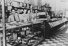
According to information published by the Blackall Shire Council the Cominos opened a café in the 1920s in Shamrock Street, Blackall which they called the Central.
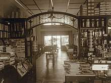
A few years later it was taken over by the Logos Brothers who installed a news agency at one side.[21] The Queensland Country Women's Association met at the cafe to farewell their secretary Mrs R.A.G. Malcolm in September 1929.[22]
Blackall's population was more than 3,000 in 1965. A declining population has coincided with the decline in the wool industry in the district.[9] At the 2011 census Blackall had a population of 1,588.[23]
Heritage listings
Blackall has a number of heritage-listed sites, including:
- Hawthorn Street: Blackall Masonic Temple[24]
- 4 kilometres (2.5 mi) northeast of Blackall: Blackall Woolscour[25]
Transport
QantasLink has services connecting the town to Brisbane.
Facilities
Blackall has a showground, racecourse, golf course, bowling club and aquatic centre, cultural centre and an historical association.[26]
The Blackall-Tambo Regional Council operates a public library at 14 Clematis Street.[27]
The Blackall branch of the Queensland Country Women's Association has its rooms at 47 William Street.[28]
The Blackall Golf Club has an 18-hole golf course at Shamrock Street (24.42172°S 145.45276°E).[29]
Education
Blackall State School is a government primary and secondary (P-12) school located at the corner of Hawthorne and Shamrock Streets (24.425596°S 145.470046°E).[30] In 2012, there were 152 students enrolled with 14.5 teachers.[31]
St Joseph's Catholic Primary School is a Roman Catholic primary (P-7) school located at 109 Thistle Street (24.42004°S 145.459587°E).[30]
Climate
The town has a semi-arid climate according to Köppen (BSh).
| Climate data for Blackall | |||||||||||||
|---|---|---|---|---|---|---|---|---|---|---|---|---|---|
| Month | Jan | Feb | Mar | Apr | May | Jun | Jul | Aug | Sep | Oct | Nov | Dec | Year |
| Record high °C (°F) | 44.6 (112.3) |
43.9 (111.0) |
41.8 (107.2) |
37.3 (99.1) |
35.0 (95.0) |
32.8 (91.0) |
31.3 (88.3) |
35.1 (95.2) |
38.4 (101.1) |
41.2 (106.2) |
44.0 (111.2) |
44.6 (112.3) |
44.6 (112.3) |
| Average high °C (°F) | 36.0 (96.8) |
35.1 (95.2) |
33.7 (92.7) |
30.3 (86.5) |
25.8 (78.4) |
22.7 (72.9) |
22.3 (72.1) |
24.6 (76.3) |
28.5 (83.3) |
32.2 (90.0) |
34.7 (94.5) |
36.0 (96.8) |
30.2 (86.4) |
| Average low °C (°F) | 22.4 (72.3) |
22.0 (71.6) |
19.9 (67.8) |
16.1 (61.0) |
11.8 (53.2) |
8.0 (46.4) |
6.9 (44.4) |
8.4 (47.1) |
12.1 (53.8) |
16.5 (61.7) |
19.5 (67.1) |
21.4 (70.5) |
15.4 (59.7) |
| Record low °C (°F) | 12.9 (55.2) |
12.4 (54.3) |
10.1 (50.2) |
4.1 (39.4) |
0.1 (32.2) |
−0.7 (30.7) |
−2.0 (28.4) |
−1.8 (28.8) |
1.4 (34.5) |
3.0 (37.4) |
8.2 (46.8) |
10.7 (51.3) |
−2.0 (28.4) |
| Average rainfall mm (inches) | 85.2 (3.35) |
81.9 (3.22) |
62.8 (2.47) |
37.1 (1.46) |
33.6 (1.32) |
26.3 (1.04) |
25.1 (0.99) |
16.4 (0.65) |
18.4 (0.72) |
33.2 (1.31) |
43.5 (1.71) |
69.8 (2.75) |
533.3 (20.99) |
| Average rainy days (≥ 0.2mm) | 7.1 | 6.5 | 5.3 | 3.2 | 3.2 | 2.8 | 2.6 | 2.2 | 2.6 | 4.2 | 5.3 | 6.3 | 51.3 |
| Source: Bureau of Meteorology[32] | |||||||||||||
Notable people
- Ashley Adams – Paralympic shooter
- Bonny Barry – Politician
- Eric "Eckers" Barnes - High Court Judge in Hong Kong (1980-1991).
- Jack "Jackie" Howe – Shearer
- Chris Nyst – Solicitor and crime fiction writer
- Edgar Towner – Recipient of the Victoria Cross
Gallery
 Jack Howe's gravesite in Blackall cemetery
 Gravestone memorial for Jack Howe in Blackall cemetery
See also
References
- Australian Bureau of Statistics (27 June 2017). "Blackall (SSC)". 2016 Census QuickStats. Retrieved 14 August 2018.

- Bureau of Meteorology Archived 2 September 2007 at the Wayback Machine – retrieved 27 January 2008
- "Blackall (town) (entry 2967)". Queensland Place Names. Queensland Government. Retrieved 21 April 2014.
- "Blackall (locality) (entry 47058)". Queensland Place Names. Queensland Government. Retrieved 21 April 2014.
- "Bidjara". State Library of Queensland. Retrieved 15 January 2020.
-

-
- ADB: Mitchell, Sir Thomas Livingstone (1792 - 1855) Archived 5 February 2010 at the Wayback Machine Retrieved 2010-5-1
- Environmental Protection Agency (Queensland) (2002). Heritage Trails of the Queensland Outback. State of Queensland. p. 39. ISBN 0-7345-1040-3.
- Premier Postal History. "Post Office List". Premier Postal Auctions. Retrieved 10 May 2014.
- "Opening and closing dates of Queensland Schools". Queensland Government. Retrieved 25 May 2014.
- "Blackall State School – Prep to year 12". Blackall State School. Archived from the original on 3 February 2014. Retrieved 28 May 2014.
- "BLACKALL". The Brisbane Courier. XXXV (7, 243). Queensland, Australia. 30 March 1881. p. 2. Retrieved 27 August 2016 – via National Library of Australia.
- "BLACKALL". The Week. XI (275). Brisbane. 2 April 1881. p. 11. Retrieved 27 August 2016 – via National Library of Australia.
- "BLACKALL". The Brisbane Courier. XXXV (7, 244). Queensland, Australia. 31 March 1881. p. 2. Retrieved 27 August 2016 – via National Library of Australia.
- Reader's Digest Guide to Australian Places, Reader's Digest (Australia) Pty. Limited, Surry Hills N.S.W., 1993, ISBN 0-86438-399-1
- "Labor Federation Memorial". Blackall Tambo Tourism. Archived from the original on 5 June 2020. Retrieved 5 June 2020.
- "St Joseph's Catholic Primary School". St Joseph's Catholic Primary School. Archived from the original on 29 May 2014. Retrieved 28 May 2014.
- "BLACKALL CONVENT SCHOOL". The Morning Bulletin. Rockhampton, Qld. 26 July 1917. p. 4. Retrieved 28 May 2014 – via National Library of Australia.
- "Blackall War Memorial". Monument Australia. Archived from the original on 22 July 2015. Retrieved 28 May 2014.
- "Greek cafés: a specialty in Queensland's central west | John Oxley Library". Retrieved 28 January 2020.
- "CWA". The Capricornian. Queensland, Australia. 3 October 1929. p. 67. Retrieved 28 January 2020 – via Trove.
- Australian Bureau of Statistics (31 October 2012). "Blackall (SSC)". 2011 Census QuickStats. Retrieved 21 April 2014.
- "Blackall Masonic Temple (entry 600032)". Queensland Heritage Register. Queensland Heritage Council. Retrieved 7 July 2013.
- "Blackall Woolscour (entry 600033)". Queensland Heritage Register. Queensland Heritage Council. Retrieved 7 July 2013.
- "Blackall". Centre for the Government of Queensland. Archived from the original on 8 February 2012. Retrieved 12 December 2011.
- "Blackall Library". Public Libraries Connect. State Library of Queensland. Archived from the original on 11 January 2018. Retrieved 11 January 2018.
- "Branch locations". Queensland Country Women's Association. Archived from the original on 26 December 2018. Retrieved 26 December 2018.
- "Blackall Golf Club". World Golf. Retrieved 28 May 2014.
- "Queensland State and Non-State Schools". Queensland Government. Archived from the original on 8 May 2014. Retrieved 25 May 2014.
- "2012 School Annual Report" (PDF). Blackall State School. Archived from the original (PDF) on 29 May 2014. Retrieved 28 May 2014.
- "BLACKALL TOWNSHIP". Climate statistics for Australian locations. Bureau of Meteorology. Retrieved 8 April 2013.
External links
| Wikimedia Commons has media related to Blackall, Queensland. |
| Authority control |
|
|---|