Churchill County, Nevada
Churchill County is a county in the western U.S. state of Nevada. As of the 2010 census, the population was 24,877.[1] Its county seat is Fallon. Named for Mexican–American War hero brevet Brigadier General Sylvester Churchill, the county was formed in 1861. It is not named after Sir Winston Churchill, born thirteen years after the county was formed and named.
Churchill County | |
|---|---|
| Churchill County | |
 Churchill County Courthouse in Fallon | |
 Flag  Seal | |
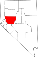 Location within the U.S. state of Nevada | |
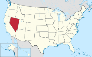 Nevada's location within the U.S. | |
| Coordinates: 39°36′N 118°20′W | |
| Country | |
| State | |
| Founded | 1861 (created) 1864 (organized) |
| Named for | Sylvester Churchill |
| Seat | Fallon |
| Largest city | Fallon |
| Area | |
| • Total | 5,024 sq mi (13,010 km2) |
| • Land | 4,930 sq mi (12,800 km2) |
| • Water | 94 sq mi (240 km2) 1.9% |
| Population (2010) | |
| • Total | 24,877 |
| • Estimate (2019) | 24,909 |
| • Density | 5.0/sq mi (1.9/km2) |
| Time zone | UTC−8 (Pacific) |
| • Summer (DST) | UTC−7 (PDT) |
| Congressional district | 2nd |
| Website | churchillcounty |
Churchill County comprises the Fallon, NV Micropolitan Statistical Area. It is in northwestern Nevada.
Churchill County is noteworthy in that it owns and operates the local telephone carrier, Churchill County Communications.[2]
History
Churchill County was established in 1861, and was named for Fort Churchill (which is now in Lyon County), which was named for General Sylvester Churchill, a Mexican–American War hero who was Inspector General of the U.S. Army in 1861. Churchill County was not organized until 1864, and its first county seat was Bucklands (which is now in Lyon County). In 1864 the county seat was moved to La Plata;[3] in 1868 it was moved to Stillwater; and in 1904 it was settled in its present position, Fallon. In the 19th century there were several attempts to eliminate Churchill County because of its small population, but Assemblyman Lemuel Allen stopped it on all occasions including convincing the Governor to veto an 1875 bill after it had been passed by both houses.
Railroads
The Eagle Salt Works Railroad ran for 13.5 miles (21.7 km), primarily on the original Central Pacific grade from Luva (2 miles (3.2 km) east of Fernley) to Eagle Salt Works.
The Central Pacific portion of the nation's first transcontinental railroad ran through Churchill County, although a portion of the original route has been shifted for a new route south of Wadsworth in favor of Fernley. The Central Pacific later became the Southern Pacific Railroad which was merged into Union Pacific in 1996.
Geography
The terrain of Churchill County consists of rugged mountainous ridges, dotted with lakes and ponds.[3] The county's east and west sides are higher than the intermediate valley; its highest point around the county periphery is a ridge on the lower east boundary line, at 9,380' (2859m) ASL.[4] The county has an area of 5,024 square miles (13,010 km2), of which 4,930 square miles (12,800 km2) is land and 94 square miles (240 km2) (1.9%) is water.[5] The county's highest point is Desatoya Peak at 9,977' (3041m), while the most topographically prominent peak is Mount Augusta, at 9,970' (3039m) ASL.
Major highways
.svg.png)
.svg.png)


Adjacent counties
- Lyon County – west
- Washoe County – northwest
- Pershing County – north
- Lander County – east
- Nye County – southeast
- Mineral County – south
Protected areas[3]
- Fallon National Wildlife Refuge
- Humboldt State Wildlife Management Area
- Lahontan State Game Refuge
- Lahontan State Recreation Area (partial)
- Sand Mountain Recreation Area
- Stillwater National Wildlife Refuge
Lakes and reservoirs[3]
- Big Water[6]
- Carson Lake[7]
- Cattail Lake[8]
- Division Lake[9]
- Dog Head Pond[10]
- Dry Lake[11]
- Dutch Bill Lake[12]
- East Alkali Lake Number One[13]
- East Alkali Lake Number Two[14]
- Foxtail Lake[15]
- Goose Lake[16]
- Humboldt Lake (partial)[17]
- Lahontan Reservoir[18]
- Little Soda Lake[19]
- North Nutgrass Lake[20]
- Pintail Bay[21]
- Scheckler Reservoir[22]
- Soda Lake[23]
- Stillwater Point Reservoir[24]
- Swan Check[25]
- Swan Lake[26]
- Tule Lake[27]
- West Nutgrass[28]
- Willow Lake[29]
Demographics
| Historical population | |||
|---|---|---|---|
| Census | Pop. | %± | |
| 1870 | 196 | — | |
| 1880 | 479 | 144.4% | |
| 1890 | 703 | 46.8% | |
| 1900 | 830 | 18.1% | |
| 1910 | 2,811 | 238.7% | |
| 1920 | 4,649 | 65.4% | |
| 1930 | 5,075 | 9.2% | |
| 1940 | 5,317 | 4.8% | |
| 1950 | 6,161 | 15.9% | |
| 1960 | 8,452 | 37.2% | |
| 1970 | 10,513 | 24.4% | |
| 1980 | 13,917 | 32.4% | |
| 1990 | 17,938 | 28.9% | |
| 2000 | 23,982 | 33.7% | |
| 2010 | 24,877 | 3.7% | |
| Est. 2019 | 24,909 | [30] | 0.1% |
| US Decennial Census[31] 1790-1960[32] 1900-1990[33] 1990-2000[34] 2010-2018[1] | |||
2000 census
As of the 2000 United States Census,[35] the county had 23,982 people, 8,912 households, and 6,461 families. The population density was 5 people per square mile (2/km²). There were 9,732 housing units at an average density of 2 per square mile (1/km²).
The country's racial makeup was 84.2% White, 1.6% Black or African American, 4.8% Native American, 2.7% Asian, 0.2% Pacific Islander, 3.2% from other races, and 3.3% from two or more races. 8.7% of the population were Hispanic or Latino of any race.
There were 8,912 households, of which 37.2% had children under the age of 18 living with them, 57.7% were married couples living together, 10.4% had a female householder with no husband present, and 27.5% were non-families. 22.0% of all households were made up of individuals and 8.5% had someone living alone who was 65 years of age or older. The average household size was 2.64 and the average family size was 3.09.
28.0% of the county's population was under age 18, 8.1% was from age 18 to 24, 28.7% was from age 25 to 44, 22.3% was from age 45 to 64, and 11.9% was age 65 or older. The median age was 35 years. For every 100 females there were 100.6 males. For every 100 females age 18 and over, there were 99.1 males.
The country's median household income was $40,808 and the median family income was $46,624. Males had a median income of $36,478 versus $25,000 for females. The county's per capita income was $19,264. About 6.2% of families and 8.7% of the population were below the poverty line, including 10.8% of those under age 18 and 7.0% of those age 65 or over.
2010 census
As of the 2010 United States Census, the county had 24,877 people, 9,671 households, and 6,631 families.[36] The population density was 5.0 inhabitants per square mile (1.9/km2). There were 10,826 housing units at an average density of 2.2 per square mile (0.85/km2).[37]
The county's racial makeup was 82.0% white, 4.5% American Indian, 2.7% Asian, 1.6% black or African American, 0.2% Pacific islander, 4.8% from other races, and 4.2% from two or more races. Those of Hispanic or Latino origin made up 12.1% of the population.[36] In terms of ancestry, 19.2% were English, 18.8% were German, 13.6% were Irish, 6.5% were Italian, and 5.9% were American.[38]
Of the 9,671 households, 33.2% had children under the age of 18 living with them, 52.0% were married couples living together, 11.3% had a female householder with no husband present, 31.4% were non-families, and 25.2% of all households were made up of individuals. The average household size was 2.53 and the average family size was 3.01. The median age was 39.0 years.[36]
The county's median household income was $51,597 and the median family income was $63,599. Males had a median income of $45,057 versus $32,550 for females. The county's per capita income was $22,997. About 6.8% of families and 8.8% of the population were below the poverty line, including 7.3% of those under age 18 and 10.4% of those age 65 or over.[39]
Communities
City
Census-designated place
Unincorporated places[3]
- Bernice
- Bolivia
- Boyer
- Clan Alpine
- Clemens
- Cold Springs
- Coppereid
- Dixie
- Dixie Valley
- Eagleville
- Eastgate
- Fillmore
- Frenchman
- Gregory
- Hazen
- Humboldt Salt Marsh
- Island City
- Jessup
- Kingston
- Lahontan
- Leete
- Leeteville
- Middlegate
- Miriam
- Nevada City
- Nevada Hills
- Northam
- Parran
- Ragtown
- Red top
- Salt Wells
- Sand Springs
- St. Clair
- Stillwater
- Trinity
- White Cloud City
- Willowtown
Politics
Lying on the boundary between the northwest urban areas of Nevada and the conservative Mormon Great Basin, Churchill County has more in common with the latter region, being overwhelmingly Republican. It was one of three Nevada counties Barry Goldwater won in 1964, and since that time only Jimmy Carter in 1976 and Barack Obama in 2008 have passed so much as thirty percent of the county’s ballots. The last time Churchill County voted for a Democratic Presidential candidate was when it supported Franklin D. Roosevelt against Wendell Willkie in 1940.
| Year | Republican | Democratic | Third parties |
|---|---|---|---|
| 2016 | 71.6% 7,830 | 20.2% 2,210 | 8.2% 898 |
| 2012 | 68.8% 7,061 | 28.9% 2,961 | 2.4% 243 |
| 2008 | 64.4% 6,832 | 33.0% 3,494 | 2.6% 279 |
| 2004 | 71.7% 7,335 | 26.4% 2,705 | 1.9% 197 |
| 2000 | 70.7% 6,237 | 24.8% 2,191 | 4.5% 395 |
| 1996 | 56.3% 4,369 | 29.4% 2,282 | 14.3% 1,112 |
| 1992 | 49.5% 3,789 | 23.1% 1,770 | 27.5% 2,104 |
| 1988 | 72.9% 4,578 | 23.6% 1,481 | 3.6% 224 |
| 1984 | 75.5% 4,479 | 22.0% 1,304 | 2.5% 147 |
| 1980 | 72.8% 3,841 | 20.0% 1,055 | 7.2% 377 |
| 1976 | 53.0% 2,358 | 40.5% 1,800 | 6.5% 288 |
| 1972 | 74.1% 2,970 | 25.9% 1,038 | |
| 1968 | 52.3% 1,954 | 32.4% 1,211 | 15.4% 575 |
| 1964 | 50.7% 1,607 | 49.3% 1,565 | |
| 1960 | 57.4% 1,765 | 42.6% 1,309 | |
| 1956 | 65.3% 2,013 | 34.7% 1,069 | |
| 1952 | 68.3% 1,948 | 31.7% 903 | |
| 1948 | 50.8% 1,206 | 44.5% 1,055 | 4.7% 111 |
| 1944 | 51.9% 1,130 | 48.1% 1,046 | |
| 1940 | 48.0% 1,171 | 52.0% 1,267 | |
| 1936 | 37.0% 759 | 63.0% 1,290 | |
| 1932 | 30.8% 674 | 69.3% 1,518 | |
| 1928 | 60.0% 1,126 | 40.0% 751 | |
| 1924 | 41.6% 655 | 19.7% 310 | 38.7% 608 |
| 1920 | 54.0% 873 | 31.3% 506 | 14.7% 237 |
| 1916 | 34.2% 531 | 53.5% 831 | 12.3% 191 |
| 1912 | 15.4% 157 | 34.2% 349 | 50.4% 515[lower-alpha 1] |
| 1908 | 46.4% 389 | 45.5% 382 | 8.1% 68 |
| 1904 | 49.5% 185 | 44.1% 165 | 6.4% 24 |
See also
Notes
- The leading "other" candidate, Progressive Theodore Roosevelt, received 304 votes, while Socialist candidate Eugene Debs received 211 votes.
References
- "State & County QuickFacts". United States Census Bureau. Retrieved September 23, 2013.
- "Churchill County Communications is the only county-owned telephone company in the United States." (accessed 10 February 2019)
- Churchill County NV Google Maps (accessed 10 February 2019)
- ""Find an Altitude" Google Maps (accessed 10 February 2019)". Archived from the original on May 21, 2019. Retrieved February 10, 2019.
- "2010 Census Gazetteer Files". US Census Bureau. August 22, 2012. Retrieved December 20, 2014.
- "Big Water". Geographic Names Information System. United States Geological Survey.
- "Carson Lake". Geographic Names Information System. United States Geological Survey.
- "839358". Geographic Names Information System. United States Geological Survey.
- "Division Lake". Geographic Names Information System. United States Geological Survey.
- "Dog Head Pond". Geographic Names Information System. United States Geological Survey.
- "Dry Lake". Geographic Names Information System. United States Geological Survey.
- "Dutch Bill Lake". Geographic Names Information System. United States Geological Survey.
- "East Alkali Lake Number One". Geographic Names Information System. United States Geological Survey.
- "East Alkali Lake Number Two". Geographic Names Information System. United States Geological Survey.
- "Foxtail Lake". Geographic Names Information System. United States Geological Survey.
- "Goose Lake". Geographic Names Information System. United States Geological Survey.
- "Humboldt Lake". Geographic Names Information System. United States Geological Survey.
- "Lahontan Reservoir". Geographic Names Information System. United States Geological Survey.
- "Little Soda Lake". Geographic Names Information System. United States Geological Survey.
- "North Nutgrass". Geographic Names Information System. United States Geological Survey.
- "Pintail Bay". Geographic Names Information System. United States Geological Survey.
- "Sheckler Reservoir". Geographic Names Information System. United States Geological Survey.
- "Soda Lake". Geographic Names Information System. United States Geological Survey.
- "Stillwater Point Reservoir". Geographic Names Information System. United States Geological Survey.
- "Swan Check". Geographic Names Information System. United States Geological Survey.
- "Swan Lake". Geographic Names Information System. United States Geological Survey.
- "Tule Lake". Geographic Names Information System. United States Geological Survey.
- "West Nutgrass". Geographic Names Information System. United States Geological Survey.
- "Willow Lake". Geographic Names Information System. United States Geological Survey.
- "Population and Housing Unit Estimates". Retrieved May 18, 2019.
- "US Decennial Census". US Census Bureau. Retrieved December 20, 2014.
- "Historical Census Browser". University of Virginia Library. Retrieved December 20, 2014.
- "Population of Counties by Decennial Census: 1900 to 1990". US Census Bureau. Retrieved December 20, 2014.
- "Census 2000 PHC-T-4. Ranking Tables for Counties: 1990 and 2000" (PDF). US Census Bureau. Retrieved December 20, 2014.
- "U.S. Census website". US Census Bureau. Retrieved January 31, 2008.
- "Profile of General Population and Housing Characteristics: 2010 Geographic Profile Data". US Census Bureau. Archived from the original on February 13, 2020. Retrieved January 21, 2016.
- "Population, Housing Units, Area, and Density: 2010 – County". US Census Bureau. Archived from the original on February 13, 2020. Retrieved January 21, 2016.
- "Selected Social Characteristics in the US – 2006–2010 American Community Survey 5-Year Estimates". US Census Bureau. Archived from the original on February 13, 2020. Retrieved January 21, 2016.
- "Selected Economic Characteristics – 2006–2010 American Community Survey 5-Year Estimates". US Census Bureau. Archived from the original on February 13, 2020. Retrieved January 21, 2016.
- Leip, David. "Atlas of US Presidential Elections". uselectionatlas.org. Retrieved April 12, 2018.
External links
Places adjacent to Churchill County, Nevada | ||||||||||
|---|---|---|---|---|---|---|---|---|---|---|
| ||||||||||
Municipalities and communities of Churchill County, Nevada, United States | ||
|---|---|---|
| City | Churchill County map | |
| CDP | ||
| Unincorporated communities |
| |
| Indian reservations | ||
| Ghost towns | ||
| Authority control |
|
|---|