Santa Fe, Nueva Vizcaya
Santa Fe, officially the Municipality of Santa Fe, is a 3rd class municipality in the province of Nueva Vizcaya, Philippines. According to the 2015 census, it has a population of 16,180 people.[3]
Santa Fe | |
|---|---|
| Municipality of Santa Fe | |
.jpg) | |
 Seal | |
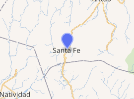
 Map of Nueva Vizcaya with Santa Fe highlighted | |
| |
.svg.png) Santa Fe Location within the Philippines | |
| Coordinates: 16°09′43″N 120°56′20″E | |
| Country | |
| Region | Cagayan Valley (Region II) |
| Province | Nueva Vizcaya |
| District | Lone district |
| Barangays | 16 (see Barangays) |
| Government | |
| • Type | Sangguniang Bayan |
| • Mayor | Tidong A. Benito |
| • Vice Mayor | Jonathan M. Tindaan |
| • Congressman | Luisa L. Cuaresma |
| • Electorate | 11,635 voters (2019) |
| Area | |
| • Total | 399.81 km2 (154.37 sq mi) |
| Elevation | 574.3 m (1,884.2 ft) |
| Population (2015 census)[3] | |
| • Total | 16,180 |
| • Density | 40/km2 (100/sq mi) |
| • Households | 3,721 |
| Economy | |
| • Income class | 3rd municipal income class |
| • Poverty incidence | 15.14% (2015)[4] |
| • Revenue (₱) | 96,284,067.56 (2016) |
| Time zone | UTC+8 (PST) |
| ZIP code | 3705 |
| PSGC | |
| IDD : area code | +63 (0)78 |
| Climate type | tropical rainforest climate |
| Native languages | Gaddang Ilocano Ibaloi Kallahan language Tagalog |
It is the only town that borders Pangasinan and is a typical bus stop for commuters going to the provinces of Isabela and Cagayan. This town is the end point of the Dalton Pass, a zig zag road from San Jose to Carranglan, Nueva Ecija. Local products include brooms, strawberry jam, strawberry wine, peanut butter, orchids and quilts.
Barangays
Santa Fe is politically subdivided into 16 barangays.
- Bacneng
- Baliling
- Bantinan
- Baracbac
- Buyasyas
- Imugan
- Poblacion
- Sinapaoan
- Tactac
- Villa Flores
- Atbu
- Balete
- Canabuan
- Malico
- Santa Rosa
- Unib
Demographics
| Population census of Santa Fe | ||
|---|---|---|
| Year | Pop. | ±% p.a. |
| 1918 | 3,571 | — |
| 1939 | 2,043 | −2.62% |
| 1948 | 2,126 | +0.44% |
| 1960 | 4,982 | +7.35% |
| 1970 | 4,254 | −1.57% |
| 1975 | 5,961 | +7.00% |
| 1980 | 6,338 | +1.23% |
| 1990 | 9,960 | +4.62% |
| 1995 | 11,854 | +3.32% |
| 2000 | 12,949 | +1.91% |
| 2007 | 13,421 | +0.50% |
| 2010 | 14,427 | +2.67% |
| 2015 | 16,180 | +2.21% |
| Source: Philippine Statistics Authority[3][5][6][7] | ||
Gallery
 Municipal hall
 Public market
.jpg) Balete Pass National Park
Balete Pass National Park Municipal hall complex
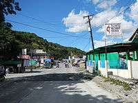 Town proper
References
- "Municipality". Quezon City, Philippines: Department of the Interior and Local Government. Retrieved 31 May 2013.
- "Province: Nueva Vizcaya". PSGC Interactive. Quezon City, Philippines: Philippine Statistics Authority. Retrieved 12 November 2016.
- Census of Population (2015). "Region II (Cagayan Valley)". Total Population by Province, City, Municipality and Barangay. PSA. Retrieved 20 June 2016.
- "PSA releases the 2015 Municipal and City Level Poverty Estimates". Quezon City, Philippines. Retrieved 1 January 2020.
- Census of Population and Housing (2010). "Region II (Cagayan Valley)". Total Population by Province, City, Municipality and Barangay. NSO. Retrieved 29 June 2016.
- Censuses of Population (1903–2007). "Region II (Cagayan Valley)". Table 1. Population Enumerated in Various Censuses by Province/Highly Urbanized City: 1903 to 2007. NSO.
- "Province of Nueva Vizcaya". Municipality Population Data. Local Water Utilities Administration Research Division. Retrieved 17 December 2016.
External links
| Wikimedia Commons has media related to Santa Fe, Nueva Vizcaya. |
- Santa Fe Profile at PhilAtlas.com
- Local Government Unit of Santa Fe, Nueva Vizcaya
- Philippine Standard Geographic Code
- Philippine Census Information
- Local Governance Performance Management System
Places adjacent to Santa Fe, Nueva Vizcaya | ||||||||||
|---|---|---|---|---|---|---|---|---|---|---|
| ||||||||||
This article is issued from Wikipedia. The text is licensed under Creative Commons - Attribution - Sharealike. Additional terms may apply for the media files.