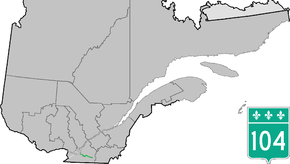
Quebec Route 104
Route 104 is an east/west highway on the south shore of the St. Lawrence River. Its eastern terminus is in Knowlton at the junction of Route 243 and its western terminus is in La Prairie at the junction of Route 134.
| ||||
|---|---|---|---|---|
 | ||||
| Route information | ||||
| Maintained by Transports Québec | ||||
| Length | 93.5 km[1] (58.1 mi) | |||
| Major junctions | ||||
| West end | ||||
| East end | ||||
| Location | ||||
| Counties | Roussillon / Le Haut-Richelieu / Brome-Missisquoi | |||
| Highway system | ||||
| ||||

Municipalities along Route 104
Major intersections
The entire route is located in Montérégie.
| Location | km | mi | Destinations | Notes | |
|---|---|---|---|---|---|
| La Prairie | 0.0 | 0.0 | |||
| 2.7 | 1.7 | Exit 62 on A-30; northern terminus of Route 217 | |||
| Saint-Jean-sur-Richelieu | 18.8 | 11.7 | Exit 47 on A-35; western terminus of concurrency with A-35 | ||
| 19.9 | 12.4 | Exit 45 on A-35; northern terminus of Route 219 | |||
| 21.9 | 13.6 | Exit 43 on A-35 | |||
| Félix-Gabriel-Marchand Bridge over Richelieu River | |||||
| 23.5 | 14.6 | Exit 42 on A-35; western terminus of concurrency with Route 133 | |||
| 25.9 | 16.1 | Exit 39 on A-35; eastern terminus of concurrency with A-35 and Route 133 | |||
| Mont-Saint-Grégoire | 38.3 | 23.8 | |||
| Farnham | 28.2 | 17.5 | Southern terminus of Route 233 | ||
| 49.9 | 31.0 | Western terminus of concurrency with Route 235 | |||
| 51.9 | 32.2 | Eastern terminus of concurrency with Route 235 | |||
| Cowansville | 70.6 | 43.9 | Western terminus of concurrency with Route 139 | ||
| 73.3 | 45.5 | Eastern terminus of Route 202 | |||
| 78.6 | 48.8 | Southern terminus of Route 241 | |||
| Brome Lake | 81.3 | 50.5 | Eastern terminus of concurrency with Route 139 | ||
| 87.4 | 54.3 | ||||
| 93.6 | 58.2 | ||||
1.000 mi = 1.609 km; 1.000 km = 0.621 mi
| |||||
See also
References
- Ministère des transports, "Distances routières", page 55, Les Publications du Québec, 2005
External links
- Official Transport Quebec Road Map (Courtesy of the Quebec Ministry of Transportation) (in French)
- Route 104 on Google Maps
This article is issued from Wikipedia. The text is licensed under Creative Commons - Attribution - Sharealike. Additional terms may apply for the media files.