Brezovica, Kosovo
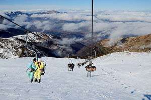
Brezovica (Serbian Cyrillic: Брезовица, Albanian: Brezovicë) is a settlement in the Štrpce municipality in Kosovo,[lower-alpha 1] known for its Brezovica ski resort. According to the 2011 Census in Kosovo, Brezovica's total population is 68.[1]
Brezovicë | |
|---|---|
Settlement | |
 Brezovica Ski Resort | |
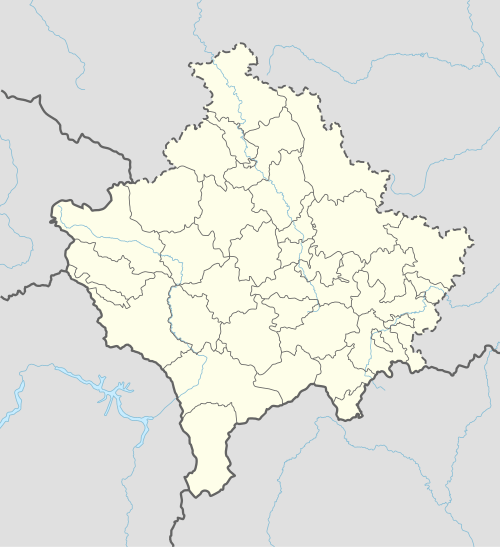 Brezovicë Location in Kosovo | |
| Coordinates: 42°13′19″N 21°00′17″E | |
| Location | |
| District | Ferizaj |
| Municipality | Shtërpcë |
| Area | |
| • Total | 80 km2 (30 sq mi) |
| Elevation | 1,015 m (3,330 ft) |
| Population (2011)[1] | |
| • Total | 68 |
| • Density | 0.85/km2 (2.2/sq mi) |
| Time zone | UTC+1 (CET) |
| • Summer (DST) | UTC+2 (CEST) |
| Postal code | 38357 |
| Area code(s) | +383 290 |
| Car plates | 05 |
Brezovica is the most visited winter tourist destinations in Kosovo. The ski resort area is ideally situated on the north and northwest-facing slopes of the Šar National Park. The ridge line spans 39,000 hectares of high alpine mountain terrain and forests, with a highly diverse and abundant flora and fauna. Located within 90 minutes of two international airports, the Brezovica resort area represents one of the last remaining under-developed ski resort areas in Southeast Europe.
Geography
It is situated in the northeastern part of the Sharri Mountains, and in the drainage basin of the Lepenac river. The Brezovica ski resort is situated between 900 m and 2,500 m above sea level, about 14km south of the village. There is a combination of mild valley climate in the lower parts and Alpine climate in the higher regions.
History
In Medieval Serbia, the župa (province) of Sirinić (first mentioned in a charter of the 13th century, the second time in 1331, in a charter of Emperor Stephen Dušan) existed, covering the whole of modern Štrpce municipality, having the cities of Gradište (in Brezovica) and Zidinac (in Gotovuša). Several remains of Byzantine forts exist in the region.[2]
At the top of the Čajlije hill, above the mouth of the Piljevac creek of the Lepenac river, there exists the remains of the Gradište fort, which has two layers, the first from the 6th century,[2] and the second from the 13th century.[3] The fort is in ruins, of which a donjon tower, and outlines of other buildings, can be identified. The entrance to the city, at the north, was protected by a tower. From that tower, a rampart continued, with another tower, from where a defensive wall stretched to the foot of the hill, towards the Lepenac.[3]
On 28 June 1944, during World War II, Bulgarian soldiers executed 46 locals (of whom 12 were children) at Rakanovac, in Brezovica, after the death of one of their soldiers.[4]
Demographics
| Ethnic group | 1981[5] | 2011[6] |
|---|---|---|
| Serbs | 323 (98.48%) | 44 (67.71%) |
| Albanians | 23 (33.82%) | |
| Others | 5 (1.53%) | 1 (1.47%) |
| Total[7] | 328 | 68 |
Annotations
- Kosovo is the subject of a territorial dispute between the Republic of Kosovo and the Republic of Serbia. The Republic of Kosovo unilaterally declared independence on 17 February 2008, but Serbia continues to claim it as part of its own sovereign territory. The two governments began to normalise relations in 2013, as part of the 2013 Brussels Agreement. Kosovo is currently recognized as an independent state by 97 out of the 193 United Nations member states. In total, 112 UN member states recognized Kosovo at some point, of which 15 later withdrew their recognition.
References
- "2011 Kosovo Census: Population by localities".
- Rastko website, rastko.rs; accessed 4 December 2015.(in Serbian)
- SANU, National Center for Digitization, Cultural Monuments in Serbia: Ostaci tvrđave Gradište-Čajlije
- SANU, National Center for Digitization, Cultural Monuments in Serbia: Rakanovac, spomenicikulture.mi.sanu.ac.rs; accessed 4 December 2015.
- 1981 Census, Kosovo Archived March 17, 2012, at the Wayback Machine
- 2011 Census, Kosovo |date=January 4, 2020 }}
- Kosovo censuses 1948-1991
External links
- viewkosova.com Brezovica
- Official site of the Brezovica Ski Center
- Brezovica.biz
- Kosovo Ski Holiday, 2016 NYTimes feature
| Town | Štrpce |  |
|---|---|---|
| Villages | ||
| Landmarks |
| |