Metohija
Metohija (Serbian Cyrillic: Метохија, pronounced [mɛtɔ̌xija]) or Dukagjini (Albanian: Rrafshi i Dukagjinit, pronounced [ˈrafʃi i dukaˈɟinit]) is a large basin and the name of the region covering the southwestern part of Kosovo.[lower-alpha 1] The region covers 35% (3,891 km2) of Kosovo's total area. According to the 2011 census, the population of the region is 700,577.
Метохија / Metohija Dukagjini | |
|---|---|
_map.png) | |
| Country | Kosovo[lower-alpha 1] |
| Districts | Gjakova Peć Prizren |
| Area | |
| • Total | 3,891 km2 (1,502 sq mi) |
| Population (2011) | |
| • Total | 700,577 |
| • Density | 180/km2 (470/sq mi) |
Districts
It encompasses three of the seven districts of Kosovo:
| Districts | Population (2011) | Area (km2) | Density (per km2)) |
|---|---|---|---|
| Gjakova | 194,672 | 1,129 | 172.4 |
| Peć | 174,235 | 1,365 | 127.6 |
| Prizren | 331,670 | 1,397 | 237.4 |
| Metohija/Dukagjini | 700,577 | 3,891 | 180.1 |
Names
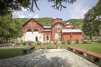
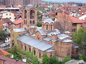
The name Metohija derives from the Greek word μετόχια (metóchia; singular μετόχιον, metóchion), meaning "monastic estates" – a reference to the large number of villages and estates in the region that were owned by the Serbian Orthodox monasteries and Mount Athos during the Middle Ages.[1]
In Albanian the area is called Rrafshi i Dukagjinit[2] and means "the plateau of Dukagjin", as the toponym (in Albanian language) took the name of the Dukagjini family.[3]
The term "Kosovo and Metohija" (Serbian Cyrillic: Косово и Метохија) was in official use for the Autonomous Region of Kosovo and Metohija (1945-1963), and also for the Autonomous Province of Kosovo and Metohija (1963-1968). The term "Metohija" was dropped from the official name of the province in 1968,[4] and thus the term "Kosovo" became the official name of the province as a whole. The change was not welcomed by Serbs, who continued to use the old name (for example in the 1986 Draft Memorandum of SANU). In 1990, the new Constitution of the Republic of Serbia was adopted, changing the official name of the province back to Autonomous Province of Kosovo and Metohija.[5] This time, the change was not welcomed by ethnic Albanians, who protested against the official use of the term "Metohija". In 2008, after the Kosovo declaration of independence, Serbia included the term "Metohija" into official name of the newly formed Ministry for Kosovo and Metohija, that was transformed in 2012 into the Office for Kosovo and Metohija.
Geography
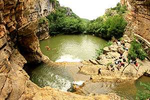
Metohija is 23 km (14 mi) wide at its broadest point and about 60 km (37 mi) long, at an average altitude of 450 m (1,476 ft)[6] above sea level. Its principal river is the White Drin. It is bordered by the mountain ranges Mokra Gora in the north and northwest, the Prokletije in the west, Paštrik (Albanian: Pashtrik) in the southwest, the Šar Mountains (Albanian: Malet e Sharrit) in the south and southeast, and Drenica, which distinguishes it from the rest of Kosovo in the east and northeast.
The geographic division between Metohija and rest of Kosovo causes differences between the two areas' flora and fauna. Metohija has the characteristic influences of the Mediterranean, while rest of Kosovo's ecology does not differ from Central Serbia's.
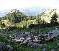
Metohija consists of fertile arable land with many small rivers which provide water for irrigation and, in combination with the Mediterranean climate, give excellent fields except for cereals. This area is well known for its high-quality vineyards, fruit orchards, and for the growing of chestnut and almond trees.
The geographical region of Metohija is further divided into four parts: Podgor, Prekoruplje, Reka and Rugovo.[7]
History
Prehistory
Based on archaeology, the region of Kosovo and Metohija and the Morava Valley were interconnected in the Neolithic (Starčevo and Vinča) and Eneolithic.[8] The Triballi of Morava entered Kosovo in two waves in the 8th and 7th centuries BC, then took part in the genesis of the Dardani.[8] Necropolises near Zhur suggest that the southwesternmost part of Metohija at the end of 6th century BC was subject to Illyrian influx.[8] After the Roman conquests, the Metohija region was divided into Dardania and Praevalitana.
Middle Ages
Coinciding with the decline of the Roman Empire, many "barbarian" tribes passed through the Balkans, most of whom did not leave any lasting state. The Slavs, however, overwhelmed the Balkans in the 6th and 7th centuries. The Principality of Serbia included the city of Destinikon, which is mostly believed to have been in Metohija. The region was conquered by Bulgaria in the early 10th century, after which Byzantine rule was restored, briefly ca. 970-975, and again after 1018. In terms of ecclesiastical administration, the region of Metohija belonged to the Eparchy of Prizren, created in 1019.[9] During the 11th and the 12th century, the region was contested between Grand Principality of Serbia and the Byzantine Empire.[10] Serbian Grand Prince Stefan Nemanja was recognized as independent in 1190, keeping northern parts of the Metohija (region of Hvosno), while southern parts were incorporated into Kingdom of Serbia by the beginning of the 13th century. After the Fall of the Serbian Empire in 1371, the region of Metohija was controlled by the Balšić family of Zeta, and since 1378 by the Branković family. It was part of the Serbian Despotate until 1455, when it was conquered by the Ottoman Empire.[11]
Early modern
Metohija was conquered by the Ottoman Empire in 1455 and incorporated into the Sanjak of Prizren (southern part of Metohija) and Sanjak of Peć (northern part of Metohija). In 1878, after several administrative reforms, the region was included into Ottoman Vilayet of Kosovo.
Modern
The area was taken by the Kingdom of Montenegro in the 1912 First Balkan War except Prizren area, conquered by Kingdom of Serbia. During the First World War, Montenegro was conquered by the Austro-Hungarian forces in 1915. The Central Powers were pushed out of Metohija by the Serbian Army in 1918. Montenegro subsequently joined the Kingdom of Serbia, which was followed by the formation of the Kingdom of Serbs, Croats and Slovenes. The Kingdom was reformed into the Kingdom of Yugoslavia in 1929. The Kingdom suffered an Axis invasion during World War II in 1941, and the region of Metohija was incorporated into Italian-controlled Albania, with the Italians employing the "Vulnetari", an Albanian volunteer militia, to control the villages. After Italy's treaty with the Allies in 1943, the Germans took direct control over the region, supported by the local Albanian collaborationists (Balli Kombëtar). After numerous rebellions of Serb Chetniks and Yugoslav Partisans, Metohija was captured by Serb forces in 1944. In 1946, it became part of Serbia's Autonomous Province of Kosovo and Metohija, within the transitional Democratic Federal Yugoslavia.
On 17 February 2008, Kosovo unilaterally declared independence from Serbia. The country still considers Metohija part of its sovereign territory.
Notes
- Kosovo is the subject of a territorial dispute between the Republic of Kosovo and the Republic of Serbia. The Republic of Kosovo unilaterally declared independence on 17 February 2008, but Serbia continues to claim it as part of its own sovereign territory. The two governments began to normalise relations in 2013, as part of the 2013 Brussels Agreement. Kosovo is currently recognized as an independent state by 97 out of the 193 United Nations member states. In total, 112 UN member states recognized Kosovo at some point, of which 15 later withdrew their recognition.
References
- Paulin Kola, The Search for Greater Albania, p. 47 fn 108. C. Hurst & Co, 2003. ISBN 978-1-85065-664-7
- Elsie, Robert (2004). Historical dictionary of Kosova. Rowman & Littlefield Publishers, Inc. p. 119. ISBN 978-0-8108-5309-6.
- Ulqini, Kahreman (12–18 January 1968). "Prejardhja dhe zhvillimi i toponimit DUKAGJIN". Second Conference of Albanological Studies. Archived from the original on 21 November 2015. Retrieved 10 May 2012.
- Bennett 1995, p. 53.
- Krieger 2001, p. XXI.
- Geographical Atlas of Yugoslavia, University Press "Liber", Zagreb, 1987. – made from military maps of Geographical Military Institute, Belgrade.
- Alekan Jovanović (1937). Spomenica dvadesetpetogodishnjice oslobodjenja Južne Srbije. p. 432.
- Stojić, Milorad (2000). "Етнокултурни однос Косова и Поморавља у праисторији". Зборник радова Филозофског факултета у Приштини. 30.
- Ćirković 2004, p. 20-21.
- Ćirković 2004, p. 23.
- Ćirković 2004, p. 107.
Sources
- Bennett, Christopher (1995). Yugoslavia's Bloody Collapse: Causes, Course and Consequences. London: Hurst & Company.CS1 maint: ref=harv (link)
- Ćirković, Sima (2004). The Serbs. Malden: Blackwell Publishing.CS1 maint: ref=harv (link)
- Krieger, Heike (2001). The Kosovo Conflict and International Law: An Analytical Documentation 1974–1999. Cambridge: Cambridge University Press.CS1 maint: ref=harv (link)
- Pejin, Jovan (2006). "The Extermination of the Serbs in Metohia, 1941-1944". Срби на Косову и у Метохији: Зборник радова са научног скупа (PDF). Београд: Српска академија наука и уметности. pp. 189–207. Archived from the original (PDF) on 2017-08-01. Retrieved 2017-08-01.CS1 maint: ref=harv (link)
- Pavlowitch, Stevan K. (2002). Serbia: The History behind the Name. London: Hurst & Company.CS1 maint: ref=harv (link)
| Authority control |
|
|---|