Borough of Chorley
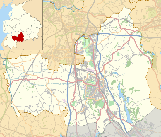
The Borough of Chorley is a local government district with borough status in Lancashire, England. The population of the Borough at the 2011 census was 104,155.[2] It is named after its largest settlement, the town of Chorley.
Borough of Chorley | |
|---|---|
Borough | |
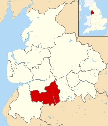 Shown within Lancashire and England | |
| Sovereign state | United Kingdom |
| Constituent country | England |
| Region | North West England |
| Ceremonial county | Lancashire |
| Founded | 1 April 1974 |
| Admin. HQ | Chorley |
| Government | |
| • Type | Chorley Borough Council |
| • Leadership: | Leader & Cabinet |
| • Executive: | Labour |
| • MPs: | Lindsay Hoyle (Speaker) |
| Area | |
| • Total | 78.3 sq mi (202.8 km2) |
| Area rank | 159th |
| Population (mid-2019 est.) | |
| • Total | 118,216 |
| • Rank | Ranked 203rd |
| • Density | 1,500/sq mi (580/km2) |
| Time zone | UTC+0 (Greenwich Mean Time) |
| • Summer (DST) | UTC+1 (British Summer Time) |
| Postcode areas | |
| Area code(s) | 01257, 01204, 01254, 01704, 01772 |
| ISO 3166-2 | – |
| ONS code | 30UE (ONS) E07000118 (GSS) |
| OS grid reference | SD5817 |
| NUTS 3 | – |
| Ethnicity | 93.6% White British 2.5% Asian[1] |
| Website | chorley.gov.uk |
Creation
The present non-metropolitan Borough of Chorley was formed on 1 April 1974 by the merger of the then existing Municipal Borough of Chorley with the urban districts of Adlington and Withnell, and Chorley Rural District.
Parishes
With exception of the town of Chorley, which remains an unparished area, the borough has twenty-three civil parishes:
Wards
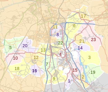
Chorley Council is made up of forty-seven councillors, representing the following twenty electoral wards:[3][4]
- Adlington & Anderton
- Astley & Buckshaw
- Brindle and Hoghton
- Chisnall (covering Charnock Richard, Heskin and Coppull West)
- Chorley East
- Chorley North East
- Chorley North West
- Chorley South East
- Chorley South West
- Clayton-le-Woods & Whittle-le-Woods
- Clayton-le-Woods North
- Clayton-le-Woods West & Cuerden
- Coppull
- Eccleston & Mawdesley
- Euxton North
- Euxton South
- Heath Charnock & Rivington
- Lostock (covering Bretherton, Croston, & Ulnes Walton)
- Pennine (covering Heapey & Anglezarke)
- Wheelton & Withnell
Settlements
Parliamentary constituency
The Chorley Parliament constituency is a constituency in the House of Commons, and from 1997 until 2010 it was coterminous with the borough. Through boundary changes, Croston, Eccleston, Bretherton and Mawdesley were transferred to the South Ribble constituency. The current Member of Parliament for Chorley is Lindsay Hoyle, who was first elected to the seat in 1997.
See also
- Chorley local elections
References
- "Neighbourhood Statistics - Chorley (Local Authority)". Office for National Statistics. Retrieved 6 September 2008.
- "Non=-Metropolitan district council population 2011". Retrieved 15 January 2016.
- Your Councillors by Ward. Chorley Council. Retrieved 27 June 2010.
- Chorley Lower-Layer Super Output Areas Archived 10 March 2010 at the Wayback Machine. Lancashire County Council. Retrieved 27 June 2010.
Buildings and structures in the Borough of Chorley | |||||
|---|---|---|---|---|---|
| Grade I |
|  | |||
| Grade II* |
| ||||
| Grade II |
| ||||
| Scheduled monuments | |||||
| Unlisted |
| ||||
| Derelict or demolished | |||||
| Listed in | |||||

William Wilcock 1st term is actually the Father of William Wilcock 2nd and 3rd term