Eden District
Eden is a local government district in Cumbria, England. Its council is based in Penrith. It is named after the River Eden which flows north through the district toward Carlisle.
Eden District | |
|---|---|
District | |
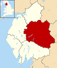 Shown within Cumbria | |
| Sovereign state | United Kingdom |
| Constituent country | England |
| Region | North West England |
| Ceremonial county | Cumbria |
| Historic county | Cumberland (part) Westmorland (part) |
| Founded | 1 April 1974 |
| Admin. HQ | Penrith |
| Government | |
| • Type | Eden District Council |
| • Leadership: | Alternative - Sec.31 |
| • Executive: | NOC (LibDem/ Independent/ Labour/ Green administration) |
| • MPs: | Neil Hudson |
| Area | |
| • Total | 827 sq mi (2,142 km2) |
| Area rank | 9th |
| Population (2011) | |
| • Total | 52,564 |
| • Rank | Ranked 313th |
| • Density | 64/sq mi (25/km2) |
| Time zone | UTC+0 (Greenwich Mean Time) |
| • Summer (DST) | UTC+1 (British Summer Time) |
| ONS code | 16UF (ONS) E07000030 (GSS) |
| Ethnicity | 99.6% White |
| Website | eden.gov.uk |
Extent
It has an area of 2,156 square kilometres, making it (since 2009) the eighth largest district in England and the largest non-unitary district. It also has the lowest population density of any district in England and Wales, with a mean of just 25 persons per square kilometre.[1]
In 2011, the population was 5 per cent above its 2001 level.[1]
The district council was created on 1 April 1974 under the Local Government Act 1972, from the Penrith Urban District, Alston with Garrigill Rural District and Penrith Rural District, all in Cumberland, and Appleby Municipal Borough, part of Lakes urban district and North Westmorland Rural District, all in Westmorland.
Parts of the Lake District and Yorkshire Dales National Parks are in the district.
Communications
The West Coast Main Railway Line runs through the district but with only one station at Penrith. Services on this line are provided by Avanti West Coast and TransPennine Express. The Northern Settle-Carlisle Railway also goes through the district and has stations at Armathwaite, Lazonby, Langwathby, Appleby and Kirkby Stephen.
Roads through the district are the M6 motorway, the A6 and the A66.
Green space
It was shown in a national detailed Land Use Survey by the Office for National Statistics in 2005 that Eden District has the second lowest proportion of land taken up by roads of any district in England: 0.8 per cent, fractionally greater than Craven in North Yorkshire and both adjoining the Pennines. This compared with a maximum of over 20 per cent in four London boroughs and the City of London.[2]
In that detailed survey (to the nearest square metre) it was shown that Eden District had the greatest proportion of green space (which excludes domestic gardens) of any district, 97.9 per cent, as shown by the following extract:
| District | % Green space (June 2005)[2] |
|---|---|
| Copeland | 96.0% |
| Scarborough | 96.1% |
| Ryedale | 96.3% |
| West Somerset | 96.6% |
| Northumberland | 96.7% |
| West Devon | 97.2% |
| Richmondshire | 97.5% |
| Eden | 97.9% |
Wards
Below is a list of the wards that form Eden (with numbers of councillors):
- Alston Moor (2)
- Appleby (Appleby) (1)
- Appleby (Bongate) (1)
- Askham (1)
- Brough (1)
- Crosby Ravensworth (1)
- Dacre (1)
- Eamont (1)
- Greystoke (1)
- Hartside (1)
- Hesket (2)
- Kirkby Stephen (2)
- Kirkby Thore (1)
- Kirkoswald (1)
- Langwathby (1)
- Lazonby (1)
- Long Marton (1)
- Morland (1)
- Orton with Tebay (1)
- Penrith Carleton (1)
- Penrith East (2)
- Penrith North (3)
- Penrith Pategill (1)
- Penrith South (2)
- Penrith West (2)
- Ravenstonedale (1)
- Shap (1)
- Skelton (1)
- Ullswater (1)
- Warcop (1)
Amenities
In Eden there are King George's Fields, named after King George V, at Appleby and Patterdale.
The council owns the Penrith Leisure Centre, which is run by a private company under contract. The council also owns a number of playing fields and recreation grounds throughout the district, notably the sports grounds at Frenchfield near Carleton on the outskirts of Penrith.
The council owns and runs Penrith and Eden Museum and the Penrith Tourist Information Centre.
See also
- Grade II* listed buildings in Eden
- List of churches in Eden District
References
| Wikimedia Commons has media related to Eden. |
- Lucy Townsend and Kathryn Westcott (17 July 2012). "Census 2011: Five lesser-spotted things in the data". BBC News Magazine. Retrieved 17 July 2012.
- Key Statistics: Dwellings; Quick Statistics: Population Density; Physical Environment: Land Use Survey 2005 2011 census

Cumbria Portal | |
| Boroughs or districts | |
| Major settlements |
|
| Topics | |
| Authority control |
|
|---|