Biscuit Fire
The Biscuit Fire was a massive wildfire in 2002 that burned nearly 500,000 acres (780 sq mi; 2,000 km2) in the Rogue River–Siskiyou National Forest, in southern Oregon and northern California, in the Western United States. The fire was named after Biscuit Creek in southern Oregon.[2] The Biscuit Fire was the largest wildfire in the recorded history of Oregon.[2] The Biscuit Fire area is subject to warm, dry winds known as the Brookings effect (also known as Chetco effect), driven by high pressure over the Great Basin. The fire re-burned portions of the 1987 Silver Fire and subsequently burned in the 2017 Chetco Bar Fire.
| Biscuit Fire | |
|---|---|
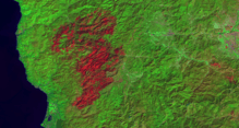
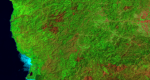
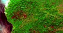
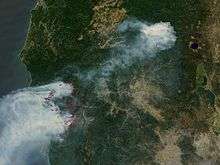 NASA satellite image of the Biscuit Fire, on August 12, 2002 | |
| Location | Siskiyou National Forest, Oregon and California, USA |
| Coordinates | 42.05°N 123.883333°W |
| Statistics[1][2] | |
| Cost | Millions of dollars |
| Date(s) | July 12, 2002– December 31, 2002 |
| Burned area | 500,000 acres (2,000 km2) |
| Cause | Lightning |
| Land use | Mixed, residential and wildlands |
| Deaths | None |
| Non-fatal injuries | Unknown |
| Map | |
 | |
The wildfire
The fire season in 2002 was an especially active one that started early with major fires in Arizona, Colorado, and New Mexico, pulling resources from the Pacific Northwest. Between July 12 and July 15, a series of lightning storms occurred in California and Oregon starting hundreds of small wildfires. During this period, five such fires were started within a 20-mile (32 km) radius of each other near the state border. Due to the fires already burning in other areas, insufficient numbers of fire crews and smokejumpers were available to combat these fires and they began to burn out of control. The large Florence Fire, which had started approximately 30 miles (48 km) north of the border, eventually joined what was known as the Sour Biscuit Fire, which was burning very close to the border. Once the massive Biscuit Fire was created, it ended up burning a total of 500,000 acres (2,000 km2), and the fire was unable to be fully contained until December 31, 2002.[1][2]
Damages
The fire destroyed 4 primary residences and 10 other structures, put 15,000 residents on evacuation notice and burned most of the 180,000-acre (730 km2) Kalmiopsis Wilderness. Despite the level of destruction, there were no deaths attributed to the fire.
Aftermath
Since the fire, the United States Forest Service has been trying to log most of the severely burnt area, despite ecologists' concerns about the Port Orford Cedar, which is threatened from a root-attacking fungal-like organism that is most commonly spread on car tires and shoes. This will be the largest recorded timber sale in U.S. history, and a landmark case setting the future for all fires in national forests. The cost of salvage logging far outweighed the proceeds from sales ($1.9 million).
In 2006, a research paper on the effects of post-wildfire salvage logging caused a controversy within the forest sciences community.
See also
- 2002 California wildfires
- Fire ecology
- List of California Wildfires
- Wildfire suppression
References
Citations
- Jeff LaLande (October 20, 2017). "Biscuit Fire of 2002". The Oregon Encyclopedia. Retrieved December 11, 2017.
- "The Biscuit Fire: 15 Years After Oregon's Largest Wildfire". Oregon Public Broadcasting. September 11, 2017. Retrieved December 11, 2017.
- "2002 Large Fires" (PDF). CAL FIRE. February 11, 2003. Retrieved December 10, 2017.
Bibliography
- "Biscuit Fire - Analysis of Fire Response, Resource Availability, and Personnel Certification Standards" (PDF). United States Government Accountability Office. Retrieved September 30, 2005.
| Pre-2000 |
|
|---|---|
| 2002 | |
| 2003 | |
| 2004 | |
| 2005 | |
| 2006 | |
| 2007 | |
| 2008 | |
| 2009 | |
| 2010 | |
| 2011 | |
| 2012 | |
| 2013 | |
| 2014 | |
| 2015 | |
| 2016 | |
| 2017 | |
| 2018 | |
| 2019 | |
| 2020 | |
| |
Oregon wildfires | |
|---|---|
| Pre-2000 | |
| 2000–2015 | |
| 2017 |
|
| 2018 | |
| |