Bintan Regency
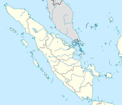
Bintan Regency (Formerly Riau Islands Regency; Indonesian: Kabupaten Kepulauan Riau)[1][2] is an administrative area in the Riau Islands Province of Indonesia. Bintan Regency includes all of Bintan Island (except for the city of Tanjung Pinang which is separately administered as an autonomous area of the island) and also includes many outlying islands including the Tambelan Archipelago and Badas Islands situated between Bintan and West Kalimantan.
Bintan Regency Kabupaten Bintan | |
|---|---|
 Seal | |
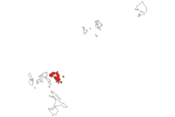 Location within Riau Islands | |
| Coordinates: 1.01°N 104.55°E | |
| Country | Indonesia |
| Province | Riau Islands |
| Capital | Bandar Seri Bentan |
| Government | |
| • Regent | Apri Sujadi |
| • Vice Regent | Dalmasri Syam |
| Area | |
| • Total | 1,318.21 km2 (508.96 sq mi) |
| Population (2017) | |
| • Total | 154,584 |
| • Density | 120/km2 (300/sq mi) |
| Time zone | UTC+7 (Indonesia Western Time) |
| Area code | (+62) 770 |
| Website | bintankab.go.id |

Location
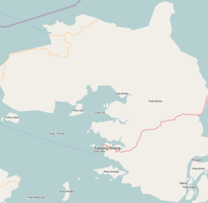
The Island is located 40 kilometres from Singapore, with an area of 1,462.77 km2, and it has a population of around 330,000 at the 2010 Census (including Tanjung Pinang), which by 2014 had risen to about 400,000. Famous places in Bintan include Trikora Beach, on the east coast, and the international Bintan Resort.
Administration
The Regency (excluding the city of Tanjung Pinang) is divided into ten districts (kecamatan) – tabulated below with their areas and 2010 Census populations:[3]
| Name | Area in km2 | Population Census 2010[4] | No. of Villages | Post Code |
|---|---|---|---|---|
| Teluk Bintan | 129.8 | 8,934 | 6 | 29132 -29136 |
| Bintan Utara (North Bintan) | 53.8 | 21,193 | 5 | 29152 |
| Teluk Sebong | 324.4 | 16,019 | 7 | 29154 |
| Seri Kuala Lobam | 90.3 | 17,632 | 5 | 29153 |
| Bintan Timur (East Bintan) | 96.5 | 39,006 | 4 | 29150 |
| Gunung Kijang | 215.9 | 12,007 | 4 | 29155 |
| Mantang1 | 64.7 | 3,896 | 4 | 29156 |
| Bintan Pesisir1 | 121.1 | 8,005 | 4 | 29151 |
| Toapaya | 149.2 | 10,633 | 4 | 29157 |
| Tambelan2 | 90.4 | 4,975 | 8 | 29193 |
Notes:
- 1 Bintan Pesisir and Mantang districts comprise numerous islands lying to the south and east of Bintang Island, but do not include any part of that island itself.
- 2 Tambelan district comprises the Tambelan Archipelago and Badas Islands situated between Bintan and West Kalimantan.
Demography
Religion
Islam is the dominant religion in the city, with 86.88% of the total population identify themselves as Muslim. Other religions are Christianity, which forms 7.52% of the total population, Buddhism, which forms 5.37% of the total population, Hinduism, which forms 0.09% of the total population and Confucianism, which forms 0.38% of the total population.
Airports
Besides Raja Haji Fisabilillah Airport in Tanjung Pinang in the south of the Bintan Island, since 2012 a private company builds an airport at Lagoi in the north of the Bintan Island to facilitates tourism with investment $80 to $100 million and predicted operational in 2014.[6]
References
- "PERATURAN PEMERINTAH REPUBLIK INDONESIA NOMOR 5 TAHUN 2006 TENTANG PERUBAHAN NAMA KABUPATEN KEPULAUAN RIAU MENJADI KABUPATEN BINTAN" (in Indonesian). The Government of Indonesia. Retrieved 23 February 2006.
- "Kabupaten Kepulauan Riau Diubah Menjadi Kabupaten Bintan" (in Indonesian). Tempo.co. Retrieved 28 February 2006.
- Biro Pusat Statistik, Jakarta, 2011.
- Biro Pusat Statistik, Jakarta, 2011.
- "Riau Islands Province in Figures 2017". BPS Kepulauan Riau. Retrieved 22 July 2018.
- "Kepri Akan Bangun Bandara Internasional di Lagoi". 20 March 2012.