Betagi Upazila
Betagi (Bengali: বেতাগী) is an Upazila of Barguna District[1] in the Division of Barisal, Bangladesh.
Betagi বেতাগী | |
|---|---|
Upazila | |
 Betagi Location in Bangladesh | |
| Coordinates: 22°25′N 90°10.1′E | |
| Country | |
| Division | Barisal Division |
| District | Barguna District |
| Area | |
| • Total | 167.75 km2 (64.77 sq mi) |
| Population (1991) | |
| • Total | 110,926 |
| • Density | 660/km2 (1,700/sq mi) |
| Time zone | UTC+6 (BST) |
| Website | Official Map of the Betagi Upazila |
Geography
Betagi is located at 22.4167°N 90.1681°E . It has 22,156 households and a total area of 167.75 km².
Demographics
According to the 1991 Bangladesh census, Betagi had a population of 110,926. Males constitute 49.95% of the population, and females 50.05%. The population aged 18 or over was 57,885. Betagi had an average literacy rate of 87% (7+ years), compared to the national average of 72.4%.[2]
Administration
Betagi has 1 town council with 9 Wards, 7 Unions/Wards, 61 Mauzas/Mahallas, and 75 villages.
Educational Institutions
- Rotary Betagi Union High School
See also
- Upazilas of Bangladesh
- Districts of Bangladesh
- Divisions of Bangladesh
References
- Saidul Islam Mantu (2012). "Betagi Upazila". In Sirajul Islam and Ahmed A. Jamal (ed.). Banglapedia: National Encyclopedia of Bangladesh (Second ed.). Asiatic Society of Bangladesh.
- "Population Census Wing, BBS". Archived from the original on 2005-03-27. Retrieved November 10, 2006.
| Upazila/Thana: | ||
|---|---|---|
Capital: Barisal | ||
| Barguna District | 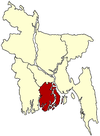 | |
| Barisal District | ||
| Bhola District |
| |
| Jhalokati District | ||
| Patuakhali District | ||
| Pirojpur District | ||
This article is issued from Wikipedia. The text is licensed under Creative Commons - Attribution - Sharealike. Additional terms may apply for the media files.