Friendly, West Virginia
Friendly is a town in Tyler County, West Virginia, in the United States. The population was 132 at the 2010 census.
Friendly, West Virginia | |
|---|---|
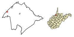 Location of Friendly in Tyler County, West Virginia. | |
| Coordinates: 39°30′54″N 81°3′40″W | |
| Country | United States |
| State | West Virginia |
| County | Tyler |
| Area | |
| • Total | 0.10 sq mi (0.26 km2) |
| • Land | 0.10 sq mi (0.26 km2) |
| • Water | 0.00 sq mi (0.00 km2) |
| Elevation | 627 ft (191 m) |
| Population | |
| • Total | 132 |
| • Estimate (2018)[3] | 123 |
| • Density | 1,217.82/sq mi (470.38/km2) |
| Time zone | UTC-5 (Eastern (EST)) |
| • Summer (DST) | UTC-4 (EDT) |
| ZIP code | 26146 |
| Area code(s) | 304 |
| FIPS code | 54-29404[4] |
| GNIS feature ID | 1554513[5] |
History
The town was likely named for Friend Cochrane Williamson, an early settler.[6] Friendly was incorporated in 1898.[7]
It is the setting of the novel Shiloh.
The 1884 Heirloom tomato variety was said to be discovered by James Lyde Williamson growing in a pile of flood debris along the Ohio River near Friendly, after the Great Flood of 1884.[8][9]
In 1903 the Parkersburg and Ohio Valley Electric Railway began to build a major electric interurban railway between Wheeling and Parkersburg. It only opened five miles (8 km) between Sistersville and Friendly, and operated until 1918. Friendly was claimed to have been one of the smallest settlements in the USA with a dedicated interurban service, since it only had 217 residents at the time.[10]
The Friendly City Building and Jail has been listed on the National Register of Historic Places.
Geography
Friendly is located at 39°30′54″N 81°3′40″W (39.514888, -81.061011),[11] along the Ohio River; directly across from Matamoras, Ohio.[12]
According to the United States Census Bureau, the town has a total area of 0.09 square miles (0.23 km2), all of it land.[13]
Demographics
| Historical population | |||
|---|---|---|---|
| Census | Pop. | %± | |
| 1900 | 253 | — | |
| 1910 | 217 | −14.2% | |
| 1920 | 173 | −20.3% | |
| 1930 | 170 | −1.7% | |
| 1940 | 148 | −12.9% | |
| 1950 | 216 | 45.9% | |
| 1960 | 195 | −9.7% | |
| 1970 | 190 | −2.6% | |
| 1980 | 242 | 27.4% | |
| 1990 | 146 | −39.7% | |
| 2000 | 159 | 8.9% | |
| 2010 | 132 | −17.0% | |
| Est. 2018 | 123 | [3] | −6.8% |
| U.S. Decennial Census[14] | |||
2010 census
At the 2010 census there were 132 people, 55 households, and 37 families living in the town. The population density was 1,466.7 inhabitants per square mile (566.3/km2). There were 73 housing units at an average density of 811.1 per square mile (313.2/km2). The racial makeup of the town was 100.0% White.[2] Of the 55 households 27.3% had children under the age of 18 living with them, 45.5% were married couples living together, 10.9% had a female householder with no husband present, 10.9% had a male householder with no wife present, and 32.7% were non-families. 21.8% of households were one person and 3.6% were one person aged 65 or older. The average household size was 2.40 and the average family size was 2.68.
The median age in the town was 47 years. 20.5% of residents were under the age of 18; 7.5% were between the ages of 18 and 24; 17.4% were from 25 to 44; 32.6% were from 45 to 64; and 22% were 65 or older. The gender makeup of the town was 51.5% male and 48.5% female.
2000 census
At the 2000 census there were 159 people, 62 households, and 47 families living in the town. The population density was 1,664.3 inhabitants per square mile (613.9/km²). There were 70 housing units at an average density of 732.7 per square mile (270.3/km²). The racial makeup of the town was 99.99% White.[4] Of the 62 households 30.6% had children under the age of 18 living with them, 64.5% were married couples living together, 11.3% had a female householder with no husband present, and 22.6% were non-families. 19.4% of households were one person and 9.7% were one person aged 65 or older. The average household size was 2.56 and the average family size was 2.83.
The age distribution was 22.0% under the age of 18, 5.0% from 18 to 24, 33.3% from 25 to 44, 25.8% from 45 to 64, and 13.8% 65 or older. The median age was 36 years. For every 100 females, there were 91.6 males. For every 100 females age 18 and over, there were 90.8 males.
The median household income was $33,571 and the median family income was $34,821. Males had a median income of $37,500 versus $15,000 for females. The per capita income for the town was $15,386. About 13.2% of families and 15.0% of the population were below the poverty line, including 12.5% of those under the age of eighteen and 26.7% of those sixty five or over.
See also
- List of cities and towns along the Ohio River
References
- "2018 U.S. Gazetteer Files". United States Census Bureau. Retrieved Feb 16, 2020.
- "U.S. Census website". United States Census Bureau. Retrieved 2013-01-24.
- "Population and Housing Unit Estimates". Retrieved June 4, 2019.
- "U.S. Census website". United States Census Bureau. Retrieved 2008-01-31.
- "US Board on Geographic Names". United States Geological Survey. 2007-10-25. Retrieved 2008-01-31.
- Kenny, Hamill (1945). West Virginia Place Names: Their Origin and Meaning, Including the Nomenclature of the Streams and Mountains. Piedmont, WV: The Place Name Press. p. 255.
- West Virginia Blue Book. Published annually by the Clerk's Office of the West Virginia Senate.
- http://store.tomatofest.com/ProductDetails.asp?ProductCode=TF-0002.
- Hilton & Due: The Electric Interurban Railways in America Stamford University Press 1960 p. 305
- "US Gazetteer files: 2010, 2000, and 1990". United States Census Bureau. 2011-02-12. Retrieved 2011-04-23.
- West Virginia Atlas & Gazetteer. Yarmouth, Me.: DeLorme. 1997. p. 23. ISBN 0-89933-246-3.
- "US Gazetteer files 2010". United States Census Bureau. Archived from the original on 2012-07-02. Retrieved 2013-01-24.
- "Census of Population and Housing". Census.gov. Retrieved June 4, 2015.
Municipalities and communities of Tyler County, West Virginia, United States | ||
|---|---|---|
| Cities | 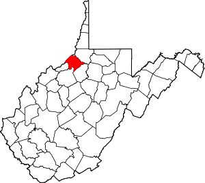 Tyler County map | |
| Towns | ||
| Unincorporated communities | ||
| Footnotes | ‡This populated place also has portions in an adjacent county or counties | |