Hambleton, West Virginia
Hambleton is a town in Tucker County, West Virginia, United States. The population was 232 at the 2010 census. Hambleton was established in 1889, but not incorporated until 1905. It was named by then United States Senator Stephen B. Elkins in honor of a stockholder by this name in the West Virginia Central Railroad Company. The town was previously known as Hulings.[6]
Hambleton, West Virginia | |
|---|---|
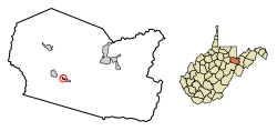 Location of Hambleton in Tucker County, West Virginia. | |
| Coordinates: 39°4′53″N 79°38′45″W | |
| Country | United States |
| State | West Virginia |
| County | Tucker |
| Area | |
| • Total | 0.16 sq mi (0.42 km2) |
| • Land | 0.14 sq mi (0.36 km2) |
| • Water | 0.02 sq mi (0.06 km2) |
| Elevation | 1,722 ft (525 m) |
| Population | |
| • Total | 232 |
| • Estimate (2018)[3] | 216 |
| • Density | 1,565.22/sq mi (605.89/km2) |
| Time zone | UTC-5 (Eastern (EST)) |
| • Summer (DST) | UTC-4 (EDT) |
| ZIP code | 26269 |
| Area code(s) | 304 |
| FIPS code | 54-34492[4] |
| GNIS feature ID | 1551333[5] |
Geography
Hambleton is located at 39°4′53″N 79°38′45″W (39.081439, -79.645851),[7] along the Black Fork River.
According to the United States Census Bureau, the town has a total area of 0.16 square miles (0.41 km2), of which, 0.12 square miles (0.31 km2) is land and 0.04 square miles (0.10 km2) is water.[8]
Climate
The climate in this area has mild differences between highs and lows, and there is adequate rainfall year-round. According to the Köppen Climate Classification system, Hambleton has a marine west coast climate, abbreviated "Cfb" on climate maps.[9]
Demographics
| Historical population | |||
|---|---|---|---|
| Census | Pop. | %± | |
| 1910 | 1,300 | — | |
| 1920 | 488 | −62.5% | |
| 1930 | 368 | −24.6% | |
| 1940 | 394 | 7.1% | |
| 1950 | 283 | −28.2% | |
| 1960 | 275 | −2.8% | |
| 1970 | 328 | 19.3% | |
| 1980 | 403 | 22.9% | |
| 1990 | 265 | −34.2% | |
| 2000 | 246 | −7.2% | |
| 2010 | 232 | −5.7% | |
| Est. 2018 | 216 | [3] | −6.9% |
| U.S. Decennial Census[10] | |||
2010 census
At the 2010 census there were 232 people, 97 households, and 68 families living in the town. The population density was 1,933.3 inhabitants per square mile (746.5/km2). There were 128 housing units at an average density of 1,066.7 per square mile (411.9/km2). The racial makeup of the town was 99.1% White and 0.9% from two or more races. Hispanic or Latino of any race were 1.7%.[2]
Of the 97 households 29.9% had children under the age of 18 living with them, 45.4% were married couples living together, 15.5% had a female householder with no husband present, 9.3% had a male householder with no wife present, and 29.9% were non-families. 24.7% of households were one person and 12.4% were one person aged 65 or older. The average household size was 2.39 and the average family size was 2.84.
The median age in the town was 42 years. 21.1% of residents were under the age of 18; 11.7% were between the ages of 18 and 24; 21.1% were from 25 to 44; 30.2% were from 45 to 64; and 15.9% were 65 or older. The gender makeup of the town was 47.0% male and 53.0% female.
2000 census
At the 2000 census there were 246 people, 102 households, and 68 families living in the town. The population density was 1,858.7 inhabitants per square mile (730.6/km²). There were 113 housing units at an average density of 853.8 per square mile (335.6/km²). The racial makeup of the town was 99.19% White, 0.41% Asian and 0.41% Pacific Islander.[4] Of the 102 households 30.4% had children under the age of 18 living with them, 54.9% were married couples living together, 7.8% had a female householder with no husband present, and 32.4% were non-families. 30.4% of households were one person and 16.7% were one person aged 65 or older. The average household size was 2.41 and the average family size was 2.97.
The age distribution was 22.8% under the age of 18, 9.3% from 18 to 24, 28.5% from 25 to 44, 22.8% from 45 to 64, and 16.7% 65 or older. The median age was 38 years. For every 100 females, there were 87.8 males. For every 100 females age 18 and over, there were 81.0 males.
The median household income was $23,625 and the median family income was $31,250. Males had a median income of $24,688 versus $14,500 for females. The per capita income for the town was $12,835. About 10.4% of families and 16.5% of the population were below the poverty line, including 10.7% of those under the age of eighteen and 12.8% of those sixty five or over.
References
- "2018 U.S. Gazetteer Files". United States Census Bureau. Retrieved Feb 16, 2020.
- "U.S. Census website". United States Census Bureau. Retrieved 2013-01-24.
- "Population and Housing Unit Estimates". Retrieved June 4, 2019.
- "U.S. Census website". United States Census Bureau. Retrieved 2008-01-31.
- "US Board on Geographic Names". United States Geological Survey. 2007-10-25. Retrieved 2008-01-31.
- Kenny, Hamill (1945). West Virginia Place Names: Their Origin and Meaning, Including the Nomenclature of the Streams and Mountains. Piedmont, WV: The Place Name Press. p. 293.
- "US Gazetteer files: 2010, 2000, and 1990". United States Census Bureau. 2011-02-12. Retrieved 2011-04-23.
- "US Gazetteer files 2010". United States Census Bureau. Retrieved 2013-01-24.
- Climate Summary for Hambleton, West Virginia
- "Census of Population and Housing". Census.gov. Retrieved June 4, 2015.
Municipalities and communities of Tucker County, West Virginia, United States | ||
|---|---|---|
| Cities |  Map of West Virginia highlighting Tucker County | |
| Towns | ||
| Unincorporated communities | ||
| Ghost towns | ||