Al-Haffah
Al-Haffah (Arabic: الحفة) is a town in northwestern Syria administratively belonging to the Latakia Governorate, located 33 kilometres (21 miles) east of Latakia. It is the centre of al-Haffah District, one of the four districts (mantiqah) of the Latakia Goverorate. Located at an average height of 310 metres (1,020 feet) above sea level, al-Haffa's population was 4,298 in 2004 according to the Central Bureau of Statistics (CBS). Together with the surrounding villages in the al-Haffa subdistrict (nahiya) greater al-Haffa had a population of 23,347.[1] Half of the town's inhabitants are Sunni Muslim,[2] about 40% are Alawite, while Christians constitute about 10% of the population. The communities have lived together in al-Haffah for centuries.[3]
Al-Haffah الحفة | |
|---|---|
Town | |
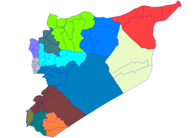
 Al-Haffah Location in Syria | |
| Coordinates: 35°35′55″N 36°2′6″E | |
| Country | |
| Governorate | Latakia Governorate |
| District | Al-Haffah District |
| Nahiyah | Al-Haffah |
| Elevation | 310 m (1,020 ft) |
| Population (2004 census) | |
| • Town | 4,298 |
| • Metro | 23,347 |
| Time zone | UTC+2 (EET) |
| • Summer (DST) | UTC+3 (EEST) |
The residents of al-Haffa are largely involved in agriculture. The town produces many types of fruits such as olive, fig, pomegranate, apple and pear.
History
Al-Haffa is surrounded with mountains and located just 7 km to the west of Salah Ed-Din Castle, a UNESCO World Heritage Site. The area has an ancient history starting with the settlement of the Phoenicians. Later on, it became a strategic point for the invading Crusaders.
Syrian geographer Yaqut al-Hamawi visited al-Haffah in the early 13th-century, during Ayyubid rule, and noted that it was a district to the west of Halab (Aleppo), comprising many villages. The cloths called Haffiyyah come from here ..."[4]
In 1919 al-Haffah was part of the mini-revolt led by Umar al-Bitar in the Sahyun region of which al-Haffah was the center.[5] Around this time, it joined the revolt of Saleh al-Ali which was in alliance with al-Bitar.[6]
From 5 to 13 June 2012, the town was involved in the Battle of Al-Haffah as part of the Syrian uprising, during which nearly entire population fled the city.[7]
References
- General Census of Population and Housing 2004. Syria Central Bureau of Statistics (CBS). Latakia Governorate. (in Arabic)
- Morris, Loveday. Fears grow of new massacre as UN warns of civil war in Syria. The Independent. 2012-06-13. Retrieved on 2012-06-13.
- Balanche, 2006, p. 88.
- le Strange, 1890, p. 445.
- Choueiri, 1993, p. 19.
- Moosa, 1987, p. 283.
- The ghost town of Syria: Haunting pictures from the place abandoned by 26,000 as it was shelled to smithereens
Bibliography
- Balanche, Fabrice (2006). La région alaouite et le pouvoir syrien (in French). Karthala Editions. ISBN 2845868189.
- Choueiri, Youssef M. (1993). State and society in Syria and Lebanon. University of Exeter Press. ISBN 085989410X.
- Moosa, Matti (1987). Extremist Shiites: The Ghulat Sects. Syracuse University Press. ISBN 0-8156-2411-5.
- le Strange, Guy (1890). Palestine Under the Moslems: A Description of Syria and the Holy Land from A.D. 650 to 1500. Committee of the Palestine Exploration Fund.
Capital: Latakia | |||||
| |||||
| |||||