Al-Busayrah
Al-Busayrah (Arabic: البصيرة) is a town in eastern Syria, administratively part of the Deir ez-Zor Governorate. The town is located, at the confluence of the Euphrates and Khabur Rivers, southeast of Deir ez-Zor. Nearby localities include Muhassan to the northwest and al-Asharah, Mayadin and Hajin to the southeast. According to the Syria Central Bureau of Statistics (CBS), Al-Busayrah had a population of 6,199 in the 2004 census.[1] The town was known by its Latin name, Circesium, under the Romans.
Al-Busayrah البصيرة | |
|---|---|
Town | |
 Al-Busayrah | |
| Coordinates: 35°09′20″N 40°25′33″E | |
| Country | |
| Governorate | Deir ez-Zor Governorate |
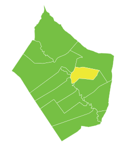
| District | Deir ez-Zor District |
| Nahiyah | Al-Busayrah |
| Population (2004 census)[1] | |
| • Total | 6,199 |
| Time zone | UTC+2 (EET) |
| • Summer (DST) | UTC+3 (EEST) |
During the Syrian Civil War, the city was occupied by ISIL until the SDF captured it on 12 November 2017.[2]
Climate
In Al-Busayrah, there is a desert climate. Most rain falls in the winter. The Köppen-Geiger climate classification is BWh. The average annual temperature in Al-Busayrah is 20.2 °C (68.4 °F). About 154 mm (6.06 in) of precipitation falls annually.
| Climate data for Al-Busayrah | |||||||||||||
|---|---|---|---|---|---|---|---|---|---|---|---|---|---|
| Month | Jan | Feb | Mar | Apr | May | Jun | Jul | Aug | Sep | Oct | Nov | Dec | Year |
| Average high °C (°F) | 13.1 (55.6) |
15.9 (60.6) |
20.2 (68.4) |
25.9 (78.6) |
32.1 (89.8) |
37.6 (99.7) |
40.5 (104.9) |
40.4 (104.7) |
35.8 (96.4) |
29.7 (85.5) |
21.6 (70.9) |
14.9 (58.8) |
27.3 (81.2) |
| Average low °C (°F) | 2.7 (36.9) |
3.9 (39.0) |
7.0 (44.6) |
11.6 (52.9) |
16.7 (62.1) |
21.5 (70.7) |
24.4 (75.9) |
24.2 (75.6) |
19.5 (67.1) |
13.9 (57.0) |
7.7 (45.9) |
3.8 (38.8) |
13.1 (55.5) |
| Average precipitation mm (inches) | 29 (1.1) |
24 (0.9) |
25 (1.0) |
22 (0.9) |
9 (0.4) |
0 (0) |
0 (0) |
0 (0) |
1 (0.0) |
7 (0.3) |
12 (0.5) |
25 (1.0) |
154 (6.1) |
| Source: Climate-Data.org, Climate data | |||||||||||||
References
- General Census of Population and Housing 2004. Syria Central Bureau of Statistics (CBS). Deir al-Zor Governorate. (in Arabic)
- "Syrian Democratic Forces, SDF captured Al Busayrah in Deir ez Zor region which is at the right side of the Khabour river". Liveuamap. 12 November 2017. Retrieved 21 June 2019.
Capital: Deir ez-Zor | |||||||
| |||||||
| |||||||
| |||||||