Acadia Valley
Acadia Valley is a hamlet in southeast Alberta within the Municipal District (M.D.) of Acadia No. 34.[3] The M.D. of Acadia No. 34's municipal office is located in Acadia Valley.
Acadia Valley | |
|---|---|
.jpg) | |
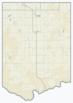 Location in M.D. of Acadia  Location in Alberta | |
| Coordinates: 51.1569°N 110.2097°W | |
| Country | Canada |
| Province | Alberta |
| Planning region | Red Deer |
| Municipal district | M.D. of Acadia No. 34 |
| Government | |
| • Type | Unincorporated |
| • Governing body | M.D. of Acadia No. 34 Council |
| Area | |
| • Land | 0.47 km2 (0.18 sq mi) |
| Elevation | 716 m (2,349 ft) |
| Population (2016)[1] | |
| • Total | 149 |
| Time zone | UTC-7 (MST) |
Acadia Valley is located along Highway 41 commonly referred to as Buffalo Trail between Oyen and Medicine Hat and sits about 14.5 km (9.0 mi) west of the Alberta-Saskatchewan border. Acadia Valley sits at a elevation of 716 m (2,349 ft).
The hamlet is located within census division No. 4.
Demographics
As a designated place in the 2016 Census of Population conducted by Statistics Canada, Acadia Valley recorded a population of 149 living in 71 of its 82 total private dwellings, a change of 8.8% from its 2011 population of 137. With a land area of 0.47 km2 (0.18 sq mi), it had a population density of 317.0/km2 (821.1/sq mi) in 2016.[1]
As a designated place in the 2011 Census, Acadia Valley had a population of 137 living in 59 of its 63 total dwellings, a -2.1% change from its 2006 population of 140. With a land area of 0.48 km2 (0.19 sq mi), it had a population density of 285/km2 (739/sq mi) in 2011.[4]
Attractions
- Prairie Elevator Museum[5]
- Acadia Municipal Recreation Dam - trout fishing
See also
References
- "Population and dwelling counts, for Canada, provinces and territories, and designated places, 2016 and 2011 censuses – 100% data (Alberta)". Statistics Canada. February 8, 2017. Retrieved February 13, 2017.
- "Alberta Private Sewage Systems 2009 Standard of Practice Handbook: Appendix A.3 Alberta Design Data (A.3.A. Alberta Climate Design Data by Town)" (PDF) (PDF). Safety Codes Council. January 2012. pp. 212–215 (PDF pages 226–229). Retrieved October 8, 2013.
- Alberta Municipal Affairs (2010-04-01). "Specialized and Rural Municipalities and Their Communities" (PDF). Archived from the original (PDF) on 2012-02-29. Retrieved 2010-06-20.
- "Population and dwelling counts, for Canada, provinces and territories, and designated places, 2011 and 2006 censuses (Alberta)". Statistics Canada. 2012-02-08. Retrieved 2012-04-06.
- M.D. of Acadia No. 34 - Points of Interest
External links
- Hamlet of Acadia Valley from the M.D. of Acadia No. 34 official web site
| Cities | |
|---|---|
| Towns | |
| Villages | |
| Hamlets |
|
| Summer villages |
|
| Municipal districts | |
| Special areas | |
| Indian reserves | |
| Other topics |
|