Dorothy, Alberta
Dorothy is a hamlet in southern Alberta, Canada within Special Area No. 2.[1][2] It is located approximately 21 kilometres (13 mi) east of Highway 56 and 85 kilometres (53 mi) northwest of Brooks.
Dorothy | |
|---|---|
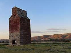 Dorothy grain elevator at sunrise | |
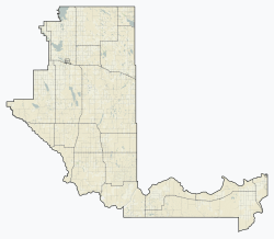 Dorothy Location in Special Area No. 2  Dorothy Location in Alberta | |
| Coordinates: 51°16′45″N 112°19′30″W | |
| Country | Canada |
| Province | Alberta |
| Planning region | Red Deer |
| Special area | 2 |
| Government | |
| • Type | Unincorporated |
| • Governing body | Special Areas Board |
| Time zone | UTC-7 (MST) |
The community was named for Dorothy Wilson, a young girl that lived in the area at the time the post office opened.[3]
Dorothy is home to two former churches, a United Church that was in service between 1932 and 1961, and Our Lady of Perpetual Help Roman Catholic Church[4] that was in service between 1944 and 1967. They hosted numerous social events for the area.[5]
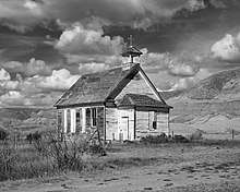
Catholic church located in Dorothy, Alberta
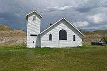
United Church located in Dorothy, Alberta
References
- Alberta Municipal Affairs (2010-04-01). "Specialized and Rural Municipalities and Their Communities" (PDF). Archived from the original (PDF) on 2012-02-29. Retrieved 2010-07-11.
- Statistics Canada (2010-03-05). "Standard Geographical Classification 2006 – Special Area No. 2, geographical codes and localities, 2006". Archived from the original on 2011-07-06. Retrieved 2010-07-11.
- Place-names of Alberta. Ottawa: Geographic Board of Canada. 1928. p. 43.
- "Simon Wroot's Studio". Archived from the original on 2013-04-10. Retrieved 2013-03-27.
- "Ghost Towns of Alberta". Retrieved 2013-03-11.
External links

This article is issued from Wikipedia. The text is licensed under Creative Commons - Attribution - Sharealike. Additional terms may apply for the media files.