53rd parallel north

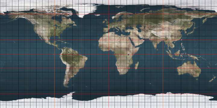
The 53rd parallel north is a circle of latitude that is 53 degrees north of the Earth's equatorial plane. It crosses Europe, Asia, the Pacific Ocean, North America, and the Atlantic Ocean.

53°
53rd parallel north

At this latitude the sun is visible for 16 hours, 56 minutes during the summer solstice and 7 hours, 34 minutes during the winter solstice.[1]

One minute of longitude along the 53rd parallel is approximately 0.6042 nautical miles (0.6953 mi; 1.119 km).

European countries entirely north of 53° N

Around the world

Starting at the Prime Meridian (northeast of Boston, Lincolnshire, England) and heading eastwards, the parallel 53° north passes through:

Co-ordinates Country, territory or sea Notes
53°0′N 0°0′E  United Kingdom England
53°0′N 0°8′E North Sea
53°0′N 4°43′E  Netherlands Island of Texel (Province of North Holland)
53°0′N 4°47′E Wadden Sea
53°0′N 5°24′E  Netherlands Provinces of Friesland, Drenthe and Groningen
53°0′N 7°13′E  Germany Lower Saxony, Saxony-Anhalt (for about10 Km), Brandenburg
53°0′N 14°15′E  Poland West Pomeranian Voivodeship
53°0′N 23°56′E  Belarus Grodno Region
53°0′N 31°19′E  Russia Bryansk Oblast
53°0′N 61°9′E  Kazakhstan For about 10 km
53°0′N 61°18′E  Russia For about 7 km
53°0′N 61°24′E  Kazakhstan For about 12 km
53°0′N 61°35′E  Russia For about 18 km
53°0′N 61°51′E  Kazakhstan For about 4 km
53°0′N 61°54′E  Russia For about 15 km
53°0′N 62°7′E  Kazakhstan Kostanay Region
53°0′N 78°12′E  Russia Passing through Lake Baikal
53°0′N 120°26′E  People's Republic of China
53°0′N 125°41′E  Russia Amur Oblast
53°0′N 141°11′E Strait of Tartary
53°0′N 141°54′E  Russia Island of Sakhalin
53°0′N 143°17′E Sea of Okhotsk
53°0′N 156°7′E  Russia Kamchatka Peninsula
53°0′N 158°53′E Pacific Ocean
53°0′N 172°45′E  United States AlaskaAttu Island
53°0′N 172°48′E Bering Sea
53°0′N 169°45′W  United States AlaskaKagamil Island
53°0′N 169°40′W Bering Sea
53°0′N 168°55′W  United States Alaska - Umnak Island, Alaska
53°0′N 168°37′W Pacific Ocean Gulf of Alaska
53°0′N 132°23′W  Canada British ColumbiaHibben Island, Moresby Island and Louise Island
53°0′N 131°41′W Hecate Strait
53°0′N 129°41′W  Canada
53°0′N 80°50′W James Bay
53°0′N 78°58′W  Canada
53°0′N 55°46′W Atlantic Ocean
53°0′N 9°25′W  Ireland
53°0′N 6°3′W Irish Sea
53°0′N 4°26′W  United Kingdom

See also

References

This article is issued from Wikipedia. The text is licensed under Creative Commons - Attribution - Sharealike. Additional terms may apply for the media files.