24th parallel north

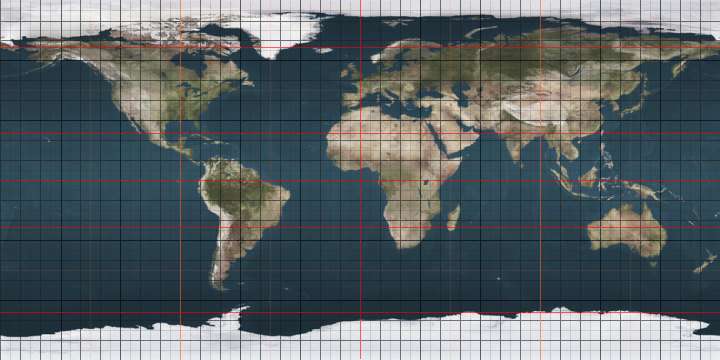
The 24th parallel north is a circle of latitude that is 24 degrees north of the Earth's equatorial plane, about 60 KM North of the Tropic of Cancer. It is the line which demarcates boundary between Pakistan and India in general area of Rann of Kutch. It also crosses Africa, Asia, the Indian Ocean, the Pacific Ocean, North America and the Atlantic Ocean.

24°
24th parallel north

At this latitude the sun is visible for 13 hours, 37 minutes during the summer solstice and 10 hours, 39 minutes during the winter solstice.[1]

Around the world

Starting at the Prime Meridian and heading eastwards, the parallel 24° north passes through:

Co-ordinates Country, territory or sea Notes
24°0′N 0°0′E  Algeria
24°0′N 11°42′E  Libya
24°0′N 25°0′E  Egypt
24°0′N 35°42′E Red Sea
24°0′N 38°9′E  Saudi Arabia Yanbu, Al Madinah Region
Riyadh Region
Eastern Region
24°0′N 51°41′E  United Arab Emirates Emirate of Abu Dhabi - for about 13 km
24°0′N 51°49′E Persian Gulf
24°0′N 52°19′E  United Arab Emirates Emirate of Abu Dhabi
24°0′N 55°35′E  Oman
24°0′N 57°6′E Indian Ocean Arabian Sea
24°0′N 67°24′E  Pakistan Sindh
24°0′N 68°45′E  India Gujarat - for about 8 km
Rajasthan - for about 12 km
Madhya Pradesh
Uttar Pradesh
Chhattisgarh
Jharkhand
West Bengal
24°0′N 88°44′E  Bangladesh For about 1 km
24°0′N 88°45′E  India West Bengal - for about 2 km
24°0′N 88°46′E  Bangladesh
24°0′N 91°22′E  India Tripura
Mizoram
24°0′N 93°20′E  Myanmar (Burma) For about 14 km
24°0′N 93°28′E  India Manipur - for about 15 km
24°0′N 93°37′E  Myanmar (Burma) For about 16 km
24°0′N 93°46′E  India Manipur
24°0′N 94°13′E  Myanmar (Burma)
24°0′N 97°36′E  People's Republic of China Yunnan, for about 28 km
24°0′N 97°53′E  Myanmar (Burma)
24°0′N 98°46′E  People's Republic of China Yunnan, Guangxi, Guangdong, and Fujian
24°0′N 117°48′E South China Sea Taiwan Strait
24°0′N 120°21′E  Taiwan Island of Taiwan
24°0′N 121°38′E Pacific Ocean Passing just south of Hateruma island,  Japan
Passing just south of South Iwo Jima island,  Japan
Passing just north of Tern Island, Hawaii,  United States
24°0′N 110°55′W  Mexico Baja California peninsula
24°0′N 109°49′W Gulf of California
24°0′N 107°4′W  Mexico
24°0′N 97°44′W Gulf of Mexico
24°0′N 80°21′W  Bahamas Cay Sal Bank atoll
24°0′N 79°50′W Atlantic Ocean
24°0′N 77°50′W  Bahamas Andros island
24°0′N 77°32′W Atlantic Ocean
24°0′N 76°20′W  Bahamas Exuma cays
24°0′N 76°19′W Atlantic Ocean Passing just south of Cat Island,  Bahamas
Passing just north of Conception Island,  Bahamas
24°0′N 74°32′W  Bahamas San Salvador Island
24°0′N 74°27′W Atlantic Ocean
24°0′N 15°40′W Western Sahara Claimed by  Morocco
24°0′N 12°0′W  Mauritania
24°0′N 6°27′W  Mali
24°0′N 3°15′W  Algeria

See also

References

This article is issued from Wikipedia. The text is licensed under Creative Commons - Attribution - Sharealike. Additional terms may apply for the media files.