Zlarin
| Zlarin | |
|---|---|
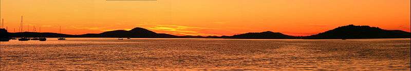
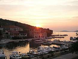 Sunset on Zlarin | |
 | |
| Coordinates: 43°41′N 15°51′E / 43.683°N 15.850°ECoordinates: 43°41′N 15°51′E / 43.683°N 15.850°E | |
| Country |
|
| County | Šibenik–Knin |
| Municipality | Šibenik |
| Area | |
| • Total | 8.19 km2 (3.16 sq mi) |
| Elevation | 174 m (571 ft) |
| Population (2011)[1] | |
| • Total | 284 |
| • Density | 35/km2 (90/sq mi) |
| Time zone | UTC+1 (CET) |
| • Summer (DST) | UTC+2 (CEST) |
| Postal code | 22232 |
| Area code(s) | (+385) 22 |
Zlarin (Italian: Slarino) is a small island of the Dalmatian coast of Croatia near the mainland city of Šibenik. Administratively, it is part of the Šibenik-Knin County. During wintertime, the island has a population of 284 people,[1] but from March to October its population grows substantially up to 1,500 people. Zlarin has a large expatriate community.
Zlarin's highest point is Klepac at 174 metres (571 feet) above sea level. During bright and sunny days from this point you can see Mount Velebit and volcanic Jabuka island in the Adriatic Sea. Zlarin has a myriad of fig and cypress trees, and other natural plants. Inner parts of the island are uninhabited and covered with thick forest. Zlarin is one of few islands on the Adriatic Sea that do not allow access to cars.
Geographical position
Zlarin is, with an area of 8.19 square kilometres (3.16 square miles), and 18.7 km (11.6 mi) of coastline,[2] the third largest island of the Šibenik archipelago, south-west from Šibenik in middle Dalmatia. It is situated a bit more than 2 kilometres (1 mile) far from the mainland. In the administrative and territorial partition of the Republic of Croatia, Zlarin belongs to the Šibenik-Knin County, more precisely to the city of Šibenik. The island is connected to the mainland cities of Šibenik and Vodice by ferry, about 10 times a day.
History
There is evidence of life on Zlarin since prehistory from Neolithic times to Roman ages. There is also evidence that Liburnians often visited and maybe lived on Zlarin.
1245. In a document called “Privilegije” from Béla IV of Hungary, the name of Zlarin is mentioned as part of the City of Šibenik.
1298. The name of Zlarin is mentioned in an official paper where the city of Šibenik gifts the entire island to the Bishop of Šibenik (until 1843).
1458. The brotherhood of Our Lady of Raselj Church has its own statute which is the first Čakavian matricula in Latin script. The legend surrounding the building of the church of Our Lady of Raselj says that the church was planned to be built on the hill of Klepac. However, some people found a picture of Our Lady on a tree near the current location of the church. They moved the picture to Klepac, but next day it disappeared and was re-discovered in the same place so they decided to build the church there. The actual date of construction is unknown but had been completed by March 1448.
1621. In the bay of Bućina a small chapel was built in which was a painting from the Tizian school.
1649. Šibenik nobles arrived in Zlarin escaping the plague epidemic.
1735. A second, bigger, church was built, on the same site, called the Assumption of Mary Church,
1810. An elementary school was opened on the island.
1826. Zlarin became the centre of the district.
1835. A cholera outbreak killed 70 of approximately 1400 inhabitants of the island.
1839. The public clock tower, the Leroj, was built.
1852. Zlarin school became the main district school.
1909. The Leroj clock was renovated.
1929. A small power plant was built.
WWII During the Second World War the inhabitants of Zlarin resisted the Fascist occupation, many of them lost their lives in the process. After the war, many Zlarinians reached high positions in the Yugoslav Army and Navy. During the war, Zlarin was bombed several times.
1956. Zlarin was connected to the energy grid of Croatia.
1972. A small telephone exchange was opened; a daily boat service to Šibenik is introduced.
1975. Zlarin has its own magazine called "Pisma s otoka" ("Letters from the island").
1976. In the most significant development project on the island, water was connected by waterway from cape Jadrija; 8 kilometres (5 miles) of the waterways are built on the island.
1977. A monument consisting of two great anchors, dedicated to all Zlarin sailors and emigrants, was erected on the second biggest pier of Zlarin's port.
1991. During the Croatian War of Independence Zlarin was bombarded for the second time in 50 years, by Serbian artillery. In a separate incident following a ballistic error, the centre of the village was hit by a cannon grenade from Žirje.
1993. The Papal nuncio opened a renovated and enlarged telephone exchange.
2000. A waste processing plant was built; primarily sponsored by Anthony Maglica, as of March 2007, it is not yet operational.
Traditions
Zlarin is famous for its red corals. In summer, when many tourists are on the island, one may witness a ceremony that is held for sailors who are going to the sea at night to find corals. Dalmatian songs are sung, and men and women are dressed in folk costumes typical of the area. The ceremony is held to wish luck to the sailors.
Traditional clothes are usually made of light fabric with three different colors, black, red and white. Women's clothes are profusely decorated. It is customary to wear gold necklaces and earrings with folk clothes, as well as white socks and black shoes. Ladies wear knives on the back of folk clothes.
Each year the yacht club of Zlarin organizes three boat regattas, "Zlarinska regata krstaša", "Latinskin idrun na kureja" and New Year "Zlarinska regata krstaša". "Latinskin idrun na kureja" is reserved for wooden boats built on old, exclusively hand-made traditional ways, and propelled by Latin sail (mainsail, triangular sail).
2006. Latinskin idrun na kureja regatta
 Leut
Leut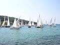 Latin regatta1
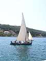 Latin regatta2
Notable people from Zlarin
- Anthony Maglica, entrepreneur, founder of Maglite
- Ivica Matković (Ustaša) (1913–1945), Ustaša concentration camp commandant
- Jagoda Kaloper, painter, actress
- Vesna Parun, poet
Pictures of Zlarin
 Zlarin's Sailors monument
 The Leroj
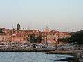
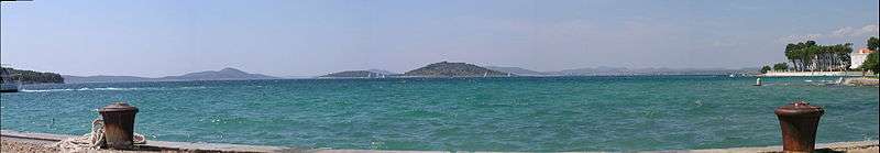
 Beautiful view of Zlarin from Zablaće
References
- 1 2 "Population by Age and Sex, by Settlements, 2011 Census: Zlarin". Census of Population, Households and Dwellings 2011. Zagreb: Croatian Bureau of Statistics. December 2012.
- ↑ Duplančić Leder, Tea; Ujević, Tin; Čala, Mendi (June 2004). "Coastline lengths and areas of islands in the Croatian part of the Adriatic Sea determined from the topographic maps at the scale of 1 : 25 000" (PDF). Geoadria. Zadar. 9 (1): 5–32. Retrieved 2011-01-21.
External links
| Wikimedia Commons has media related to Zlarin. |
- Zlarin Tourist Board (in Croatian) (in English) (in German) (in Italian)
- Zlarin Portal Site
- "Urbanistički plan uređenja Zlarina" (PDF) (in Croatian). City of Šibenik. April 2009. Retrieved 2013-06-05.