Yarmolyntsi
| Yarmolyntsi Ярмолинці Jarmolińce Jarmolynzi | ||
|---|---|---|
| Urban-type settlement | ||
| ||
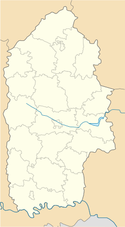 Yarmolyntsi Location of Yarmolyntsi in Khmelnytskyi Oblast  Yarmolyntsi Yarmolyntsi (Ukraine) | ||
| Coordinates: 49°11′33″N 26°50′23″E / 49.19250°N 26.83972°ECoordinates: 49°11′33″N 26°50′23″E / 49.19250°N 26.83972°E | ||
| Country |
| |
| Province |
| |
| Raion | Yarmolyntsi Raion | |
| Founded | 1400 | |
| Town status | 1958 | |
| Government | ||
| • Town Head | Viktor Khoptyar [1] | |
| Area | ||
| • Total | 4.46 km2 (1.72 sq mi) | |
| Elevation[2] | 341 m (1,119 ft) | |
| Population (2012) | ||
| • Total |
| |
| Time zone | UTC+2 (EET) | |
| • Summer (DST) | UTC+3 (EEST) | |
| Postal code | 32100 | |
| Area code | +380 3853 | |
| Website | http://rada.gov.ua/ | |

Yarmolyntsi (Ukrainian: Ярмолинці; Jarmolynzi, Jarmolińce) is an urban-type settlement in the Khmelnytskyi Oblast in western Ukraine.[1] It serves as the administrative center of the Yarmolyntsi Raion (district), housing the district's local administration buildings. The town's population was 8,806 as of the 2001 Ukrainian Census[1] and 7,954 in 2011.[3]
The settlement was first founded in 1400. It received the Magdeburg rights in 1455. Yarmolyntsi has had the status of an urban-type settlement since 1958.[1]
References
- 1 2 3 4 "Yarmolyntsi, Khmelnytskyi Oblast, Yarmolyntsi Raion". Regions of Ukraine and their Structure (in Ukrainian). Verkhovna Rada of Ukraine. Retrieved 12 March 2013.
- ↑ "Yarmolyntsi (Khmelnytskyi Oblast, Yarmolyntsi Raion)". weather.in.ua. Retrieved 12 March 2013.
- ↑ "Actual Population of Ukraine on January 1, 2011" (PDF). State Statistics Committee of Ukraine (in Ukrainian). Main Statistical Office in L'viv region. Retrieved 12 March 2013.
External links
- The murder of the Jews of Yarmolyntsi during World War II, at Yad Vashem website.
| Raions | |||||
|---|---|---|---|---|---|
| Cities |
| ||||
| |||||
This article is issued from
Wikipedia.
The text is licensed under Creative Commons - Attribution - Sharealike.
Additional terms may apply for the media files.