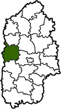
Volochysk Raion
| Volochysk Raion Волочи́ський район | |||
|---|---|---|---|
| Raion | |||
| |||
 | |||
| Country |
| ||
| Region | Khmelnytskyi Oblast | ||
| Established | 1923 | ||
| Admin. center | Volochysk | ||
| Subdivisions |
List
| ||
| Government | |||
| • Governor | Paziuk Serhii Mykolaiovych | ||
| Area | |||
| • Total | 1,103 km2 (426 sq mi) | ||
| Population | |||
| • Total | 50,382 | ||
| • Density | 46/km2 (120/sq mi) | ||
| Time zone | UTC+2 (EET) | ||
| • Summer (DST) | UTC+3 (EEST) | ||
| Postal index | 31200-31274 | ||
| Area code | 380-3845 | ||
| Website | Volochysk District Council website | ||
Volochysk Raion (Ukrainian: Волочи́ський район) is a raion (administrative district) of the Khmelnytskyi Oblast. As of 2004, its population is 58,900, its area is 1,103 square kilometres, and the administrative center is Volochysk. The population of the Volochysky Raion: (as of 2004) was 58,900, (as January 1, 2018) was 50382[1]
Geography
Volochysk Raion is south of Teofipol Raion, west of Krasyliv Raion and Khmelnytskyi, north of Horodok Raion, and east of Ternopil Oblast.
The Buzhok, Grabarka, Zbruch, Sluch, Ushuka and other rivers flow through the district. The district is the source of the Southern Bug River (near the village Kholodets). There is a rail line through the district as well as the Uzhhorod-Ternopil-Kropyvnytskyi-Donetsk E50 highway. Two gas pipelines run through the district, Dashava-Kiev and Kiev-Western Ukraine.
History
There are more than 70 archaeological sites in the district. The sites include Paleolithic, Mesolithic, Bronze Age, Early Iron Age, Chernyakhov culture and Kievan Rus' settlements.
From 1923 to 1932 the district was part of the Proskuriv region, then from 1932 to 1937 it was part of the Vinnytsia region. Following that from 1937 to 1954 it was part of the Kamenets Podolsk region. Since 1954 it has been part of the Khmelnytskyi region.
During the 1930s collectivization of farms was enforced under Soviet rule. By June 10, 1932, 83.4% of the farms in the district had been collectivized. By 1935 the process was complete and there were no longer any privately owned farms. In 1932 an agricultural college was opened which trained students in agronomy and animal husbandry. On March 1, 1930 a communist newspaper “Dawn” began publication. In 1934 a library for adults was opened and in 1937 a children's library followed.
During World War II there was a heavy loss of life and property in the district. Thousands of residents were killed or transported to Germany to labor camps. After the war the property losses were estimated at 107.8 million rubles, based on prewar values.
Administrative divisions
The Volochysk Raion consists of 1 city (Volochysk), 2 towns (Viitivtsi and Narkevychi), and 85 villages. The villages of the Volochysk Raion include:
|
|
|
|
|
|
|
References
- ↑ "5. Чисельність наявного населення в розрізі регіонів, районів, міст, селищ міського типу (за оцінкою)". Chyselnist' nayavnoho naselennya Ukrayiny na 1 sichnya 2018 roku Чисельність наявного населення України на 1 січня 2018 року [The number of available population of Ukraine as of January 1, 2018] (PDF). State Statistics Service of Ukraine (Report) (in Ukranian). Kyiv. 2018-06-11. p. 73. ISBN 978-966-8459-82-5. Retrieved 2018-08-02.
External links
- (in Ukrainian) Volochysk District Council website
- (in Ukrainian) Khmelnitskyi Oblast Electoral Districts Listing
Administrative geographic location | |
|---|---|
| Raions | |||||
|---|---|---|---|---|---|
| Cities |
| ||||
| |||||