Khmelnytskyi Raion
| Khmelnytskyi Raion Хмельницький район | |||
|---|---|---|---|
| Raion | |||
| |||
 | |||
| Coordinates: 49°31′06″N 26°58′27″E / 49.51833°N 26.97417°ECoordinates: 49°31′06″N 26°58′27″E / 49.51833°N 26.97417°E | |||
| Country |
| ||
| Region | Khmelnytskyi Oblast | ||
| Established | January 4, 1965 | ||
| Admin. center | Khmelnytskyi | ||
| Subdivisions |
List
| ||
| Government | |||
| • Governor | Kateryna Andriychuk[1] (PR) | ||
| Area | |||
| • Total | 1,220 km2 (470 sq mi) | ||
| Population (2012) | |||
| • Total |
| ||
| Time zone | UTC+2 (EET) | ||
| • Summer (DST) | UTC+3 (EEST) | ||
| Postal index | 31301—31364 | ||
| Area code | +380 382 | ||
| Website | http://khmeladmin.org.ua | ||


Khmelnytskyi Raion (Ukrainian: Хмельницький район, Khmel'nyts'kyi raion) is one of the 20 administrative raions (a district) of the Khmelnytskyi Oblast in western Ukraine. Its administrative center is located in the city of Khmelnytskyi. Even though the city of Khmelnytskyi is separate from the raion's government, it still serves as its administrative center in addition to its role as that of the Khmelnytskyi Oblast's administrative center. Its population was 53,686 in the 2001 Ukrainian Census[1] and 52,906 as of 2012.
Geography
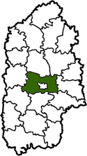
The Khmelnytskyi Raion is located in the central part of the Khmelnytskyi Oblast, corresponding to the modern-day boundaries of the Volhynia and Podolia historical regions. One of the main rivers that runs through the raion is the Southern Bug. Geographically, the Khmelnytskyi Raion completely surrounds the Khmelnytskyi City Municipality forming an enclave.
History
The Khmelnytskyi Raion was established on January 4, 1965 out of a combination of village councils from the Krasyliv Raion, Letychiv Raion, Yarmolyntsi Raion, Horodok Raion, and Volochysk Raions.[2]
Administrative divisions
The Khmelnytskyi Raion is divided in a way that follows the general administrative scheme in Ukraine. Local government is also organized along a similar scheme nationwide. Consequently, raions are subdivided into councils, which are the prime level of administrative division in the country.
Each of the raion's urban localities administer their own councils, often containing a few other villages within its jurisdiction. However, only a handful of rural localities are organized into councils, which also may contain a few villages within its jurisdiction.
Accordingly, the Khmelnytskyi Raion is divided into:[1]
- 1 settlement council—made up of the urban-type settlement of Chornyi Ostriv
- 38 village councils
Overall, the raion has a total of 78 populated localities, consisting of one urban-type settlement, 76 villages, and one rural settlement.[1]
References
- 1 2 3 4 "Krasyliv Raion, Khmelnytskyi Oblast". Regions of Ukraine and their Structure (in Ukrainian). Verkhovna Rada of Ukraine. Retrieved 7 January 2013.
- ↑ "Information card about the district". Official website of the Khmelnytskyi Raion State Administration (in Ukrainian). Archived from the original on 18 July 2012. Retrieved 7 January 2013.
External links
- "Main Page". Khmelnytskyi Raion State Administration (in Ukrainian). Retrieved 7 January 2013.
Administrative geographic location | |
|---|---|
| Raions | |||||
|---|---|---|---|---|---|
| Cities |
| ||||
| |||||