Derazhnia Raion
| Derazhnia Raion Деражнянський район | |||
|---|---|---|---|
| Raion | |||
| |||
 | |||
| Coordinates: 49°13′13″N 27°27′52″E / 49.22028°N 27.46444°ECoordinates: 49°13′13″N 27°27′52″E / 49.22028°N 27.46444°E | |||
| Country |
| ||
| Region | Khmelnytskyi Oblast | ||
| Established | March 7, 1923 | ||
| Admin. center | Derazhnia | ||
| Subdivisions |
List
| ||
| Government | |||
| • Governor | Liudmila Striletska[1] (PR) | ||
| Area | |||
| • Total | 910 km2 (350 sq mi) | ||
| Population (2012) | |||
| • Total |
| ||
| Time zone | UTC+2 (EET) | ||
| • Summer (DST) | UTC+3 (EEST) | ||
| Postal index | 32200—32264 | ||
| Area code | +380 3856 | ||


Derazhnia Raion (Ukrainian: Деражнянський район, Derazhnians'kyi raion) is one of the 20 administrative raions (a district) of the Khmelnytskyi Oblast in western Ukraine. Its administrative center is located in the city of Derazhnia. Its population was 38,289 in the 2001 Ukrainian Census[1] and 32,955 in 2012.
Geography
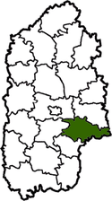
The Derazhnia Raion is located in the central-eastern part of the Khmelnytskyi Oblast, corresponding to the modern-day boundaries of the Podolia historical region.[2] Its total area constitutes 910 square kilometres (350 sq mi). To its south and east, the raion borders upon the neighboring Vinnytsia and Zhytomyr Oblasts, respectfully.
History
The Derazhnia Raion was first established on March 7, 1923 as part of a full-scale administrative reorganization of the Ukrainian Soviet Socialist Republic.[3] During the same reorganization the Vovkovyntsi Raion was created with its administrative center in Vovkovyntsi, which existed until it was merged with the Derazhnia Raion in 1958.[3]
Administrative divisions
The Derazhnia Raion is divided in a way that follows the general administrative scheme in Ukraine. Local government is also organized along a similar scheme nationwide. Consequently, raions are subdivided into councils, which are the prime level of administrative division in the country.
Each of the raion's urban localities administer their own councils, often containing a few other villages within its jurisdiction. However, only a handful of rural localities are organized into councils, which also may contain a few villages within its jurisdiction.
Accordingly, the Derazhnia Raion is divided into:[1][2]
- 1 city council—made up of the city of Derazhnia (administrative center)
- 2 settlement councils—made up of the urban-type settlements of Vovkovyntsi and Lozove
- 27 village councils
Overall, the raion has a total of 62 populated localities, consisting of one city, two urban-type settlements, and 59 villages.[1][2]
References
- 1 2 3 4 "Derazhnia Raion, Khmelnytskyi Oblast". Regions of Ukraine and their Structure (in Ukrainian). Verkhovna Rada of Ukraine. Retrieved 10 January 2013.
- 1 2 3 "Geographical statistics of the Derazhnia Raion". Derazhnia Raion Administration (in Ukrainian). Retrieved 11 January 2013.
- 1 2 "Short historical reference of the Derazhnia Raion". Derazhnia Raion Administration (in Ukrainian). Retrieved 11 January 2013.
External links
| Wikimedia Commons has media related to Derazhnia Raion. |
- "Main Page". Derazhnia Raion Administration (in Ukrainian). Retrieved 11 January 2013.
Administrative geographic location | |
|---|---|
| Cities | ||
|---|---|---|
| Urban-type settlements | ||
| Villages |
| |
| Raions | |||||
|---|---|---|---|---|---|
| Cities |
| ||||
| |||||