Xinzhou District, Wuhan
| Xinzhou 新洲区 | ||||||||||||||||||||||||||||||||||||
|---|---|---|---|---|---|---|---|---|---|---|---|---|---|---|---|---|---|---|---|---|---|---|---|---|---|---|---|---|---|---|---|---|---|---|---|---|
| District | ||||||||||||||||||||||||||||||||||||
 | ||||||||||||||||||||||||||||||||||||
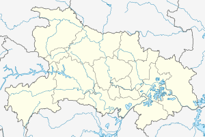 Xinzhou Location in Hubei | ||||||||||||||||||||||||||||||||||||
| Coordinates: 30°50′08″N 114°47′08″E / 30.8356°N 114.7855°ECoordinates: 30°50′08″N 114°47′08″E / 30.8356°N 114.7855°E[1] | ||||||||||||||||||||||||||||||||||||
| Country | People's Republic of China | |||||||||||||||||||||||||||||||||||
| Province | Hubei | |||||||||||||||||||||||||||||||||||
| Sub-provincial city | Wuhan | |||||||||||||||||||||||||||||||||||
| Area[2] | ||||||||||||||||||||||||||||||||||||
| • Total | 1,500.00 km2 (579.15 sq mi) | |||||||||||||||||||||||||||||||||||
| Population (2010)[3] | ||||||||||||||||||||||||||||||||||||
| • Total | 848,760 | |||||||||||||||||||||||||||||||||||
| • Density | 566/km2 (1,470/sq mi) | |||||||||||||||||||||||||||||||||||
| Time zone | UTC+8 (China Standard) | |||||||||||||||||||||||||||||||||||
| Postal code | 4314XX[4] | |||||||||||||||||||||||||||||||||||
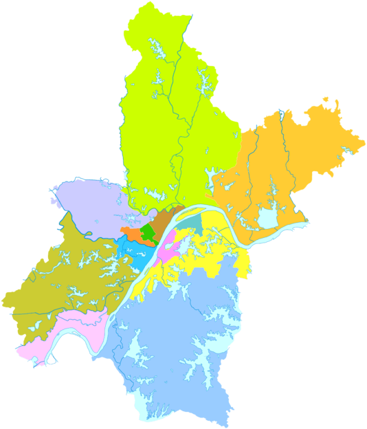
| Wuhan district map |
| |||||||||||||||||||||||||||||||||||
| Website | http://www.whxinzhou.gov.cn/ | |||||||||||||||||||||||||||||||||||
Xinzhou (Chinese: 新洲; pinyin: Xīnzhōu) is one of the 13 districts of Wuhan, the capital of Hubei province, People's Republic of China, covering part of the city's northeastern suburbs and situated on the northern (left) bank of the Yangtze River. It is also the easternmost of Wuhan's districts. It borders the districts of Hongshan to the southwest and Huangpi to the west, as well as the prefecture-level cities of Huanggang to the north and east and Ezhou to the south.
The Wuhan Yangluo Airfield (武汉阳逻机场) is located in Xinzhou District.
Geography
Administrative divisions
Xinzhou District administers:[5][6][7]
| Name (translation) | Chinese (S) |
|---|---|
| Zhucheng Subdistrict | 邾城街道 |
| Yangluo Subdistrict | 阳逻街道 |
| Cangbu Subdistrict | 仓埠街道 |
| Wangji Subdistrict | 汪集街道 |
| Liji Subdistrict | 李集街道 |
| Sandian Subdistrict | 三店街道 |
| Pantang Subdistrict | 潘塘街道 |
| Jiujie Subdistrict Old Street | 旧街街道 |
| Shuangliu Subdistrict | 双柳街道 |
| Zhangduhu Subdistrict | 涨渡湖街道 |
| Xinchong Subdistrict | 辛冲街道 |
| Xugu Subdistrict | 徐古街道 |
| Fenghuang Township Phoenix | 凤凰镇 |
| Daoguanhe Office | 道观河风景旅游管理处 |
| Yangluo Development Zone | 阳逻开发区 |
References
- ↑ Google (2014-07-02). "Xinzhou" (Map). Google Maps. Google. Retrieved 2014-07-02.
- ↑ "Wuhan Statistical Yearbook 2010" (PDF). Wuhan Statistics Bureau. p. 15. Archived from the original (PDF) on November 5, 2011. Retrieved 2011-07-31.
- ↑ "武汉市2010年第六次全国人口普查主要数据公报". Wuhan Statistics Bureau. 2011-05-11. Archived from the original on 2011-10-25. Retrieved 2011-06-11.
- ↑ "Xinzhou District, Wuhan City, Hubei Province (湖北省武汉市新洲区): 431400". Retrieved 2015-04-24.
- ↑ "新洲区行政区划" (in Simplified Chinese). 武汉市新洲区电子政务网络中心. 19 April 2017. Retrieved 21 December 2017.
邾城街 阳逻街 仓埠街 汪集街 李集街 三店街 潘塘街 旧街街 双柳街 涨渡湖 辛冲街 徐古街 凤凰镇
- ↑ "新洲区历史沿革 (translation: The Historical Development of Xinzhou District" (in Simplified Chinese). 行政区划网站 (translation: Administrative Divisions Website). 28 May 2015. Retrieved 21 December 2017.
2015年,撤销辛冲镇,设立辛冲街道(鄂民政函[2015]157号,武民政[2015]39号);撤销徐古镇,设立徐古街道(鄂民政函[2015]156号,武民政[2015]40号)。调整后,全区辖12个街道、1个镇:邾城街道、阳逻街道、仓埠街道、汪集街道、李集街道、三店街道、潘塘街道、旧街街道、双柳街道、涨渡湖街道、辛冲街道、徐古街道、凤凰镇,以及道观河风景旅游管理处、阳逻开发区。
- ↑ 2016年统计用区划代码和城乡划分代码:新洲区 [2016 Statistical Area Numbers and Rural-Urban Area Numbers: Xinzhou District]. National Bureau of Statistics of the People's Republic of China. 2016. Retrieved 21 June 2018.
统计用区划代码 名称 420117001000 邾城街道办事处 420117002000 阳逻街道办事处 420117003000 仓埠街道办事处 420117004000 汪集街道办事处 420117005000 李集街道办事处 420117006000 三店街道办事处 420117007000 潘塘街道办事处 420117008000 旧街街道办事处 420117009000 双柳街道办事处 420117010000 涨渡湖街道办事处 420117011000 辛冲街道办事处 420117012000 徐古街道办事处 420117102000 凤凰镇 420117400000 道观河风景旅游管理处 420117406000 新洲原种场
This article is issued from
Wikipedia.
The text is licensed under Creative Commons - Attribution - Sharealike.
Additional terms may apply for the media files.