Huangpi District
| Huangpi 黄陂区 | ||||||||||||||||||||||||||||||||||||
|---|---|---|---|---|---|---|---|---|---|---|---|---|---|---|---|---|---|---|---|---|---|---|---|---|---|---|---|---|---|---|---|---|---|---|---|---|
| District | ||||||||||||||||||||||||||||||||||||
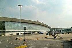 Wuhan Tianhe Airport | ||||||||||||||||||||||||||||||||||||
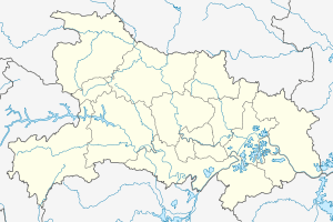 Huangpi Location in Hubei | ||||||||||||||||||||||||||||||||||||
| Coordinates: 30°52′30″N 114°22′30″E / 30.8750°N 114.3750°ECoordinates: 30°52′30″N 114°22′30″E / 30.8750°N 114.3750°E[1] | ||||||||||||||||||||||||||||||||||||
| Country | People's Republic of China | |||||||||||||||||||||||||||||||||||
| Province | Hubei | |||||||||||||||||||||||||||||||||||
| Sub-provincial city | Wuhan | |||||||||||||||||||||||||||||||||||
| Area[2] | ||||||||||||||||||||||||||||||||||||
| • Total | 2,261.00 km2 (872.98 sq mi) | |||||||||||||||||||||||||||||||||||
| Population (2010)[3] | ||||||||||||||||||||||||||||||||||||
| • Total | 874,938 | |||||||||||||||||||||||||||||||||||
| • Density | 387/km2 (1,000/sq mi) | |||||||||||||||||||||||||||||||||||
| Time zone | UTC+8 (China Standard) | |||||||||||||||||||||||||||||||||||
| Postal code | 4303XX | |||||||||||||||||||||||||||||||||||
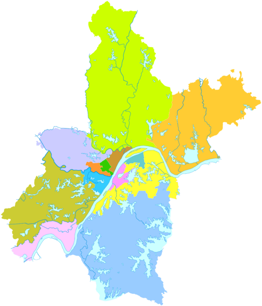
| Wuhan district map |
| |||||||||||||||||||||||||||||||||||
| Website | http://www.huangpi.gov.cn/ | |||||||||||||||||||||||||||||||||||
Huangpi District (simplified Chinese: 黄陂区; traditional Chinese: 黃陂區; pinyin: Huángpí Qū) is one of 13 districts of Wuhan, the capital of Hubei province, People's Republic of China, situated on the northern (left) bank of the Yangtze River. The Sheshui enters the Yangtze at Huangpi. The district is primarily rural, but also includes important infrastructure facilities, such as Wuhan Tianhe International Airport and Wuhan North Railway Station, which is one of the main freight stations and marshalling yards on the Beijing–Guangzhou Railway. It is the northernmost of Wuhan's districts as well as the most spacious.[2] On the left bank of the Yangtze, it borders the districts of Xinzhou to the east, and Jiang'an to the south, and Dongxihu to the southwest; on the opposite bank, it borders Hongshan. It also borders the prefecture-level cities of Huanggang to the northeast and Xiaogan to the northwest. The Sheshui (She River) enters the Yangtze River at Shekou in Huangpi.
The use of the character pi (陂) in Huangpi is cited in the Contemporary Chinese Dictionary as an example of usage of the this infrequently encountered pronunciation for the character.[4][5]
The future Wuhan–Xiaogan Intercity Railway, one of the lines of the Wuhan Metropolitan Area Intercity Railway, will serve parts of Huangpi District, in particular Wuhan Tianhe Airport. The rail line is expected to open in 2015.[6]
History
In 845 BC Marquis Wen (文侯) Huang Meng (黃孟, aka Huang Zhang (黃璋)) moved the capital of the State of Huang from Yicheng to Huangchuan (present-day Huangchuan, Henan). Huang Xi's descendants ruled State of Huang until 648 BC when it was destroyed by the State of Chu. The Marquis of Huang, Marquis Mu (穆侯) Huang Qisheng (黃企生), fled to the state of Qi. The people of Huang were forced to relocate to Chu. They settled in the region of present-day Hubei province, in a region known as the Jiangxia Prefecture (江夏郡) during the Han dynasty (206 BC-AD 220). There are many places in this region today that were named after Huang e.g. Huanggang, Huangpi, Huangmei, Huangshi, Huangan, Huangzhou etc. A large number of the people of Huang were also relocated to regions south of the Yangtze River.
Geography
Administrative divisions
Huangpi District administers:[7][8]
| Name | Chinese (S) |
|---|---|
| Qianchuan Subdistrict | 前川街道 |
| Qijiawan Subdistrict | 祁家湾街道 |
| Hengdian Subdistrict | 横店街道 |
| Luohan Subdistrict | 罗汉街道 |
| Shekou Subdistrict | 滠口街道 |
| Liuzhi Subdistrict | 六指街道 |
| Tianhe Subdistrict | 天河街道 |
| Wabgjiahe Subdistrict | 王家河街道 |
| Changxuanling Subdistrict | 长轩岭街道 |
| Lijiaji Subdistrict | 李家集街道 |
| Yaojiaji Subdistrict | 姚家集街道 |
| Caijiazha Subdistrict | 蔡家榨街道 |
| Wuhu Farm | 武湖农场 |
| Sanliqiao Subdistrict | 三里桥街道 |
| Caidian Subdistrict | 蔡店街道 |
| Mulan Township | 木兰乡 |
Notes
- ↑ Google (2014-07-02). "Huangpi" (Map). Google Maps. Google. Retrieved 2014-07-02.
- 1 2 "Wuhan Statistical Yearbook 2010" (PDF). Wuhan Statistics Bureau. p. 15. Archived from the original (PDF) on April 23, 2012.
- ↑ 武汉市2010年第六次全国人口普查主要数据公报. Wuhan Statistics Bureau. 2011-05-11. Archived from the original on 2011-10-25. Retrieved 2011-06-11.
- ↑ 中國語文 [Chinese Linguistics]. 人民教育出版社 [People's Education Press]. October 1957. p. 29.
"黄陂 (湖北) ㄏㄨㄤˊㄆㄧˊ"
- ↑ 現代漢語詞典(第七版 [Contemporary Chinese Dictionary] (7 ed.). The Commercial Press. 1 September 2016. p. 993. ISBN 978-7-100-12450-8.
陂 pí 黄陂 (Huángpí),地名,在湖北。
- ↑ 武汉至咸宁城际铁路本月28日将正式开通运营] [The Wuhan-Xianning Intercity Railway will officially open on the 28th of this month]. 2013-12-24.
- ↑ "黄陂区行政区划图 (translation: Map of the Boundaries of the Administrative Districts of Huangpi)" (in Simplified Chinese). 黄陂区电子政务网络中心 (translation: Huangpi District Digital Governing Affairs Internet Center). 19 November 2011. Retrieved 20 December 2017.
(from north to south) "蔡店乡 姚集镇 长岭镇 木兰乡 木兰山 李集镇 王河镇 罗汉街 蔡榨镇 祁家湾街 前川街 六指镇 横店街 天河街 三里镇 滠口街 武湖农场 盘龙城经济开发区" (translation: Caidian Township Yaoji Town Changling Town Mulan Township Mulan Mountain Liji Town Wanghe Town Luohan Subdistrict Caizha Subdistrict Qijiawan Subdistrict Qianchuan Subdistrict Liuzhi Town Hengdian Subdistrict Tianhe Subdistrict Sanli Town Shekou Subdistrict Wuhu Farm Panlongcheng Economic Development Zone)
- ↑ "黄陂区历史沿革 (translation: The Historical Development of Huangpi District" (in Simplified Chinese). 行政区划网站 (translation: Administrative Divisions Website). 6 August 2014. Retrieved 20 December 2017.
2010年第六次人口普查,黄陂区常住总人口874938人(包括团山部队924人),其中:前川街道190978人,祁家湾街道64228人,横店街道52988人,罗汉寺街道49793人,滠口街道42985人,六指街道62508人,天河街道25758人,王家河街道45220人,长轩岭街道32159人,李家集街道70197人,姚家集街道33669人,蔡家榨街道26228人,武湖街道35631人,三里镇15731人,蔡店乡32765人,木兰乡30039人,木兰山风景区1564人,大潭办事处3290人,盘龙城经济开发区59207人。2011年末,全区总面积2261平方千米,户籍总人口112.98万人。辖13个街道、1个镇、2个乡,65个社区、589个行政村。(武汉年鉴2012数据)2013年,撤销三里镇、蔡店乡,设立三里桥街道、蔡店街道,办事处驻地分别为银湖大道49号、蔡店西街22号。至此,全区辖15个街道、1个乡。