Winters, California
| City of Winters | |
|---|---|
| City | |
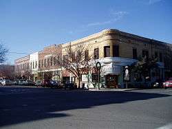 Downtown Winters | |
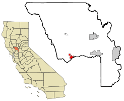 Location in Yolo County and the state of California | |
 City of Winters Location in the United States | |
| Coordinates: 38°31′30″N 121°58′15″W / 38.52500°N 121.97083°WCoordinates: 38°31′30″N 121°58′15″W / 38.52500°N 121.97083°W | |
| Country |
|
| State |
|
| County | Yolo |
| Incorporated | February 9, 1898[1] |
| Government | |
| • Mayor | Bill Biasi [2] |
| • State senator | Bill Dodd (D)[3] |
| • Assemblymember | Cecilia Aguiar-Curry (D)[3] |
| • U. S. rep. | John Garamendi (D)[4] |
| Area[5] | |
| • Total | 2.96 sq mi (7.67 km2) |
| • Land | 2.94 sq mi (7.60 km2) |
| • Water | 0.03 sq mi (0.06 km2) 0.85% |
| Elevation[6] | 135 ft (41 m) |
| Population (2010)[7] | |
| • Total | 6,624 |
| • Estimate (2016)[8] | 7,144 |
| • Density | 2,434.07/sq mi (939.86/km2) |
| Time zone | UTC−8 (Pacific) |
| • Summer (DST) | UTC−7 (PDT) |
| ZIP code | 95694 |
| Area code | 530 |
| FIPS code | 06-86034 |
| GNIS feature IDs | 1652656, 2412288 |
| Website |
www |
Winters is a city in rural Yolo County and the western Sacramento Valley, in northern California.
The estimated population of Winters was 7,034 as of July 2015. It is part of the Sacramento–Arden-Arcade–Yuba City, CA-NV Combined Statistical Area.
Geography
Winters is a small city located on Putah Creek in the western Sacramento Valley, near the northeastern Vaca Mountains foothills.
It is situated along Interstate 505, 11 miles (18 km) from Vacaville. Winters is nearly 30 miles (50 km) from Sacramento and about 60 miles (100 km) from San Francisco, California. It is located at 38°31′30″N 121°58′15″W / 38.52500°N 121.97083°W.[9]
According to the United States Census Bureau, the city has a total area of 2.9 square miles (7.5 km2), of which, 2.9 square miles (7.5 km2) of it is land and 0.03 square miles (0.078 km2) of it (0.85%) is water.
History
William Wolfskill, a Kentucky immigrant to Mexican Alta California, received a Mexican land grant for Rancho Rio de los Putos in 1842 by Governor Juan Bautista Alvarado. His brother, John Reid Wolfskill, started the agricultural development of the Sacramento Valley by planting orchards and vineyards on his lands.[10] In 1849, William Wolfskill transferred half of Rancho Rio de los Putos to John Wolfskill, and transferred the rest to his brother in 1854.[11]
The Winters post office was established in 1875.[12] Winters incorporated in 1898.[12] The name honors Theodore Winters, whose ranch provided half of the town's land.[12]
In 1935, Wolfskill's heirs deeded 100 acres of the Wolfskill Ranch in Winters to the University of California, Davis, which had been founded in 1908. The land was to be used for an experimental orchard.[13]
Climate
Winters has hot, mostly dry summers and cool, wet winters. According to the Köppen climate classification system, Winters has a hot-summer Mediterranean climate (Csa). Average January temperatures are a maximum of 55.2 °F (12.9 °C) and a minimum of 37.0 °F (2.8 °C). Average July temperatures are a maximum of 96.7 °F (35.9 °C) and a minimum of 59.8 °F (15.4 °C). There are an average of 102.0 days with highs of 90 °F (32 °C) or higher and an average of 20.3 days with lows of 32 °F (0 °C). The record high temperature was 115 °F (46 °C) on June 16, 1961, and July 14, 1972. The record low temperature was 15 °F (−9 °C) on December 23, 1990.
Average annual precipitation is 21.94 inches (557 mm). There are an average of 64 days with measurable precipitation. The wettest year was 1983 with 47.12 inches (1,197 mm) and the driest year was 1976 with 6.60 inches (168 mm). The most rainfall in one month was 17.21 inches (437 mm) in January 1995. The most rainfall in 24 hours was 7.25 inches (184 mm) on March 29, 1907. Snowfall is a rarity in Winters, but 3.3 inches (84 mm) fell in January 1973 and 1.0 inch (25 mm) fell in December 1988.[14]
| Climate data for Winters (1906-2012) | |||||||||||||
|---|---|---|---|---|---|---|---|---|---|---|---|---|---|
| Month | Jan | Feb | Mar | Apr | May | Jun | Jul | Aug | Sep | Oct | Nov | Dec | Year |
| Record high °F (°C) | 79 (26) |
81 (27) |
92 (33) |
99 (37) |
108 (42) |
115 (46) |
115 (46) |
113 (45) |
112 (44) |
106 (41) |
90 (32) |
79 (26) |
115 (46) |
| Average high °F (°C) | 55.4 (13) |
61.6 (16.4) |
67 (19) |
74.4 (23.6) |
82.8 (28.2) |
90.5 (32.5) |
96.6 (35.9) |
95.1 (35.1) |
90.9 (32.7) |
80.6 (27) |
66.2 (19) |
56.2 (13.4) |
76.4 (24.7) |
| Average low °F (°C) | 37 (3) |
40.7 (4.8) |
43.8 (6.6) |
47.4 (8.6) |
53 (12) |
58 (14) |
59.8 (15.4) |
58.5 (14.7) |
56.7 (13.7) |
50.4 (10.2) |
42.6 (5.9) |
37.4 (3) |
48.8 (9.3) |
| Record low °F (°C) | 18 (−8) |
22 (−6) |
28 (−2) |
29 (−2) |
30 (−1) |
44 (7) |
46 (8) |
44 (7) |
42 (6) |
32 (0) |
25 (−4) |
15 (−9) |
15 (−9) |
| Average precipitation inches (mm) | 5.12 (130) |
4 (100) |
2.9 (74) |
1.21 (30.7) |
0.51 (13) |
0.14 (3.6) |
0.02 (0.5) |
0.04 (1) |
0.22 (5.6) |
1.02 (25.9) |
2.59 (65.8) |
4.19 (106.4) |
21.94 (557.3) |
| Average snowfall inches (cm) | 0.1 (0.3) |
0 (0) |
0 (0) |
0 (0) |
0 (0) |
0 (0) |
0 (0) |
0 (0) |
0 (0) |
0 (0) |
0 (0) |
0 (0) |
0.1 (0.3) |
| Average precipitation days | 12 | 10 | 9 | 5 | 3 | 1 | 0 | 0 | 1 | 3 | 8 | 11 | 63 |
| Source: WRCC[15] | |||||||||||||
Government
- Federal
- State
- City
The current elected members of the Winters City Council are:
- Mayor — Wade Cowan
- Mayor Pro-Tempore — Bill Biasi[16]
- Council Member — Jesse Loren[16]
- Council Member — Harold Anderson [16]
- Council Member — Pierre Neu[16]
Other elected/appointed city officials include:
- City Treasurer — Mike Sebastian
- City Manager — John Donlevy
Economy
Top employers
According to Winters' 2017 Comprehensive Annual Financial Report,[17] the top employers in the city are:
| # | Employer | # of Employees |
|---|---|---|
| 1 | Mariani Nut Company | 350 |
| 2 | Winters Joint Unified School District | 235 |
| 3 | Buckhorn Restaurant Group | 120 |
| 4 | Double M Trucking | 75 |
| 5 | City of Winters | 55 |
Demographics
| Historical population | |||
|---|---|---|---|
| Census | Pop. | %± | |
| 1880 | 523 | — | |
| 1900 | 785 | — | |
| 1910 | 910 | 15.9% | |
| 1920 | 903 | −0.8% | |
| 1930 | 896 | −0.8% | |
| 1940 | 1,133 | 26.5% | |
| 1950 | 1,265 | 11.7% | |
| 1960 | 1,700 | 34.4% | |
| 1970 | 2,419 | 42.3% | |
| 1980 | 2,652 | 9.6% | |
| 1990 | 4,639 | 74.9% | |
| 2000 | 6,125 | 32.0% | |
| 2010 | 6,624 | 8.1% | |
| Est. 2016 | 7,144 | [8] | 7.9% |
| U.S. Decennial Census[18] | |||
2010
The 2010 United States Census[19] reported that Winters had a population of 6,624. The population density was 2,255.2 people per square mile (870.7/km²). The racial makeup of Winters was 4,635 (70.0%) White, 43 (0.6%) African American, 56 (0.8%) Native American, 63 (1.0%) Asian, 7 (0.1%) Pacific Islander, 1,488 (22.5%) from other races, and 332 (5.0%) from two or more races. Hispanic or Latino of any race were 3,469 persons (52.4%).
The Census reported that 6,618 people (99.9% of the population) lived in households, 6 (0.1%) lived in non-institutionalized group quarters, and 0 (0%) were institutionalized.
There were 2,186 households, out of which 949 (43.4%) had children under the age of 18 living in them, 1,322 (60.5%) were opposite-sex married couples living together, 255 (11.7%) had a female householder with no husband present, 134 (6.1%) had a male householder with no wife present. There were 123 (5.6%) unmarried opposite-sex partnerships, and 16 (0.7%) same-sex married couples or partnerships. 365 households (16.7%) were made up of individuals and 134 (6.1%) had someone living alone who was 65 years of age or older. The average household size was 3.03. There were 1,711 families (78.3% of all households); the average family size was 3.40.
The population was spread out with 1,707 people (25.8%) under the age of 18, 741 people (11.2%) aged 18 to 24, 1,707 people (25.8%) aged 25 to 44, 1,868 people (28.2%) aged 45 to 64, and 601 people (9.1%) who were 65 years of age or older. The median age was 35.9 years. For every 100 females, there were 102.4 males. For every 100 females age 18 and over, there were 100.9 males.
There were 2,299 housing units at an average density of 782.7 per square mile (302.2/km²), of which 1,425 (65.2%) were owner-occupied, and 761 (34.8%) were occupied by renters. The homeowner vacancy rate was 1.7%; the rental vacancy rate was 5.0%. 4,401 people (66.4% of the population) lived in owner-occupied housing units and 2,217 people (33.5%) lived in rental housing units.
2000
As of the census[20] of 2000, there were 6,125 people, 1,907 households, and 1,546 families residing in the city. The population density was 860.0/km² (2,226.6/mi²). There were 1,954 housing units at an average density of 274.3/km² (710.3/mi²). The racial makeup of the city was 69.81% White, 0.67% African American, 0.88% Native American, 1.00% Asian, 0.28% Pacific Islander, 22.56% from other races, and 4.80% from two or more races. Hispanic or Latino of any race were 44.41% of the population.
There were 1,907 households out of which 48.9% had children under the age of 18 living with them, 64.1% were married couples living together, 12.8% had a female householder with no husband present, and 18.9% were non-families. 14.5% of all households were made up of individuals and 6.3% had someone living alone who was 65 years of age or older. The average household size was 3.21 and the average family size was 3.56.
In the city, the population was spread out with 33.3% under the age of 18, 8.9% from 18 to 24, 30.9% from 25 to 44, 19.1% from 45 to 64, and 7.8% who were 65 years of age or older. The median age was 31 years. For every 100 females, there were 103.1 males. For every 100 females age 18 and over, there were 97.5 males.
The median income for a household in the city was $48,678, and the median income for a family was $55,183. Males had a median income of $40,257 versus $27,662 for females. The per capita income for the city was $17,133. About 4.2% of families and 5.0% of the population were below the poverty line, including 4.4% of those under age 18 and 5.9% of those age 65 or over.
Notable people
- John Reid Wolfskill, Winters pioneer
- Robert Craig McNamara, owner of Sierra Orchards, son of Robert S. McNamara, Secretary of the Department of Defense
- Frank Demaree, Major League baseball player
- Cartoonist Robert Crumb lived in Winters until 2007, when he and his wife moved to France, citing (as reported by The New York Times) concerns about "the infiltration of their once sleepy California town ... by newcomers who bulldozed hilltops for McMansions", and the desire to "shield their daughter ... from a growing conservative and fundamentalist Christian influence."[21]
See also
- 1892 Vacaville–Winters earthquakes
- Winters, California topics
References
- ↑ "California Cities by Incorporation Date" (Word). California Association of Local Agency Formation Commissions. Retrieved August 25, 2014.
- ↑ "ADMINISTRATIVE SERVICES -- City Manager". City of Winters. Retrieved October 14, 2014.
- 1 2 "Statewide Database". UC Regents. Retrieved January 27, 2015.
- ↑ "California's 3rd Congressional District - Representatives & District Map". Civic Impulse, LLC. Retrieved March 1, 2013.
- ↑ "2016 U.S. Gazetteer Files". United States Census Bureau. Retrieved Jun 28, 2017.
- ↑ "Winters". Geographic Names Information System. United States Geological Survey. Retrieved October 13, 2014.
- ↑ "Winters (city) QuickFacts". United States Census Bureau. Retrieved February 9, 2015.
- 1 2 "Population and Housing Unit Estimates". Retrieved June 9, 2017.
- ↑ U.S. Geological Survey Geographic Names Information System: Winters, California
- ↑ Larkey, Joann Leach; Walters, Shipley; Wellings, Marjorie; Yolo County Historical Society, Yolo County Superintendent of Schools (October 1987). Yolo County: Land of Changing Patterns : An Illustrated History. Windsor Publications. p. 18.
- ↑ The Wolfskill Rancho, Rio de los Putos by Henry Hancock
- 1 2 3 Durham, David L. (1998). California's Geographic Names: A Gazetteer of Historic and Modern Names of the State. Clovis, Calif.: Word Dancer Press. p. 578. ISBN 1-884995-14-4.
- ↑ "Olive harvest and walking tour at Wolfskill Ranch in Winters Part of UC Davis centennial celebration". Daily Democrat. 8 October 2008. Retrieved 12 August 2014.
- ↑ http://www.wrcc.dri.edu/cgi-bin/cliMAIN.pl?ca9742
- ↑ "WINTERS, CA (049742)". Western Regional Climate Center. Retrieved December 3, 2015.
- 1 2 3 4 "City Council". City of Winters. 2015-10-26. Retrieved 2017-01-05.
- ↑
- ↑ "Census of Population and Housing". Census.gov. Retrieved June 4, 2015.
- ↑ "2010 Census Interactive Population Search: CA - Winters city". U.S. Census Bureau. Retrieved July 12, 2014.
- ↑ "American FactFinder". United States Census Bureau. Retrieved 2008-01-31.
- ↑ Salkin, Allen (2007). "Mr. and Mrs. Natural". The New York Times. ISSN 0362-4331. Retrieved 2018-02-10.
External links
- Official website

- Winters LocalWiki
- The Winters Express local newspaper
- Useful information for visitors and residents
- Yolo County Visitors Bureau
| Wikimedia Commons has media related to Winters, California. |
Municipalities and communities of Yolo County, California, United States | ||
|---|---|---|
| Cities | 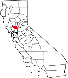 | |
| CDPs | ||
| Unincorporated communities |
| |
| Ghost towns | ||
| Footnotes | ‡This populated place also has portions in an adjacent county or counties | |