Merritt, California
Coordinates: 38°36′51″N 121°45′38″W / 38.61417°N 121.76056°W
| Merritt | |
|---|---|
| Unincorporated community | |
 Sunflowers near Merritt | |
 Merritt Location in California  Merritt Merritt (the US) | |
| Coordinates: 38°36′51″N 121°45′38″W / 38.61417°N 121.76056°W | |
| Country | United States |
| State | California |
| County | Yolo County |
| Elevation[1] | 56 ft (17 m) |
Merritt (formerly, Meritt) is an unincorporated community in Yolo County, California. It lies at an elevation of 56 feet (17 m). The post office for the area was established in 1859 as "Meritt", and discontinued in 1860. It was reestablished and ran between 1870-73 as "Merritt". It was named after Hiram P. Merritt who came to Yolo County before 1866.[2] In the late 19th century, Merritt was a shipment point on the railroad for cattle to market.[3] A 1913 book described Merritt, along with Mullen, as farming towns along the main automobile route from Davis to Woodland.[4]
References
- ↑ U.S. Geological Survey Geographic Names Information System: Merritt, California
- ↑ Durham, David L. (1998). California's Geographic Names: A Gazetteer of Historic and Modern Names of the State. Clovis, Calif.: Word Dancer Press. p. 522. ISBN 1-884995-14-4.
- ↑ Crofutt, George A. (1878). Crofutt's New Overland Tourist and Pacific Coast Guide. The Overland Publishing Company. p. 200.
- ↑ Drury, Wells; Aubrey Drury (1913). California tourist guide and handbook: authentic description of routes of travel and points of interest in California. Western guidebook company. p. 189. Retrieved 2009-06-16.
External links
Municipalities and communities of Yolo County, California, United States | ||
|---|---|---|
| Cities | 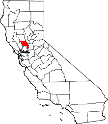 | |
| CDPs | ||
| Unincorporated communities |
| |
| Ghost towns | ||
| Footnotes | ‡This populated place also has portions in an adjacent county or counties | |
This article is issued from
Wikipedia.
The text is licensed under Creative Commons - Attribution - Sharealike.
Additional terms may apply for the media files.